
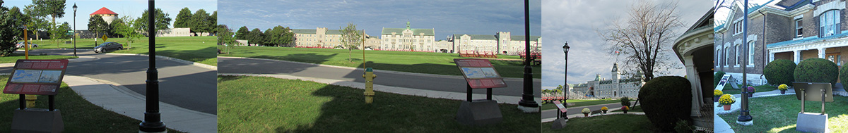

At the Royal Military College of Canada, there is a walking tour featuring information panels. The tour begins at Panet House on the grounds of the Royal Military College of Canada near where the slips on which these magnificent ships were built were located. It was erected in 2013 by the Royal Military College of Canada, made possible through a funding grant from the Department of Canadian Heritage.
There are 13 stations:
- Panel 1 is located in front of Panet House (15 Point Frederick Drive) on the eastern side of the Point and relates the importance of the Point and Naval Dockyard during the War. During the war, British naval operations on Lake Ontario were centered here at Point Frederick, at the confluence of the St Lawrence and Cataraqui rivers at Lake Ontario. In 1812, the Provincial Marines operated only four vessels armed with 20 short-barreled guns. After May 1813, when the royal Navy units under Commodore Sir James Yeo took command of the facility, it grew rapidly. At the end of 1814, the Kingston Dockyard produced the largest naval Squadron on the Great Lakes, with 1,600 personnel serving on the massive flagship St. Lawrence, on four other ships, and four smeller vessel totaling 518 guns.
- Panel 2 is location beside the walking path at the foot of General Crerar Crescent. It is sited to view the St. Lawrence Pier. During the period the pier was in the same location. You can see the protection that could be provided from batteries on Point Henry, to the east.
- Panel 3 is located just to the south of panel 2, and is oriented towards Sackets Harbor, some 45 kms to the southeast in Northern New York. These two panels are located approximately where the slips were located during the construction of HMS St. Lawrence, Canada, and Wolfe.
- Panel 4 is located at the entrance to Fort Frederick and sited back towards Navy Bay and the ship building sites. The panel refers to Canada, and Wolfe, under construction.
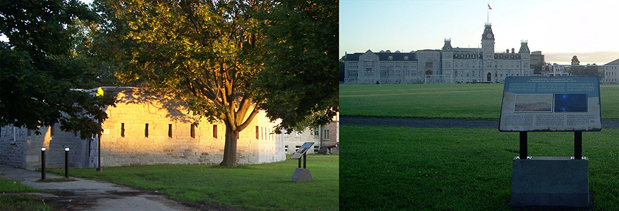
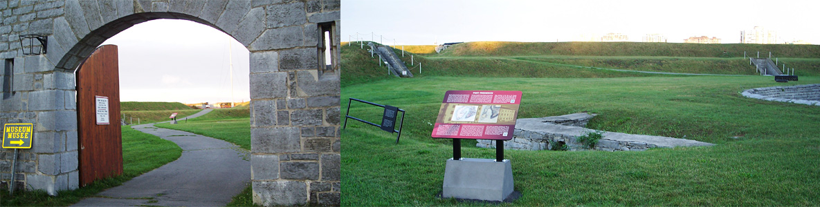
- Panel 5 is located inside Fort Frederick, just beyond the Martello Tower that serves as the RMCC Museum, beside the footings of an earlier blockhouse. In the decades after the war, Fort Frederick’s stone Martello Tower with its surrounding walls and earthworks were constructed on the original Point Frederick site. This was part of six similar installations built to strengthen Kingston’s defences, the dockyard, the Rideau Canal, and entrance to the St Lawrence River from possible United States aggression in such crises as the Canadian rebellions in 1837 and the later Oregon Boundary dispute. Fort Frederick was only abandoned in 1870. Today the Fort Frederick Martello tower houses the Royal Military College of Canada Museum.
- Panel 6 is located a little further into the Fort, just below the battery at the tip of the Point. A battery located in the area fired on the American ships that were attacking the Royal George in November 1812. Supporting buildings at the tip of Point Frederick provided protection for the blockhouse which stood on the approximate location of the Fort Frederick Tower, constructed in 1846 and preserved today as the Museum of the Royal Military College. Additional batteries and fortifications were established on Point Henry and fortified outposts were built on Amherst and Snake Islands, Lemoyne Point and Lake Ontario Point to control the approaches to Kingston harbor, but these guns were never fired in action.
- Panel 7 is located on the water-side of the gazebo in front of Fort Champlain, a dormitory located at 2 Point Frederick Drive, and is sited toward Kingston’s inner harbor, where the Royal George sought refuge. The gazebo was a gift from the Class of 1966.
- Panel 8 is located just to the south of Panel 7 (on the water side of the gazebo in front of 2 Point Frederick Drive) and is sited towards the Lake where the victualling wharf that faced Kingston and the lake where supplies were stored or loaded on the warships and commercial craft.
- Panel 9 is located at the intersection of Valour Drive and Point Frederick Drive, facing the Dockyard gate and the former guard house. While the current gate and stone wall were erected after the war, being part of an 1815 plan which included a gatehouse, earlier drawings clearly show a sentry post and gate in this area.
- Panel 10 is located at the end of Watt’s Walk (a gift of the Class of 1983) on General Crerar Drive at the southern end of Precision Drive. It looks out over the sports fields which cover much of what used to be Navy Bay.
- Panel 11 is located approximately 25 m beyond the Wall of Honour (erected by the Class of 1963) on the east side of the path and is sited looking back towards the current Commandant’s residence.
- Panel 12 is located at the north end of the Birchall Pavilion on the south side of Billy Bishop Road.
- The last stop on the tour is the Historic sites and Monuments Board of Canada cairn located across from the entrance to RMCC, at the foot of the hill and road that leads up to Fort Henry. The Historic Sites and Monuments Board of Canada monument, created in 1937 in memory of those officers and seamen of the Royal Navy and Provincial Marine, and of the officers and soldiers of the Royal Marines, Royal Newfoundland, King’s (8th) and 100th Regiments who served on Lake Ontario in defence of Canada 1812-1814.