
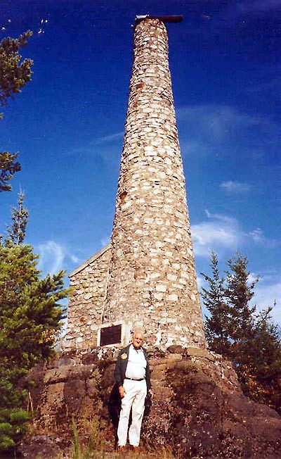
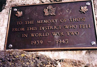
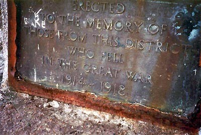
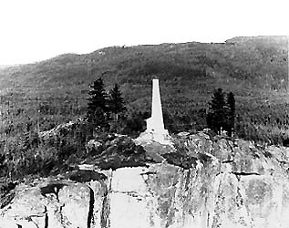
The memorial cairn on Mt. Prevost was erected in 1929 by Capt. J. Douglas Groves and the community in memory of those who had fallen in the First World War. Later, a second plaque was installed for those fallen in the Second World War. The memorial is constructed of granite and is over ten metres tall. Because of its size and location, it is visible from nearby highways.
Directions - From the Trans Canada Highway turn west onto Highway 18. Drive 0.7 kilometres, then turn north onto Somenos Rd., drive another 0.7 kilometres then turn northwest onto Mt. Prevost Rd. which turns into gravel after 0.5 kilometres. To reach the Mt. Prevost summit, drive for 8 kilometres (20 minutes) along this road and the Prevost Mainline. The roads are passable in good weather by 2WD vehicle, but high clearance is recommended. See also memorial 59012-034