
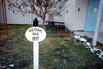
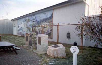
A number of markers along the highway indicate the original distance in miles to Mile 0 in Dawson Creek, British Columbia. One of those markers is located beside the cairns. The Alaska Highway was originally constructed during the Second World War to connect the lower 48 with Alaska. It starts in Dawson Creek, British Columbia and goes north 1,387 miles ending in Delta Junction, Alaska.
Whitehorse - Highway Markers
Whitehorse, Yukon
Notice:
The National Inventory of Canadian Military Memorials is a public, crowd-sourced registry that helps Canadians learn about memorials in their communities. Inclusion in the Inventory does not imply VAC ownership or authority. Responsibility for the care, management, and any changes to a memorial rests with its owning or governing organization.
Inscription
HISTORIC
MILE
917
Street View
Location
Whitehorse - Highway Markers
30 Electra Crescent
Whitehorse
Yukon
Whitehorse - Highway Markers
30 Electra Crescent
Whitehorse
Yukon
GPS Coordinates
Lat. 60.7118554
Long. -135.0796085
Lat. 60.7118554
Long. -135.0796085