
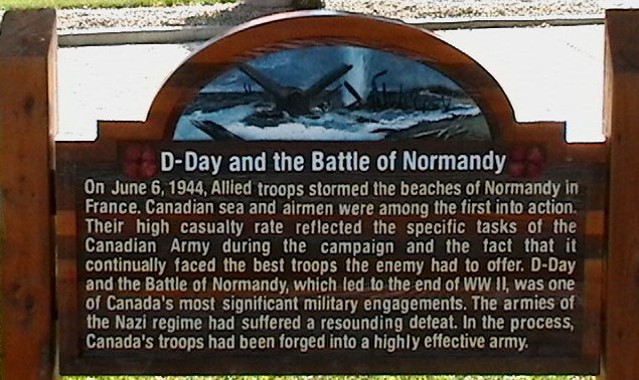
Normandy Street is named in honour of the Canadians who fought in the D-Day invasion and the Battle of Normandy. It is located in Montgomery Place, an area developed in 1946 to house returning Second World War Veterans and their families. Most streets and parks in the area are named for prominent military members, famous battles, and military units.
In 2004, the Montgomery Place Community Association embarked on a project to explain the choice of names for Montgomery Place streets. The research and writing were undertaken by Kevin Gooding who was the Finance Director at the time, with help from President Jim Earle.
The signs were produced at Abe’s Sign Design Group of Saskatoon, with owner Gerry Tunicliffe giving the Association his whole-hearted support. Gerry even offered the Cassino Avenue sign free-of-charge, since his father had fought at the Battle of Monte Cassino. With interest and dedication, Gerry was also a great help to Kevin tracking down photos for the signs.
On September 22, 2007, Kevin, Jim and Vice-President Dave Price, along with Secretary Larry Rempel, Communications Director Gary Berg and resident Don Janzen, rented an auger and then dug, filled, tamped and installed the first 16 signs. Three more signs were installed later.