Ontario

Province Code
ON
City/Municipality
Toronto
Memorial Number
35090-030
Type
Address
2 Eireann Quay
Location
Billy Bishop Toronto City Airport
in Canada
Yes
GPS Coordinates
43.6341967, -79.3973139
Inscription

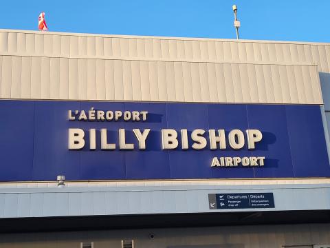
AÉROPORT de TORONTO BILLY BISHOP TORONTO CITY AIRPORT

L'AÉROPORT BILLY BISHOP AIRPORT

[front/devant]

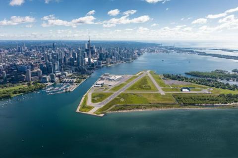
Billy Bishop Toronto City Airport

History of airport: Billy Bishop Toronto City Airport (IATA: YTZ), commonly known as the Toronto Island Airport, is a small airport located on the Toronto Islands in Toronto. It is named after Air Marshall Billy Bishop. Originally conceived in the 1930's, the paved runways and the terminal building opened in 1939. During World War II, the island airport became a military training base. From 1940 until 1943, the Norwegian Government in-exile used the island airport as a training facility for the Royal Norwegian Air Force (RNAF). Barracks were built nearby on the mainland at the foot of Bathurst Street. The nearby "Little Norway Park" is named in remembrance of the Norwegian community around the airport. For the duration of the war, the airport was used by the Royal Canadian Air Force for training pilots and as a waypoint for transporting planes. After the war, the airport returned to civilian use.

Image
Photo Credit
PortsToronto
Caption
Billy Bishop Toronto City Airport
1 of 2 images
Image
Photo Credit
Veterans Affairs Canada
Caption
Billy Bishop Toronto City Airport sign at ferry terminal
1 of 2 images
War or Conflict Term
Province
!4v1702496227206!6m8!1m7!1s38WlCjpitY12qit0EsuVNA!2m2!1d43.63419665117578!2d-79.39731386841065!3f184.5280306349763!4f-1.2951409127368976!5f0.7820865974627469
Body Content

This airport is named in honour of Air Marshal William Avery “Billy” Bishop, VC, CB, DSO & Bar, MC, DFC, ED. The airport was opened in 1939, and renamed Billy Bishop Toronto City Airport on November 10, 2009. It is managed by Toronto Port Authority.

William Avery Bishop was born in Owen Sound, Ontario on 8 February 1894. During the outbreak of the Great War, he was a cadet at the Royal Military College, in Kingston. He enrolled in the 9th Mississauga Horse, Canadian Expedition Force, on 30 September 1914, and he later transferred to the Royal Flying Corps. Bishop, who already had the Distinguished Service Order and Military Cross, became the first Canadian Airman to be awarded the Victoria Cross for his single-handed early morning attack on an enemy airfield near Cambrai, France. On 2 June 1917, he found seven aircraft on the ground; he attacked and destroyed three, and was later credited with the destruction of the remaining four aircraft. Bishop continued air operations until August 1917 and returned to the front in June 1918. He emerged as the British Empire’s second highest scoring ace, with 72 official victories.

In the Second World War, Bishop was an Air Marshal in the Royal Canadian Air Force and assisted in recruiting. He later died in Palm Beach, United States, on 11 September 1956.
City
Toronto
Country
Type Description
Airport
Memorial CF Legacy ID
8942
City/Municipality
Toronto
Memorial Number
35090-027
Type
Address
675 Ontario St
Location
Rose Avenue Public School
in Canada
Yes
GPS Coordinates
43.670295901939, -79.372692453356
Image
Photo Credit
Victoria Edwards
Caption
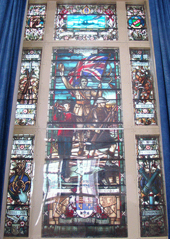
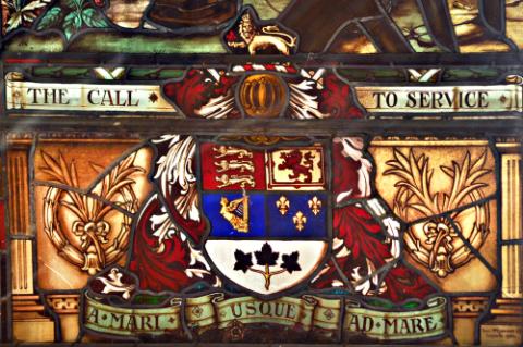
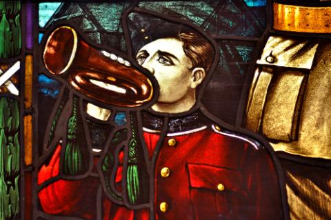
Rose Avenue Public School stained glass
1 of 5 images
Image
Caption
Rose Avenue stained glass
1 of 5 images
Image
Caption
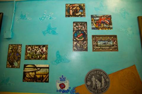
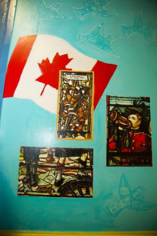
Rose Avenue Public School mural featuring photos of memorial stained glass
1 of 5 images
Image
Caption
Rose Avenue Public School mural featuring photos of memorial stained glass
1 of 5 images
Image
1 of 5 images
War or Conflict Term
Province
!4v1623342489114!6m8!1m7!1sZFHhTZR-hxpFlduiVJ03og!2m2!1d43.66994063541748!2d-79.37312916545112!3f89.14510702686992!4f8.081922452876725!5f0.7820865974627469"
Body Content

This memorial was erected by alumni and unveiled in 1944. The stained glass window is dedicated to alumni who served, and in some cases died during the First and Second World Wars.

City
Toronto
Country
Type Description
Stained glass window
Photo Credit
Victoria Edwards
Memorial CF Legacy ID
8312
City/Municipality
Toronto (Scarborough)
Memorial Number
35090-026
Type
Address
37 Crow Trail
Location
Tom Longboat Junior Public School
in Canada
Yes
GPS Coordinates
43.8101623, -79.2324079
Inscription

Tom Longboat
Junior Public School

Image
Caption
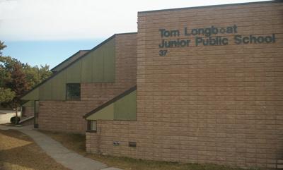
Tom Longboat Junior Public School
1 of 2 images
Image
Caption
inscription
1 of 2 images
War or Conflict Term
Province
!4v1623076312815!6m8!1m7!1sMyhJFB0NdEdxxgwG9fFk9A!2m2!1d43.81016199957329!2d-79.23240766578427!3f78.43935307454859!4f3.980504660017999!5f1.3542169332215286
Body Content

Thomas Charles Cogwagee Longboat was the son of George Longboat and Elizabeth Skye. Born on July 4, 1886, he was of the Onondaga Nation from Six Nations Territory.

In 1905, as a teenager he won the five-mile Victoria Day race at Caledonia, Ontario. Longboat won the 1906 Hamilton's Around the Bay road race, the oldest road race in North America event, by more than three minutes. In 1907, he won the Boston Marathon with a time nearly five minutes faster than the previous best. He represented Canada in the 1908 Olympics. His status as a racing celebrity was solidified in 1909, when he won the world professional marathon championships at Madison Square Garden in New York City.

At the age of 29, he set aside his athletic career to enlist. As a dispatch carrier with the 107th Pioneer Battalion in France, Longboat ran messages and orders between units. He also kept in competitive form by racing in inter-battalion sporting contests, many of which he won.

The famous runner was wounded twice during his time of service. Once he was mistakenly declared dead in the battlefields of Belgium, after being buried in rubble as a result of heavy shelling. He survived the war and returned to Canada in 1919. He served as a member of the Veterans Guard in the Second World War while stationed at a military camp near Brantford, Ontario.

Tom Longboat died in 1949 at the age of 62. He is a member of the Canadian Sports Hall of Fame and the Indian Hall of Fame.

City
Toronto (Scarborough)
Country
Type Description
Building - school
Photo Credit
Bob Braley
Memorial CF Legacy ID
6870
City/Municipality
Toronto
Memorial Number
35090-025
Type
Address
19 Trinity Square
Location
Church of the Holy Trinity
in Canada
Yes
GPS Coordinates
43.6544181, -79.3816604
Inscription

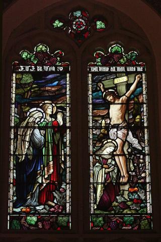
If I be lifted up I will draw all men unto me
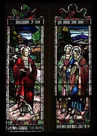
Because I live ye shall live also
Be thou faithful unto death and I will give thee a crown of life

Image
Photo Credit
Shirley Ann Brown, Victoria Edwards
Caption
Two upper panes
1 of 3 images
Image
Photo Credit
Shirley Ann Brown, Victoria Edwards
Caption
Two lower panes
1 of 3 images
Image
Photo Credit
Church of the Holy Trinity
Caption
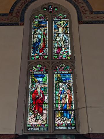
Church of the Holy Trinity First World War Window
1 of 3 images
War or Conflict Term
Province
!4v1623342921205!6m8!1m7!1sZMyiBqxZecXcXNK_EhjkUQ!2m2!1d43.65443734964939!2d-79.38167289520943!3f9.695840605544138!4f8.19664429456401!5f0.7820865974627469
Body Content

On 5 November 1922 a set of stained-glass windows were unveiled on the north side of Church of the Holy Trinity. The window was dedicated to the 32 parishioners of the congregation who had lost their lives in the First World War. The ceremony and unveiling were conducted by Bishop William Day Reeve and Canon W. L. Baynes-Reed, who drew apart two large Union Jacks to reveal the newly installed memorial window pieces.

Designed and constructed in the Tiffany style by the Robert McCausland Co. Ltd., the two top panes of the window depict the crucifixion with the Virgin Mary, John, and Mary Madeline and the lower panes depict the meeting of Jesus with his disciples on the way to Emmaus. The window was erected by members of the congregation.

City
Toronto
Country
Type Description
Stained glass window
Memorial CF Legacy ID
8287
City/Municipality
Toronto
Memorial Number
35090-024
Type
Address
Lakeshore Boulevard East
in Canada
Yes
GPS Coordinates
43.630908, -79.4235052
Inscription

[plaque]

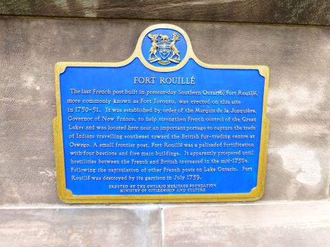
FORT ROUILLÉ
The last French post built in present-day southern Ontario, Fort Rouillé,
more commonly known as Fort Toronto, was erected on this site
in 1750-51. It was established by order of the Marquis de La Jonquière,
Governor of New France, to help strengthen French control of the Great
Lakes and was located here near an important portage to capture the trade
of Indians travelling southeast toward the British fur-trading centre at
Oswego. A small frontier post, Fort Rouillé was a palisaded fortification
with four bastions and five main buildings. It apparently prospered until
hostilities between the French and British increased in the mid-1750s.
Following the capitulation of other French posts on Lake Ontario, Fort
Rouillé was destroyed by its garrison in July 1759.

ERECTED BY THE ONTARIO HERITAGE FOUNDATION
MINISTRY OF CITIZENSHIP AND CULTURE

[plaque]

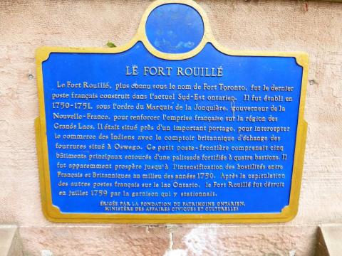
LE FORT ROUILLÉ

Le Fort Rouillé, plus connu sous le nom de Fort Toronto, fut le dernier poste français construit dans l'actuel Sud de l'Ontario. Il fut établi en 1750-1751, sous l'ordre du Marquis de La Jonquière, gouverneur de la Nouvelle-France, pour renforcer l'emprise française sur la région des Grands Lacs. Il était situé près d'un important portage, pour intercepter le commerce des Indiens avec le comptoir britannique d'échange des fourrures situé à Oswego. Ce petit poste-frontière comprenait cinq bâtiments principaux entourés d'une palissade fortifiée à quatre bastions. Il fut apparemment prospère jusqu'à l'intensification des hostilités entre Français et Britanniques au milieu des années 1750. Après la capitulation des autres postes français sur le lac Ontario, le Fort Rouillé fut détruit en juillet 1759 par la garnison qui y stationnait.

[plaque]

needs further research/recherche incomplète

Image
Caption
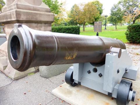
cannon
1 of 5 images
Image
Caption
Fort Rouillé plaque (English)
1 of 5 images
Image
Caption
Fort Rouillé plaque (French)
1 of 5 images
Image
Caption
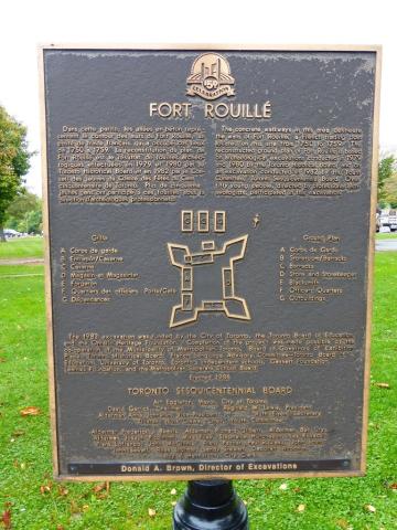
Fort Rouillé 1986 plaque
1 of 5 images
Image
Caption
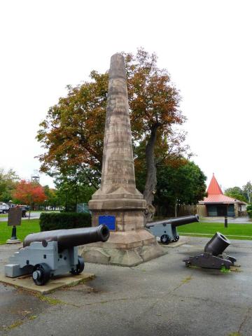
Fort Rouillé Memorial
1 of 5 images
Province
!4v1713362399610!6m8!1m7!1sDEOohOSNXOiKPM_-Kprjkw!2m2!1d43.63090798891528!2d-79.42350522340091!3f168.0712266514827!4f-5.590464889355445!5f0.7820865974627469
Body Content

A tall stone pillar carrying two Ontario historical plaque, one in English and the other in French, surrounded by cannons, mark the location of Fort Rouillé, a French fort destroyed in 1759.

City
Toronto
Country
Type Description
Pillar, cannons, plaque
Photo Credit
Tim Laye, Ontario War Memorials
Memorial CF Legacy ID
4532
City/Municipality
Toronto
Memorial Number
35090-023
Type
Address
Lakeshore Boulevard West
Location
On the grounds of the museum, Stanley Barracks
in Canada
Yes
GPS Coordinates
43.632939, -79.4128422
Inscription

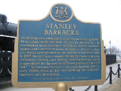
STANLEY
BARRACKS

The British army established a military post here in 1840-
41 to replace aging Fort York. Known as the New Fort, it
consisted of seven limestone buildings around a parade square, and a number of lesser structures. Massive defen-
sive works were planned for the perimeter but never built.
In 1893 the fort was renamed Stanley Barracks in honour
of Governor Lord Stanley. Canadian forces assumed
responsibility for the post in 1870 and garrisoned it until
1947. The barracks then served as public housing until the
early 1950s, when all but this building, the Officers’
Quarters, were demolished.

Ontario Heritage Foundation, Ministry of Cutlure, Tourism and Recreation

L’armée britannique établit un poste militaire ici en 1840-1841 pour remplacer le fort York. Le poste comporte sept bâtiments en Pierre à chaux érigés autour d’une cour de parade et plusieurs autres structures. Les fortifications prévues ne sont jamais construites. En 1893, le fort est rebaptisé Stanley Barracks en honneur du gouvernement general Lord Stanley. Les forces canadiennes en assument la responsibilité en 1870 et y restent publics avant sa demolition au début des années 1950. Il n’en reste plus que les quartiers des officiers.

Image
Photo Credit
(www.ontarioplaques.com)
Caption
front
War or Conflict Term
Province
!4v1623344403784!6m8!1m7!1s95ItMgK3UVAhG11n7c5WPg!2m2!1d43.63293903368493!2d-79.41284224323253!3f280.28682534755626!4f-5.077309745200239!5f2.904322225125058"
Body Content

This plaque was erected in 1963. The title of the Plaque is Stanley Barracks.

City
Toronto
Country
Type Description
Provincial Military Plaque
Photo Credit
(www.ontarioplaques.com)
Memorial CF Legacy ID
4533
City/Municipality
Toronto
Memorial Number
35090-021
Type
Address
Lakeshore Boulevard West
in Canada
Yes
GPS Coordinates
43.630944280903, -79.418264259714
Inscription

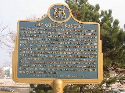
THE QUEEN’S RANGERS

The young province of Upper Canada (Ontario) required
troops to defend it and to build public works essential to
its development. The Queen’s Rangers was the first regiment
raised in Britain specifically for service in the colony. It
arrived in 1792 and was stationed in York (Toronto) in
1793. Over the next three years the regiment constructed
government buildings and fortifications. It also cut impor-
tant roads through the forest, including Yonge Street north
to the Holland River, and Governor’s Road (Dundas Street)
west to London. In 1794 detachments were posted along
the Great Lakes in response to mounting tensions on the
frontier with the United States. When the regiment was
disbanded in 1802, many of its men settled on lands in
nearby Etobicoke Township.

Ontario Heritage Foundation, Ministry of Culture, Tourism and Recreation

LES QUEEN’S RANGERS

La jeune province du Haute-Canada (l’Ontario) avait besoin de troupes pour se defender et entreprendre les travaux publics essentials à son dévelopement. Les Queen’s Rangers constituent le premier regiment recruté en Angleterre spécifiquement pour servir dans la colonie. Il arrive en 1792 et est envoyé en garnison à York (Toronto) en 1793. Le regiment construit des bâtiments gouvernementaux et des fortifications. Ils déblaient des routes à travers la forêt, dont la rue Yonge vers le nord jusqu’à la rivière Holland, et le chemain Governor’s (rue Dundas) vers l’ouest. En 1794, des détachements sont expédiés le long des Grands Lacs où les tensions s’intensifient avec les Américains. Lorsque le regiment est disperse en 1802, nombre de ses homes s’installent sur des terres du canton avoisinant d’Etobicoke.

Image
Photo Credit
(www.ontarioplaques.com)
Caption
front
Province
Body Content

The title of this plaque is Queen's Rangers. It was erected in 1979.

City
Toronto
Country
Type Description
Provincial Military Plaque
Photo Credit
(www.ontarioplaques.com)
Memorial CF Legacy ID
4535
City/Municipality
Toronto
Memorial Number
35090-020
Type
Address
Hanlans Point, Toronto Islands
Location
Near the ferry dock.
in Canada
Yes
GPS Coordinates
43.6272575, -79.3897392
Inscription

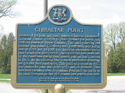
GIBRALTAR POINT

Because of its large and easily defended harbour Lieutenant-
Governor Simcoe decided to make Toronto the naval and
military centre of Upper Canada. This site, guarding the
harbour, was named Gibraltar Point. Fortification was begun
here in 1794 and by 1800 two defensible storehouses and a
guard house had been erected. These buildings were destroyed
by the Americans during the second raid on York (Toronto)
in 1813. By the following May a small blockhouse mounting
one gun had been constructed. This building, in ruins by 1823,
was dismantled some time before 1833 and not replaced. This
area later became known as Hanlans Point after the family of
the world-champion sculler “Ned” Hanlon who settled near here.

Erected by the Archaeological and Historic Sites Board,
Department of Public Records and Archives of Ontario

Image
Photo Credit
(www.ontarioplaques.com)
Caption
front
Province
Body Content

The title of this plaque is Gibraltor Point. It was erected in 1970.

City
Toronto
Country
Type Description
Provincial Military Plaque
Photo Credit
(www.ontarioplaques.com)
Memorial CF Legacy ID
4536
City/Municipality
Toronto
Memorial Number
35090-019
Type
Address
250 Fort York Boulevard
Location
Historic Fort York
in Canada
Yes
GPS Coordinates
43.639033, -79.403621
Inscription

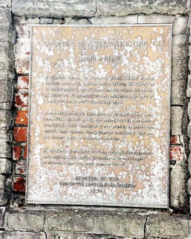
COLONEL W.J. STEWART CBE, CD.
1889-1969

A LIFELONG CITIZEN OF TORONTO, WILLI AM JAMES STEWART
DEVOTED MOST OF HIS LIFE TO PUBLIC SERVICE. HE SERVED AS
ALDERMAN 1924-30 AND AS MAYOR 1931-34. DURING HIS TENURE
AS MAYOR HE WAS INSTRUMENTAL IN RESTORING FORT YORK TO
COMMEMORATE THE CITY’S CENTENNIAL 1934.

ELECTED TO THE ONTARIO LEGISLATURE (1938), HE SERVED UNTIL
1959, AND FOR FOUR YEARS WAS SPEAKER OF THE LEGISLATIVE
ASSEMBLY. A STRONG SUPPORTER OF THE MILITIA, HE JOINED THE
QUEEN’S YORK RANGERS (1ST AMERICAN REGIMENT) AND WAS
FOR FIFTEEN YEARS ITS HONORARY COLONEL.

HE WAS ACTIVE IN NUMEROUS CHURCH, FRATERNAL AND CHARITABLE
ORGANIZATIONS, AND SERVED AS CHAIRMAN OF THE TORONTO
HISTORICAL BOARD FROM 1961 UNTIL HIS DEATH.

ERECTED BY THE
TORONTO HISTORICAL BOARD
1970

Image
Photo Credit
D. Juliusson
Caption
plaque
Province
!4v1623346330912!6m8!1m7!1sryJ0T5-OGIiZticktPJLIA!2m2!1d43.63848279181803!2d-79.40529921228124!3f83.97532235042735!4f6.903981104008977!5f0.6097076385931032"
Body Content

This memorial is dedicated to Colonel William James Stewart CBE, CD. It was erected by the Toronto Historical Board in 1970.

City
Toronto
Country
Type Description
plaque (metal)
Photo Credit
D. Juliusson
Memorial CF Legacy ID
5731
City/Municipality
Toronto
Memorial Number
35090-018
Type
Address
250 Fort York Boulevard
Location
Historic Fort York
in Canada
Yes
GPS Coordinates
43.639033, -79.403621
Inscription

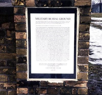
MILITARY BURIAL GROUND

THIS CEMETERY OPENED IN 1860 AND WAS THE THIRD MIITARY BURIAL GROUND IN TORONTO. IT REPLACED
ONE SITUATED A SHORT DISTANCE TO THE WEST, WHICH WAS ABANDONED AFTER A FEW BURIALS AND THE
BODIES WERE MOVED THIS LOCATION. THE LAST KNOW INTERNMENT HERE WAS IN 1911.

The following is an extract from Robertson’s Landmarks of Toronto, Vol, 1, 1894:

"There are about two hundred graves distinguishable by the mounds of earth. In the whole cemetary there
are only twenty-eight stones or wooden slabs standing to tell who lies beneath. A few broken stones have
fallen
most of them are indecipherable and the rest are nameless. All the headstones are of the simplest
and plainest character. There is not a monument or shaft in the yard. On a few graves are simple wooden
crosses without any inscription. Here and there is a square picketed enclosure about a grave, the fence in a
very dilapidated condition and overgrown with grass, thistles and ivy. But one grave bears token, that its
occupant is still cherished in memory. The grave is that of Sergeant-Major F.W. Gathercole of the
Canadian School of Infantry, who died at the new fort, Toronto February 13, 1883 aged forty-two years. A
neat marble slab, simple but quite as pretentious as any in the cemetery, bears the inscription that it was
erected by his comrades in affectionate remembrance. About the grave the grass and thistles have been
cleared away and four pots of geraniums in bloom had been placed on it. The stone marking the resting
place of assistant Commissary-General John Moirs McLean Sutherland, is broken and down. Everything
about the grounds bears evidence that they are seldom visited. The proportion of soldiers drowned among
the twenty-eight whose names are decipherable is large. They are John Manley Rattle, Deputy-Assistant
Commissary-General, J. Ramsey Akers, Ensign in the 16th Regiment, James Walsh, Private in the 30th
Regiment, and Corporal John Smeeton, of the 13th Hussars. Several graves are those of the wives and
children of soldiers. The head stones range in date, from 1860 down to that of Private E.A. Heath, of the
Canadian School of Infantry, who died in 1885, being the most recent. Among the graves is one of Walter
Toronto Lewis, the one-year old son of Mr. and Mrs. Frederick Lewis, who died in 1868. The 13th Hussars
has the greatest number of burials. At two graves are tiny marble slabs, not over five inches wide and a foot
high, bearing simply the inscription ‘G.M. and G.F.S.’ they are evidently remembered, for loving hands
had recently propped up the broken and fallen memorials with pieces of wood. Most of the stones bear
inscriptions to the effect that they were erected by comrades. But little attempt at decoration has been
made on the slabs. Here and there is a flag, a pair of crossed swords, a wreath, a cross, a crown, and other
usual emblems of this character, all very simply executed. Among the dead who lie here are: Trumpeter
James McMahon, 13th Hussars
Rachel, wife of Sergeant-Major William Ross, of the 4th Artillery
Isabella
Thompson, Private George Miller, 13th Hussars, and Colour-Sergeant John Hanney, 47th Regiment."

THIS MEMORIAL AREA WAS CREATED TO PRESERVE THE
REMAINING HEADSTONES AND TO COMMEMORATE ALL
THOSE WHO LIE HERE.

TORONTO HISTORICAL BOARD

A.D. 1970

Image
Photo Credit
D. Juliusson
Caption
plaque
Province
!4v1623346626548!6m8!1m7!1sryJ0T5-OGIiZticktPJLIA!2m2!1d43.63848279181803!2d-79.40529921228124!3f73.22930927063646!4f1.2952184464549816!5f0.988324335672085"
Body Content

This plaque describes the history of this Military Burial Ground. The plaque was erected by the Toronto Historical Board.

City
Toronto
Country
Type Description
plaque (stone)
Photo Credit
D. Juliusson
Memorial CF Legacy ID
5730