Other

City/Municipality
Lethbridge
Memorial Number
48018-029
Type
Address
155 Jerry Potts Boulevard W
in Canada
Yes
GPS Coordinates
49.6841973, -112.8920882
Inscription

MIKE MOUNTAIN HORSE ELEMENTARY SCHOOL

War or Conflict Term
Province
!4v1649072843183!6m8!1m7!1s6-BIWe_bmQWLbR_D7zjMQA!2m2!1d49.68425063310748!2d-112.8920286876131!3f76.51793888569884!4f-1.01324303989459!5f0.7820865974627469
Body Content

Shortly after the death of Albert Mountain Horse, his older brothers Mike and Joe enlisted in the First World War. Albert had died one day after his return to Canada on 19 November 1915. He was hospitalized because of gas poisoning and, with acute respiratory distress, contracted tuberculosis.

Mike was buried alive for four days at Cambrai in October 1917, for which he was hospitalized for shell shock. He returned to action, was wounded twice, became a sergeant and won the Distinguished Conduct Medal for bravery.

Mike Mountain Horse Elementary School was named in honour of Mike in 1986.

City
Lethbridge
Country
Type Description
Building - school
Memorial CF Legacy ID
10845
City/Municipality
Raymond
Memorial Number
48018-028
Type
Address
10 Broadway N, Raymond, AB
Location
Downtown Raymond, Pioneer Museum, 10 Broadway N at Church Ave
in Canada
Yes
GPS Coordinates
49.46148, -112.66257
Image
Photo Credit
Fallenheroes.ca
Caption
Fallen Heroes Memorial Walkway
Province
!4v1615477893776!6m8!1m7!1sHeqpIFVgVUvi8MNntNk9KA!2m2!1d49.46151771580161!2d-112.662157222119!3f288.04238989767026!4f0.9317808794391453!5f2.6140287643569757"
Body Content

The Fallen Heroes Memorial Walkway project allows us to better commemorate their sacrifice and beautify the museum grounds. The Museum is a vital component of our Main Street and by enhancing our municipal facilities, we enhance the perception and viability of the Raymond commercial district! The project includes redeveloping the Museum grounds. Black wrought iron fences will wrap around the perimeter and LED lighting will be strategically placed to highlight the individual veterans monuments, the Wall of Honour which will list the names of all of Raymond’s daughters and sons who have and are currently serving in the armed forces and our own “Tomb of the Unknown Soldier” where poppies can be placed to remember those who now live in Raymond but had relatives serve from other parts of Canada. Four lite flag poles flying the Canadian Flag, the Canadian Red Ensign, as well as the Alberta and Raymond flags. Irrigation will be installed along with new sod, decorative rock or chips, plants and shrubs will be placed around each monument along the walkway, a gazeebo with benches and picnic tables will be located in the “Serenity Garden” behind the museum along with a water feature of some kind.

City
Raymond
Country
Type Description
Pathway
Memorial CF Legacy ID
10095
City/Municipality
Waterton (Lethbridge)
Memorial Number
48018-026
Type
Address
Vimy Avenue, Waterton, AB
Location
Waterton Lakes National Park
in Canada
Yes
GPS Coordinates
49.04938, -113.91043
Inscription

[street sign/plaque de rue]

Vimy Ave.

Image
1 of 3 images
Image
1 of 3 images
Image
1 of 3 images
Province
!4v1615477497572!6m8!1m7!1su-7XHQBKK_-c6j1jiDrD_A!2m2!1d49.04907877112657!2d-113.9090730204918!3f352.50283498276923!4f-1.8062587238702576!5f3.325193203789971"
Body Content

Vimy Avenue is named in memory of the Battle of Vimy Ridge.

The Battle of Vimy Ridge took place from April 9 to 12 in 1917 with the combatants being the Canadian Corps, of four divisions, against three division of the German Sixth Army.

The objective of the Canadian Corps was to take control of the German-held high ground along an escarpment at the northernmost end of the Arras Offensive. This would ensure that the southern flank could advance without suffering German enfilade fire. Supported by a creeping barrage, the Canadian Corps captured most of the ridge once the Canadian Corps overcame a salient of considerable German resistance. The final objective, a fortified knoll located outside the town of Givenchy-en-Gohelle, fell to the Canadian Corps on April 12. The German forces then retreated to the Oppy-Méricourt line.

Historians attribute the success of the Canadian Corps in capturing the ridge to a combination of technical and tactical innovation, meticulous planning, powerful artillery support and extensive training. The battle was the first occasion when all four division of the Canadian Expeditionary Force participated in a battle together and thus became a Canadian nationalistic symbol of achievement and sacrifice. A 100 ha (250 acres) portion of the former battleground serves as a preserved memorial park and site of the Canadian National Vimy Memorial.

City
Waterton (Lethbridge)
Country
Type Description
Street; street sign
Memorial CF Legacy ID
9115
City/Municipality
Lethbridge
Memorial Number
48018-025
Type
Address
215 Corvette Crescent South, Lethbridge, AB
in Canada
Yes
GPS Coordinates
49.69378, -112.7985
Inscription

[sign/panneau]

General Stewart School

Image
1 of 2 images
Image
1 of 2 images
Province
!4v1615477317557!6m8!1m7!1smpRghH7xPDB4AsTaNnmteQ!2m2!1d49.6940326094978!2d-112.7981051230368!3f224.00110368893542!4f-1.7097513069230387!5f1.974047100009662"
Body Content

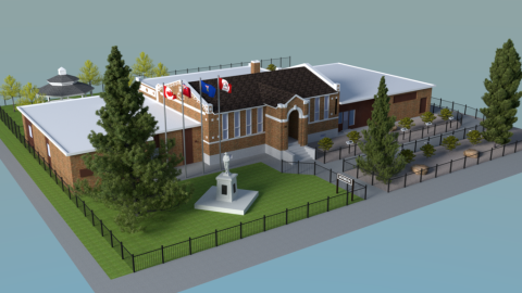
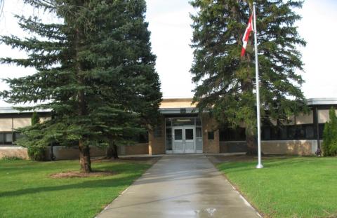
General Stewart School is named in honour of Brigadier-General John Smith Stewart, CMG, DSO, Croix de Guerre, DDS. The school opened on October 3, 1956.

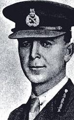
John Smith Stewart was born in 1878 in Brampton, Ontario where he completed his education before attending the Royal College of Dental Surgeons in Toronto. In 1896 he moved to Edmonton and joined the Lord Strathcona’s Horse, serving with this Regiment in South Africa from 1900 to 1901, and earning the Queen’s Medal with four clasps. Upon his return from the Boer War, he relocated to Lethbridge in 1902 and continued his military service where, as a major in 1908, he was appoint Officer Commanding the 25th (Militia) Battery, later raising the 20th Battery for overseas service. In 1915, he was appointed Officer in Command of the 7th Brigade, Canadian Field Artillery (CFA) and deployed to France in 1916 where he was twice wounded. In March 1917, he was transferred to command the Fourth Brigade CFA in France, and won the DSO and CMG. He was also twice mentioned in dispatches and awarded the French Croix de Guerre. In December, 1917, he was promoted to the rank of Brigadier General, and commanded the divisional artillery of the 3rd Canadian Division until the end of the war. Upon his return to Canada, he continued his public service as a member of the Provincial Legislature, a post he had held prior to his overseas service. He also served as a member of the House of Commons from 1930 to 1935. General Smith died in 1970.

City
Lethbridge
Country
Type Description
Building; school
Memorial CF Legacy ID
9133
City/Municipality
Highway 36/autoroute 36
Memorial Number
48018-024
Type
Location
Veterans' Memorial Highway - Highway 36 - Between Warner and Lac La Biche
in Canada
Yes
GPS Coordinates
52.0501164, -111.8619401
Image
1 of 3 images
Image
1 of 3 images
Image
1 of 3 images
Province
Body Content

This highway was renamed as Veterans' Memorial Highway on November 11, 2005. Government of Alberta - News Release - November 11, 2005 Highway 36 renamed Veterans Memorial Highway Alberta veterans honoured and remembered during Year of the Veteran Brooks…In remembrance of the sacrifices and contributions Alberta veterans have made to the province, the Government of Alberta has renamed Highway 36 the Veterans Memorial Highway. "Alberta's veterans are extraordinary Canadians who have stepped forward to serve their nation and they deserve our thanks, respect and remembrance," said Premier Ralph Klein. "This highway is a lasting tribute to the men and women who have fought to defend this province, our country and our freedom, and who continue to risk their lives in peacekeeping activities around the world." The naming of Veterans Memorial Highway is part of the provincial commemorative activities during the Year of the Veteran. The trailblazer sign that will mark the roadway incorporates the image of the red poppy and the maple leaf, the same design that adorns Alberta's veterans' license plates. "Alberta veterans have made profound contributions to the province. The Veterans Memorial Highway recognizes their contributions and honours their sacrifices as a permanent, province-wide memorial," said Dr. Lyle Oberg, Minister of Infrastructure and Transportation. The naming of the Veterans memorial Highway was an initiative of the government caucus, led by Wayne Cao, MLA for Calgary-Fort. "I am pleased to see the Veterans Memorial Highway becoming a reality, especially during the Year of the Veteran," said Cao. "The highway will serve as a daily reminder to all who travel the roadway of the sacrifices and commitment veterans have made on our behalf." Highway 36 was selected as an appropriate highway to remember Alberta veterans because it runs most of the length of the province for 626 kilometres from Warner to Lac La Biche. A total of 82 trailblazer signs will be added along the highway in the coming months, while existing Highway 36 signs will remain. Approximately 2,500 vehicles travel the Veterans Memorial Highway each day. "Alberta veterans can take pride in our new highway - it is a memorial to our efforts to defend freedom and to protect peace," said Harvey Shevalier, President of the Alberta-NWT Command, Royal Canadian Legion. "The highway pays tribute to those who lost their lives in defending our country and our way of life in Alberta. Each sign along the highway is a marker to their loss." Other names highways in Alberta include Queen Elizabeth II Highway (Highway 2), Cowboy Trail (Highway 22), Big Horn Highway (Highway 40), the David Thompson Highway (Highway 11), and Buffalo Trail (Highway 41).

City
Highway 36/autoroute 36
Country
Type Description
Highway
Memorial CF Legacy ID
7892
City/Municipality
Canadian Rocky Mountains
Memorial Number
48018-023
Type
Address
Latitude 49°02'15
in Canada
Yes
GPS Coordinates
49.0403417936, -113.8582441
Inscription

no inscription/aucune inscription

Province
!4v1615477034741!6m8!1m7!1sCAoSK0FGMVFpcFBSbm8wUkxBUkpTdU1TSGwxX3c5dlRmU0xZdFBnRjhUVlFGZW8.!2m2!1d49.0387101!2d-113.8582441!3f263.85941478535585!4f-30.435569236569463!5f0.7820865974627469"
Body Content

This peak was named in honour of the Battle of Vimy Ridge. On Easter Monday, 1917, four divisions of the Canadian Army captured and held the most heavily defended German position on the western front at the Battle of Vimy Ridge during the First World War.

City
Canadian Rocky Mountains
Country
Type Description
Mountain
Memorial CF Legacy ID
7539
City/Municipality
Canadian Rocky Mountains
Memorial Number
48018-022
Type
in Canada
Yes
GPS Coordinates
0, 0
Inscription

no inscription/aucune inscription

Province
Body Content

This ridge was named in honour of the Battle of Vimy Ridge. On Easter Monday, 1917, four divisions of the Canadian Army captured and held the most heavily defended German position on the western front at the Battle of Vimy Ridge during the First World War.

City
Canadian Rocky Mountains
Country
Type Description
Mountain
Memorial CF Legacy ID
7538
City/Municipality
Coutts
Memorial Number
48018-021
Type
Address
Needs further research
Location
Park
in Canada
Yes
GPS Coordinates
0, 0
Inscription

needs further research/recherche incomplète

Province
Body Content

The Coutts Park Cenotaph was constructed in 1988. An inscription on a plaque on an old gun is for remembrance of all soldiers. Remembrance Day services are held yearly.

City
Coutts
Country
Type Description
Old gun
Memorial CF Legacy ID
4818
City/Municipality
Coalhurst
Memorial Number
48018-020
Type
Address
6 Street
in Canada
Yes
GPS Coordinates
49.74629, -112.9249
Inscription

[left stele/stèle de gauche]
DEDICATED TO
THE GLORY OF GOD
AND TO THOSE
WHO SERVED
THEIR COUNTRY

AT THE GOING DOWN
OF THE SUN
AND IN THE MORNING
WE WILL REMEMBER THEM

ERECTED BY THE
ROYAL CANADIAN LEGION
AND LADIES AUXILIARY
COALHURST BRANCH #273
AND THE CITIZENS OF THE
VILLAGE OF COALHURST

[right stele/stèle de droite]
IN MEMORY OF
THE MINERS WHO
LOST THEIR LIVES IN
THE COALHURST
MINE EXPLOSION
DECEMBER 9TH, 1935
AND OTHERS WHO
HAVE GIVEN THEIR
LIVES IN THIS AND
OTHER MINES

ERECTED BY
THE LETHBRIDGE MINERS
LIBRARY CLUB
AND THE CITIZENS OF THE
VILLAGE OF COALHURST

Image
Photo Credit
Marge Williams
Caption
front view
1 of 3 images
Image
Caption
memorial unveiling
1 of 3 images
Image
Caption
memorial unveiling
1 of 3 images
Province
!4v1615475959163!6m8!1m7!1sYcqUT8Eyk0NgLlJsGqFt6g!2m2!1d49.74631956292886!2d-112.9247932804555!3f251.63161364486234!4f-4.375753050763834!5f3.325193203789971"
Body Content

This memorial is dedicated to those who served their country and the miners who lost their lives in the 1935 mine explosion. The Dedication Service for this memorial was held on Sunday, August 12, 1984. The stele on the left, dedicated to those who served their country, was unveiled by Edwin Hay, president of the Coalhurst Royal Canadian Legion and Mary Stoffer, president of the Ladies Auxiliary. The stele on the right, dedicated to the miners who died, was unveiled by Ronald Coombes, deputy mayor of Coalhurst and Jim Brown, president of the Miners' Library. Sixteen miners perished in a mine explosion on December 9, 1935 at approximately 4pm. The mine was never reopened. These monuments are the result of a joint effort by the Lethbridge Miners' Library, Coalhurt Legion, the Legion's Ladies Auxiliary and the Village of Coalhurst.

City
Coalhurst
Country
Type Description
Two stelia
Memorial CF Legacy ID
5551
City/Municipality
Canadian Rocky Mountains
Memorial Number
48018-019
Type
Location
Festubert Mountain
in Canada
Yes
GPS Coordinates
49.08194, -114.13333
Inscription

no inscription/aucune inscription

Province
!4v1615475803683!6m8!1m7!1sCAoSLEFGMVFpcE9xLVdGUWh2TUFYdTR0UUU3WTZtQkNsUE15T0ZjQUx3Y0hVS1pn!2m2!1d49.086188!2d-114.1196079!3f237.4179901937472!4f7.379073054923651!5f2.6077294383106943"
Body Content

This mountain was named in honour of the village of Festubert in France where Canadian troops fought in the First World War.

City
Canadian Rocky Mountains
Country
Type Description
Mountain
Memorial CF Legacy ID
7537