
Borne d’arpentage de laiton est située sur une structure de support dans l’entrée principale de l’immeuble Pearkes. Le monument a été érigé par le Service de cartographie du ministère de la Défense nationale et inauguré le 1er juillet 1978, à l’occasion du 75e anniversaire de la formation de l’organisme de cartographie militaire canadienne.
Monument aux levés cartographiques militaires
Ottawa, Ontario
Avis :
L’inventaire national des monuments commémoratifs militaires canadiens est un registre public alimenté par la contribution citoyenne qui permet aux Canadiens et aux Canadiennes de découvrir les monuments commémoratifs dans leur collectivité. La présence dans l’inventaire ne confère aucun droit de propriété ni pouvoir décisionnel à ACC. La responsabilité de l’entretien, de la gestion et de toute modification d’un monument incombe à l’organisme propriétaire ou gestionnaire.
Inscription
[front/avant]
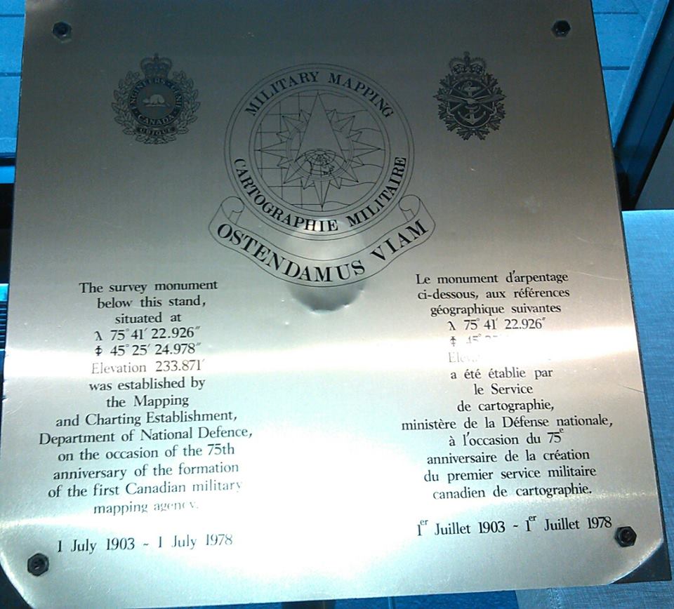
Military Mapping
OSTENDAMUS VIAM ("showing the way")
The survey monument below this stand,
situated at 75 41' 22.926' 45 25' 24.978'
Elevation 233.871 was established by
the Mapping and Charting Edtablishment,
Department of National Defence,
on the occasion of the 75th
anniversary of the formation
of the first Canadian military
mapping agency
1 July 1903 - 1 July 1978
Informations pour les visiteurs
Location
Monument aux levés cartographiques militaires
101, promenade Colonel By
Ottawa
Ontario
Monument aux levés cartographiques militaires
101, promenade Colonel By
Ottawa
Ontario
Coordonnées GPS
Lat. 45.4227886
Long. -75.6886639
Lat. 45.4227886
Long. -75.6886639