Île-du-Prince-Édouard

Province Code
PE
City/Municipality
Travellers Rest
Memorial Number
11004-010
Type
Address
Entre l’autoroute 2 et le chemin Rayner Creek
Location
Travellers Rest Memorial Grounds
in Canada
Oui
GPS Coordinates
46.418555, -63.7371903
Inscription

[front/devant]

RIMN ALLAN R. HEAD
KILLED IN ACTION
OCT. 27 1944

PTE. ROY A. CROZIER
DIED IN ENGLAND
MAY 25 1941

PTE. ALEXANDER D. MACKINNON
25TH BATT.
KILLED IN ACTION
AT VIMY RIDGE
APR. 9 1917.

IN MEMORY OF
OUR FALLEN HEROES
1939 – 1945

[Left Side/côté gauche]

PILOT OFFICER
JAMES C. TUPLIN
LOST OVER
THE NORTH SEA
APRIL 25, 1945
SGT. PILOT
OSBORNE B. LEFURGEY
KILLED IN ENGLAND
JAN. 5, 1942

PTE. CLAUDE MILLIGAN
26TH CAN. BATT.
WOUNDED AT CHERISY
AUG. 28, 1918.
DIED AT
GENERAL HOSPITAL
SEPT. 6, 1918

IN MEMORY OF
OUR FALLEN HEROES
1914 – 1918

[Rear View/vue de l’arrière]

PTE. WILLIAM W. RIELLY
R.C. REGIMENT
COMPANY
55TH BATT.
DIED FROM WOUNDS

[Right Side/côté droit]

PTE. GILBERT S. MATHIESON
48TH HIGHLANDERS
KILLED AT ARRAS
AUG. 28, 1918.


[Slab/dalle]

1913-1988
COMMEMORATING
75 YEARS OF SERVICE
FOR
”HOME AND COUNTRY
ERECTED BY
MAPLE LEAF WOMEN’S
INSTITUTE OF
TRAVELLERS REST
JULY 1 1988

Image
Crédit photo
Sgt. G.E. Gallant; Carmen Goold
Légende
Surroundings
1 sur 4 images
Image
Légende
obelisk (front)
1 sur 4 images
Image
Légende
detail of obelisk
1 sur 4 images
Image
Légende
Slab
1 sur 4 images
!4v1611160693062!6m8!1m7!1sBKspuoXTkDhO8RspMqo8sg!2m2!1d46.41858168962852!2d-63.73710895531032!3f345.4533703272191!4f-3.4605699171303143!5f3.325193203789971"
Body Content

Érigé par la communauté, ce mémorial est dédié aux citoyens locaux morts dans les cadre des les Première et Seconde Guerres mondiales.

City
Travellers Rest
Country
Type Description
Slab and marble/granite obelisk
Memorial CF Legacy ID
963
City/Municipality
North Rustico
Memorial Number
11004-009
Type
Address
31, avenue Church Hill
in Canada
Oui
GPS Coordinates
46.459326, -63.310788
Inscription

[left/gauche]

W.W. II
W.O. II FREDERICK L. BULMAN
PTE. RODOLPH GALLANT
PTE. VERNONO MACGUIGAN
PTE. ALBERT MURPHY
PTE. ARTHUR ROGERS

W.W. I
PTE. CHARLES DOIRON
PTE. LEN LECLAIR
PTE. JOSEPH MYERS

[right/droit]

DEDICATED TO THE MEN
AND WOMEN OF THIS
COMMUNITY WHO
SERVED THEIR COUNTRY
IN WORLD WAR I, WORLD
WAR II, AND THE KOREAN
WAR, AND IN GRATEFUL
TRIBUTE TO THOSE
WHO MADE THE
SUPREME SACRIFICE

Image
Crédit photo
Sgt. G.E. Gallant
Légende
front view
!4v1626094500333!6m8!1m7!1sKeff3HlATwKcrW9X6ehiXQ!2m2!1d46.45919484928307!2d-63.31061865239508!3f321.64168424268394!4f-0.20896420588401554!5f3.325193203789971"
Body Content

Érigé par le village de North Rustico, ce mémorial est dédié aux anciens combattants locaux des Première et Seconde Guerres mondiales et de la guerre de Corée, et en particulier à ceux qui sont morts durant ces conflits.

City
North Rustico
Country
Type Description
Two granite stelia, granite base and metal flagpole
Memorial CF Legacy ID
2270
City/Municipality
Nine Mile Creek
Memorial Number
11004-008
Type
Address
1552, PE-19
Location
Centre communautaire d’Afton, Autoroute 19
in Canada
Oui
GPS Coordinates
46.168462, -63.227891
Inscription

[front/devant]

LEST WE FORGET

PTE. JOHN CAMPBELL
KILLED IN ACTION IN FRANCE, SEPT. 30, 1916, AGE 33

PTE. AENEAS DOWLING
KILLED IN ACTION IN FRANCE, JULY 17, 1917, AGE 19

SGT. OBSERVER RALPH MACLEAN
KILLED IN ACTION IN BURMA, DEC. 10, 1942, AGE 21

PTE. CHARLES R. BETTS
KILLED IN ACTION IN ITALY, JAN. 8, 1944, AGE 25

Image
Crédit photo
Sgt. G.E. Gallant
Légende
stele (front)
!4v1595852497532!6m8!1m7!1sKUtxabF7-iCfs62YWkILBQ!2m2!1d46.1685970405922!2d-63.22768260333777!3f213.1599954543838!4f6.759201057523171!5f1.0470697655903353
Body Content

Érigé par les résidants de la localité, ce mémorial est dédié aux morts des Première et Seconde Guerres mondiales originaires de l'endroit.

City
Nine Mile Creek
Country
Type Description
Granite stele
Memorial CF Legacy ID
2523
City/Municipality
New Haven
Memorial Number
11004-007
Type
Address
15383, route transcanadienne
Location
Légion royale canadienne, filiale no 30
in Canada
Oui
GPS Coordinates
46.2168834, -63.2938982
Inscription

[front/devant]
LEST WE FORGET

IN GRATEFUL
REMEMBRANCE
OF THOSE WHO
GAVE THEIR LIVES

"AT THE GOING DOWN
OF THE SUN,
AND IN THE MORNING
WE WILL REMEMBER THEM"

[back/arrière]
WORLD WAR I
BEATON, HEALTH EARDLY Pte 1885 - 1916
BORN, BOSHAW   DIED, SOMME, FRANCE
BEATON, ARCHIBALD DANIEL Pte  1888 - 1918
BORN, BONSHAW   DIED, ARRAS, FRANCE
BURDETT, IVOR, Pte  1895 - 1918
BORN, FAIRVIEW  DIED, AMIENS, FRANCE
MACEACHERN, JOHN T., Pte  1890 - 1918,
BORN, RICE POINT  DIED MARQUION, FRANCE
MACEWAN, JOHN C., Sgt  1894 - 1918
BORN, NEW DOMINION   DIED, CAMBRAI, FRANCE
MACKINNON, ARCHIE N., Sgt    1885 - 1918
BORN, CANOE COVE   DIED, FRANCE
ROGERSON, RICHARD GARFIELD, Pte 1894 - 1917
BORN, CANOE COVE  DIED, VIMY RIDGE, FRANCE
MACKINNON, DANIEL, Cpl  1895 - 1918
BORN, HUNTER RIVER DIED, AMIENS, FRANCE
MCMANUS, PATRICK A., Pte 1894 - 1915
BORN, BONSHAW  DIED, FRANCE
MACEWEN, ALBERT, Pte 1890 - 1916
BORN, LONG CREEK  DIED, FRANCE

WORLD WAR II
BERRIGAN, LEONARD T., F/L D.F.C. 1914 - 1944 
BORN, DUNEDIN  DIED, BERLIN, GERMANY
CLOW, CHARLES EVERETT, WO 11915 - 1944
BORN, EMERALD  MISSING IN OPERATIONS, NORTH ATLANTIC
GORDON, LLOYD MURCHISON, L/S M.I.D. 1920 - 1944 
BORN, APPIN ROAD  DIED, ENGLISH CHANNEL (H.M.C.S. ATHABASKAN)
MACKINNON, EWEN, L/Cpl 1904 - 1944
BORN, NEW ARGYLE  DIED, FRANCE
MACKINNON, LLOYD F., Pte 1924 - 1944
BORN RIVERDALE  DIED, CORIANO RIDGE, ITALY
MACLEOD, GEORGE GARFIELD, Spr 1910 - 1944
BORN, FAIRVIEW  DIED, ANTWERP, BELGIUM
MACPHAIL, JOHN A., CODER, 1924 - 1943
BORN, ARGYLE SHORE  DIED, MEDITERRANEAN SEA (H.M.C.S. LOUISBOURG)

Image
Légende
front
1 sur 2 images
Image
Légende
back
1 sur 2 images
!4v1611159839597!6m8!1m7!1spc1OfBN_yA_p25mVZ6LaTg!2m2!1d46.21688317794688!2d-63.29389834969536!3f193.7541883056246!4f-5.449632295924545!5f3.325193203789971"
Body Content

Le Cénotaphe de New Haven se trouve sur la propriété de la filiale de Kingston de la Légion. La Légion était à l’origine une maison funéraire et une étable à chevaux avant d’être convertie plus tard en légion. On croit que le monument a été créé pour commémorer les soldats dont les noms ne figuraient pas encore sur un monument des régions locales : Kingston, Clyde River, Crapaud, Cornwall, Nine Mile Creek, Long Creek, Kelly’s Cross et Hartsville.

City
New Haven
Country
Type Description
Stele - marble
Memorial CF Legacy ID
1684
City/Municipality
Kinkora
Memorial Number
11004-006
Type
Address
45, chemin Anderson
Location
À côté de la bibliothèque publique de Kinkora
in Canada
Oui
GPS Coordinates
46.3225314, -63.5944944
Inscription

(middle columb/colonne du milieu)
KILLED IN UNIFORM
WORLD WAR I
JAMES CAIRNS

WORLD WAR II
FRANK ARSENAULT
JAMES EMMETT HUGHES
---
---
---

PEACETIME
---
---

Image
Crédit photo
Rene Audet
Légende
front view
1 sur 2 images
Image
1 sur 2 images
!4v1611159598423!6m8!1m7!1s5sQRPhQ-pAuqOIXP4ugz3w!2m2!1d46.3225313672194!2d-63.5944943828874!3f5.447788863347228!4f-1.8349851307638545!5f3.325193203789971"
Body Content

Un monument où il est inscrit « In honour of all who served » (en l’honneur de ceux qui ont servi) en hommage aux hommes et aux femmes qui ont servi dans les forces armées de la région de Kinkora a été dévoilé le jour du Souvenir de 1992. Il est situé à côté du centre communautaire de Kinkora. Le juge Armand Desroches a déclaré lors de son discours de dédicace : « En érigeant ce monument et en rendant hommage à nos morts à la guerre et à nos vétérans vivants et décédés, nous ne glorifions pas la guerre. Au contraire, nous nous souvenons de ce qui a été fait au nom de l’humanité et pour la cause de la paix ».

City
Kinkora
Country
Type Description
Stele (3 parts, middle one topped with cross)
Memorial CF Legacy ID
4310
City/Municipality
Kensington
Memorial Number
11004-004
Address
Promenade Walker
Location
Les jardins du Souvenir des anciens combattants
in Canada
Oui
GPS Coordinates
46.4355315, -63.6430515
Inscription

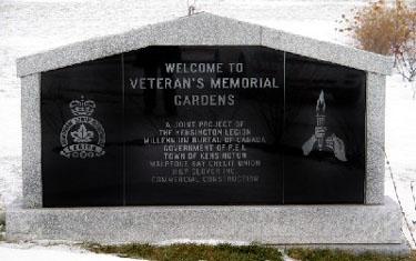
[stele front/stèle devant]

WELCOME TO
VETERAN'S MEMORIAL
GARDENS

A JOINT PROJECT OF
THE KENSINGTON LEGION
MILLENNIUM BUREAU OF CANADA
GOVERNMENT OF P.E.I.
TOWN OF KENSINGTON
MALPEQUE-BAY CREDIT UNION
H&P GLOVER INC.
COMMERCIAL CONSTRUCTION

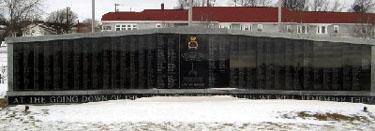
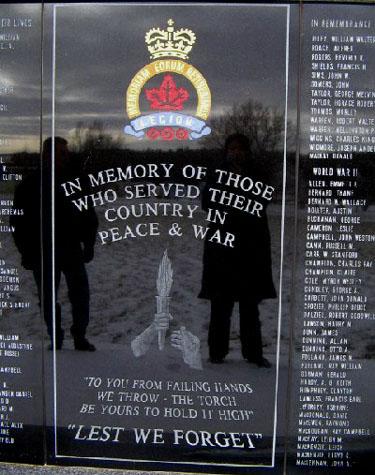
[wall centre/mur du centre]

IN MEMORY OF THOSE
WHO SERVED THEIR
COUNTRY IN
PEACE & WAR

"TO YOU FROM FAILING HANDS
WE THROW - THE TORCH.
BE YOURS TO HOLD IT HIGH"

"LEST WE FORGET"


[wall base/mur base]

AT THE GOING DOWN OF THE SUN AND IN THE MORNING WE WILL REMEMBER THEM

Image
Crédit photo
Ian M. MacGougan
Légende
wall
1 sur 4 images
Image
Légende
wall centre
1 sur 4 images
Image
Légende
stele
1 sur 4 images
Image
1 sur 4 images
!4v1611159317888!6m8!1m7!1spZ-sJRPTSARNtH6gcHhtZA!2m2!1d46.43553150220244!2d-63.64305147493245!3f42.7632955220322!4f-0.6313636867225085!5f3.325193203789971"
Body Content

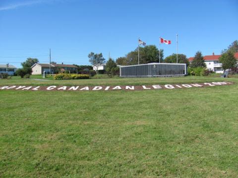
Monument érigé par la Légion de Kensington à la mémoire des victimes des Première et Seconde guerres mondiales, de la guerre de Corée et du conflit en Afghanistan, ainsi que des résidants de la région de Kensington qui ont servi dans les Forces canadiennes en temps de guerre et de paix.

City
Kensington
Country
Type Description
Monument (stele and wall)
Memorial CF Legacy ID
7047
City/Municipality
Cornwall
Memorial Number
11004-003
Type
Address
Entre chemin Cornwall et rue Main
in Canada
Oui
GPS Coordinates
46.2283179, -63.21687
Inscription

[front/devant]

THEY HAVE WON A DEATHLESS VICTORY

PTE. GEORGE E. YEO
KINGSTON
DIED OF WOUNDS
NOV. 20, 1917
PTE. HORACE GARDINER
KILLED IN ACTION
SEPT. 27, 1918

[right side/côté droit]

PTE. ROBERT E. WHITE
CORNWALL
KILLED IN ACTION
OCT. 30, 1917
PTE. ETHAN C. WHITE
CORNWALL
DIED OF WOUNDS
JUNE 14, 1918

[back/arrière]

PTE. DANIEL MCPHEE
NEW HAVEN
KILLED IN ACTION
AUG. 24, 1918
PTE. ANDREW GASS
NEW HAVEN
KILLED IN ACTION
SEPT. 2, 1918

[left side/côté gauche]

PTE. VICTOR J. MCDONALD
CORNWALL
DIED FROM EFFECTS OF GAS
JAN. 6, 1920
PTE. DAMIEN LEONARD
CORNWALL
DIED ON MILITARY SERVICE
DEC. 16, 1918

Image
Crédit photo
Sgt. G.E. Gallant
Légende
obelisk (front)
1 sur 4 images
Image
Légende
obelisk (right side)
1 sur 4 images
Image
Légende
obelisk (back)
1 sur 4 images
Image
Légende
obelisk (left side)
1 sur 4 images
War or Conflict Term
!4v1611159080168!6m8!1m7!1s6h4JYXlwZPOAPMHSaOkjNA!2m2!1d46.22831793171773!2d-63.21686995112818!3f323.6008874273826!4f-1.6098727027268182!5f3.0557788322994605"
Body Content

Ce mémorial, érigé par la ville de Cornwall et ses anciens combattants, est dédié à ceux de la localité qui sont morts durant la Première Guerre mondiale.

City
Cornwall
Country
Type Description
Marble obelisk
Memorial CF Legacy ID
2277
City/Municipality
Clyde River
Memorial Number
11004-002
Type
Address
726, chemin Clyde River
Location
Église baptiste unie de Clyde River
in Canada
Oui
GPS Coordinates
46.222832, -63.25657
Inscription

[front/devant]

ERECTED TO THE MEMORY
OF
OUR BOYS

( [Right side/côté droit]
PTE. ALEXANDER MURRAY
KILLED AT
PASSCHENDAELE,
NOV. 6, 1917,
AGED 19.

[Back/arrière]PTE. HECTOR MURRAY
KILLED AT
VIMY RIDGE
APR. 9, 1917,
AGED 18

[Left Side/ côté gauche]
CR. OSWALD DARRACH
DIED
ON MILITARY
SERVICE, HALIFAX
APR. 26, 1918,
AGED 20

Image
Crédit photo
Sgt. G.E. Gallant
Légende
obelisk (overall)
1 sur 4 images
Image
Légende
obelisk (front)
1 sur 4 images
Image
Légende
obelisk (overall)
1 sur 4 images
Image
Légende
obelisk
1 sur 4 images
War or Conflict Term
!4v1595849674164!6m8!1m7!1sR0J4EKFR5Sn-Al5aI46HMg!2m2!1d46.22283211466173!2d-63.25657079254802!3f89.34754178504309!4f-15.056511622671905!5f0.7820865974627469
Body Content

Ce mémorial est dédié aux citoyens de la localité morts en service lors de la Première Guerre mondiale.

City
Clyde River
Country
Type Description
Marble obelisk
Memorial CF Legacy ID
2522
City/Municipality
Borden
Memorial Number
11004-001
Type
Address
243 rue Main
Location
Filiale 10 de la Légion royale canadienne
in Canada
Oui
GPS Coordinates
46.25361, -63.69144
Inscription

[centre/centre]

DEDICATED TO THE MEMORY OF THOSE WHO LAID DOWN THEIR LIVES IN TWO WORLD WARS AND IN GRATITUDE TO THOSE WHO, DARING TO DIE, SURVIVED

LEST WE FORGET

[left/gauche]

1914-1918

R. ARSENAULT
J.K. BELL
C. BUXTON
J. CAIRNS
L. CAMERON
I.H. CAMERON
G.A. CAMPBELL
W.G. CAMPBELL
V. CAR
A.L. COLLETT
W.B. CORMIER
P. DEIGHAN
J. FARROW
P. FARROW
E.M. HOOPER
J.G. HOWATT
G.H. LOWTHER
B.S. MACKAY
A. ROBINSON
H. ROBINSON
W.D. SHERREN
H.W. STEWART
L. WOOD

[right/côté]

1939-1945

A. AFFLECK
A. ARSENAULT
F. ARSENAULT
F.L. ARSENAULT
L.S. AVERY
A. BARTLETT
A. BOULTER
H. CRAIG
A. DUNN
J. FERGUSON
E. FRANCIS
E. GALLANT
J.E. HUGHES
S. JEFFREY
H.L. LEFURGEY
E. MABEY
E.B. MUTTART
J. MCIVOR
G. MCMAHON
E. NORTON
P. SMITH
A.D. TAYLOR

W. NESS, 1955

Image
Crédit photo
Sgt. G.E. Gallant
Légende
stele (front)
!4v1595610592829!6m8!1m7!1s8LJcZCaH0BDoxgQHYkUflQ!2m2!1d46.25361108379385!2d-63.69144661990778!3f162.80349800805652!4f1.7730086728652736!5f0.6447661974952943
Body Content

Érigé par la Légion royale canadienne, ce mémorial est dédié aux anciens combattants et à ceux en provenance de la région qui sont morts durant les Première Guerre mondiales et la guerre de Corée.

City
Borden
Country
Type Description
Granite stele
Memorial CF Legacy ID
2274
City/Municipality
Rocky Point
Memorial Number
11003-035
Type
Address
Coin pe-19 et chemin Rogers Passage
Location
Rocky Point
in Canada
Oui
GPS Coordinates
46.1859524, -63.1466636
Inscription

SURVEY OF PRINCE EDWARD ISLAND

ARPENTAGE DE

L'ILE-DU-PRINCE-ÉDOUARD

In 1764 the British government decided to undertake a systematic survey of its North American territory, recently enlarged in the war with France. For this purpose Captain Samuel Holland was put in charge of the northern region, with orders to survey St. John’s (now Prince Edward) Island first. In October 1764 he established a base at Observation (Holland) Cove and spent the next year surveying and sounding coastal waters. Holland divided the island into 67 townships or lots and reserved land for townsites. This work provided the basis for the allocation of Island lands in 1767.

En 1764, les autorités anglaises décidèrent d'arpenter, de façon systématique leur territoire d'Amérique du Nord, agrandi aux dépens de la France pendant la récente guerre. Elles confièrent la région du nord au capitaine Samuel Holland en lui demandant de commencer par l'île Saint-Jean (île-du-Prince-Édouard). Il établit sa base à l'anse de l’Observation (Holland) en octobre 1764 et passa l'année suivante à faire des levés de terrain et à sonder les eaux côtières. Il divisa l'île en 67 cantons ou lots et réserva des terres pour la création de villes. Ce travail détermina le partage de l'île en 1767.

Historic Sites and Monuments Board of Canada.
Commission des lieux et monuments historiques du Canada.

Gouvernment of Canada - Gouvernement du Canada

Image
Crédit photo
Natalie Carragher
Légende
Captain Holland Monument
1 sur 2 images
Image
Crédit photo
National Archives of Canada NMC 23350
Légende
Capt Holland map of St John Island (Prince Edward Island)
1 sur 2 images
!4v1611325196979!6m8!1m7!1shrRXu3i-ac2-zx8P6qdEnA!2m2!1d46.18595242244631!2d-63.14666359380337!3f97.03859598298022!4f-0.8973192523473301!5f3.325193203789971"
Body Content

A monument in memory of Captain Samuel Holland, the surveyor who mapped the Island, and who laid out its lots and parishes between the years of 1764 and 1766.  Holland has left behind a legacy, particularly in the Rocky Point, and Holland Cove region. Today, a solitary Island sandstone monument stands handsomely in an open patch of grass just up from his original campsite in Rocky Point, which bears his name and brief description of his expedition in 1764.

King George III appointed Captain Samuel Holland as Surveyor-General of British North America in 1764. Holland, who was a skilled surveyor and cartographer, was given the task of providing a detailed survey of the land and water ways of the Island. He was also responsible for noting the physical characteristics of the Island such as soil quality, timber, climate conditions, as well as animal and fish species’; all of which are pertinent to colonizing a new land. Captain Holland’s North American expedition was executed in 1764, with the first stop being Ile Saint Jean. The entire survey took the better part of two years to complete. After travelling around the entire Island with dog-teams of men and canoes, he was able to devise a map with utmost accuracy, displaying every river, stream, harbour and bay. He was notorious for dividing the Island into three counties, and 67 townships, each consisting of 20 000 acres.

City
Rocky Point
Country
Type Description
Granite
Memorial CF Legacy ID
10381