Army Survey Establishment Cairn

Ottawa, Ontario
Type
Other

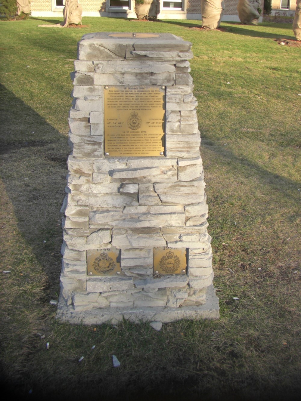
On October 18, 1996, a cairn was erected to commemorate the 50th Anniversary of the formation of the Army Survey Establishment. The cairn bears an engraved plaque that also recognizes the unit’s significant contributions to Canada’s arctic mapping program, the support provided to the Canadian Forces at home and abroad, and the continued pursuit of excellence in defence geomatics.

This memorial consists of a cairn constructed of slabs of stone with a metal plaque at the top, and two small metal plaques at the bottom. One bears the 1946 badge of the Royal Canadian Engineers - the badge worn by members of the Army Survey Establishment at the time the unit was founded, and the other bears the 1996 badge of the Canadian Military Engineers - the badge worn by members of the Mapping and Charting Establishment at the time of the unit's 50th anniversary.

The Major-General Anderson RoomLCol C.H. Smith Room and Major-General Burns Room are also located here.

Inscription

[front/devant]

18 October 1996 – This cairn was erected to commemorate the 50th anniversary of the formation of the Army Survey Establishment (renamed Mapping and Charting Establishment in 1966). It also recognizes the unit’s significant contributions to Canada’s arctic mapping programme, the support provided to our Armed Forces at home and abroad, and the continuing pursuit of excellence in defence geomatics.

Latitude                                                                            Longitude
45° 24’ 01.1                                                                      75° 42’ 19.0”
North/nord                                                                        West/ouest

Le 18 octobre 1996 – Ce cairn a été érigé pour commémorer le 50e anniversaire de l’établissement de « Army Survey Establishment » (rebaptisé le Service de Cartographie en 1966). Il reconnaît aussi la contribution significative de l’unité envers le programme de cartographie de l’arctique canadien, le soutien fourni à nos Forces armées chez nous ainsi qu’à l’étranger, et la poursuite continue de l’excellence dans la géomatique de la défense.

Location
Army Survey Establishment Cairn

615 Booth Street 580
Ottawa
Ontario
GPS Coordinates
Lat. 45.4000733
Long. -75.7048609

Cairn

Richard Turcotte
1 of 3 images

Cairn

Richard Turcotte
1 of 3 images

Plaque

Richard Turcotte
1 of 3 images
Table of contents