
Military service
Burial/memorial information
Digital gallery of Private Hugh James Doherty
-
Document
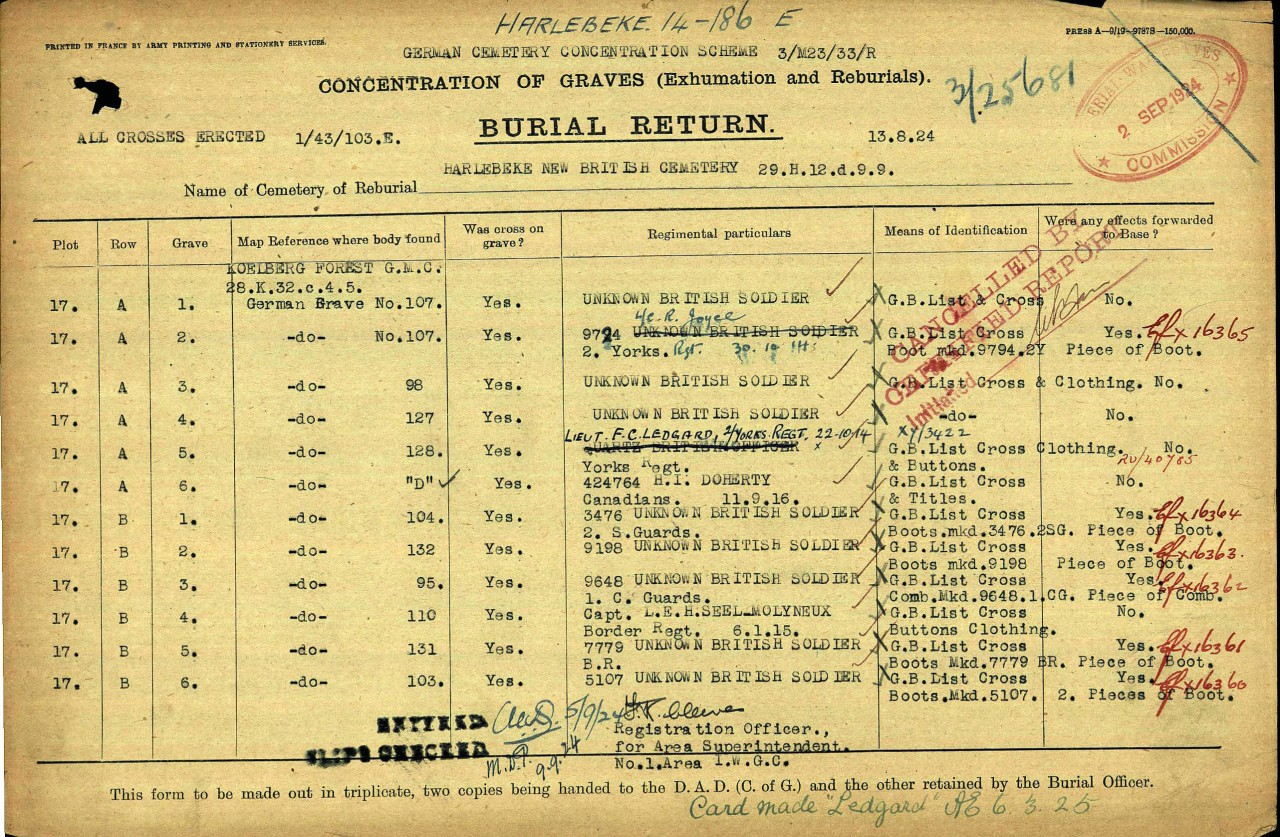
Private Doherty was originally buried in the Koelberg (Kolenberg?) Forest German Military Cemetery, Trench Map Coordinates 28.K.32.c.4.5 (GPS= 50.8188, 3.0436) in German Grave D. His remains were exhumed and reburied in the Harlebeke New British Cemetery on 13 September 1924, as part of the IWGC project to concentrate fallen soldiers so that their grave sites could be properly maintained. This record shows his original grave site. -
Document
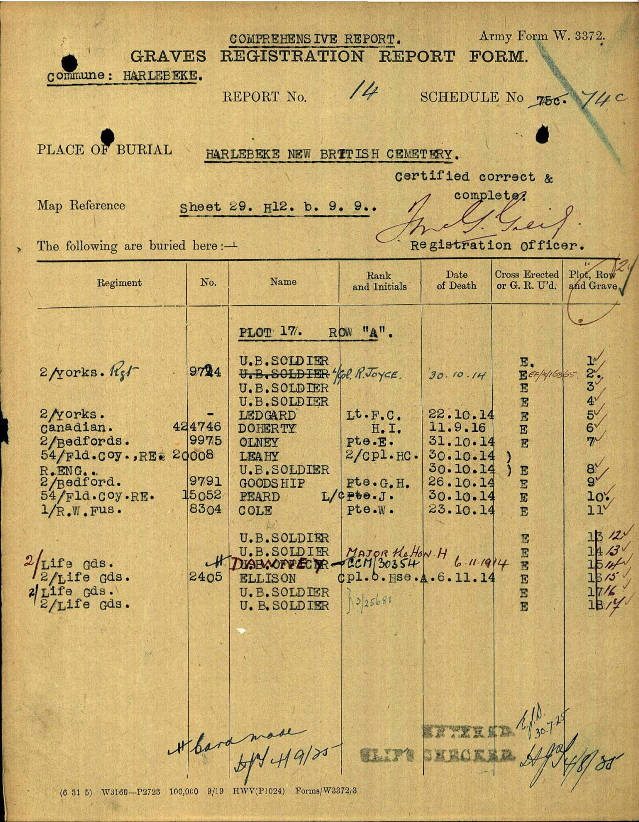
Private Doherty was originally buried in the Koelberg (Kolenberg?) Forest German Military Cemetery, Trench Map Coordinates 28.K.32.c.4.5 (GPS= 50.8188, 3.0436) in German Grave D. His remains were exhumed and reburied in the Harlebeke New British Cemetery on 13 September 1924, as part of the IWGC project to concentrate fallen soldiers so that their grave sites could be properly maintained. This record shows his new grave site. -
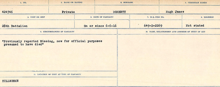
Circumstances of death registers
Source: Library and Archives Canada. CIRCUMSTANCES OF DEATH REGISTERS, FIRST WORLD WAR. Surnames: Deuel to Domoney. Microform Sequence 28; Volume Number 31829_B016737. Reference RG150, 1992-93/314, 172. Page 955 of 1084.
Digital gallery of
Private Hugh James Doherty
Digital gallery of
Private Hugh James Doherty
Digital gallery of
Private Hugh James Doherty
In the Books of Remembrance
Commemorated on:
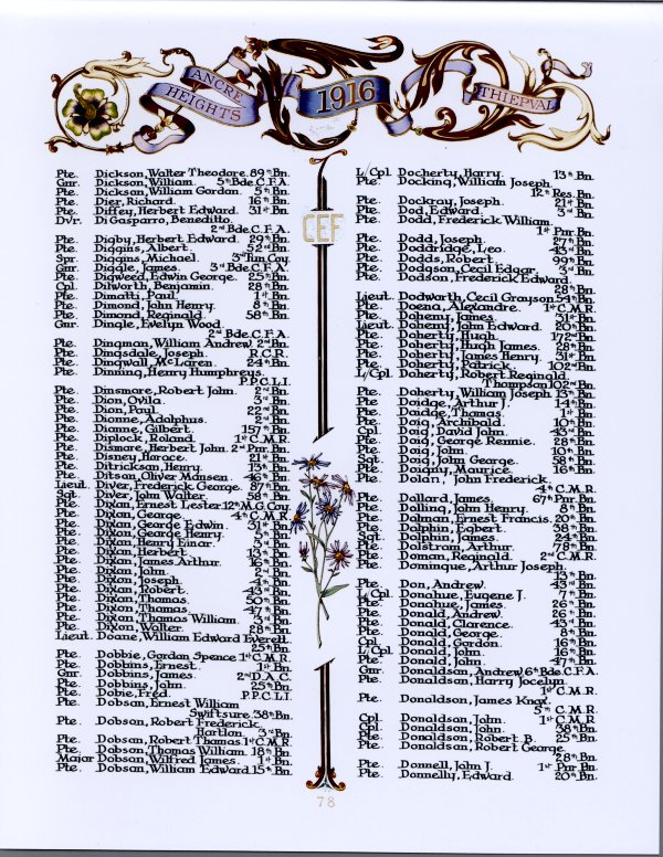
Page 78 of the First World War Book of Remembrance.
Request this page
Download this page
HARLEBEKE NEW BRITISH CEMETERY Belgium
HARLEBEKE NEW BRITISH CEMETERY is located 32 Km east of Ieper town centre on a road leading from the N8 Meenseweg, connecting Ieper to Menen (Menin), Wevelgem, Kortrijk and Zwevegem.
Ieper is linked to Kortrijk via the N8 passing through Menen and Wevelgem, joining the A17 1.5 Km after Wevelgem,in the direction of Gent. The A17 continues for 4 Km then meets the junction with the E17 continuing towards Gent.
12 Km along the E17 lies the junction with the N36 towards Harlebeke. The N36 ends at a T junction with the N43. Turning left at this junction towards Kortrijk leads to the left hand turning onto Deerlijksestraat. The HARLEBEKE NEW BRITISH CEMETERY is located 250 metres along the Deerlijksestraat on the left hand side.
For more information, visit Commonwealth War Graves Commission.
The Poppy Design is a trademark of The Royal Canadian Legion (Dominion Command) and is used with permission. Click here to learn more about the poppy.
Did we miss something?
Contribute information to this commemorative page
Do you have photographs, information or a correction relating to this individual’s virtual memorial? Learn more about the CVWM and the information we collect.