Ontario

Province Code
ON
City/Municipality
Ottawa
Memorial Number
35059-218
Type
Address
347 Richmond Road
Location
First United Church
in Canada
Yes
GPS Coordinates
45.3918138, -75.7544265
Inscription

[front/devant]
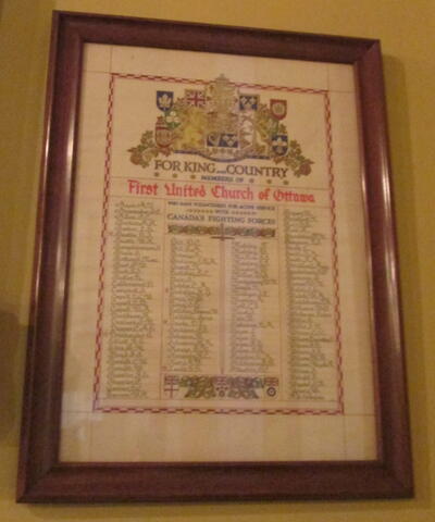
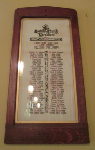
For King & Country
Members of
First United Church of Ottawa
who have volunteered for active service
with Canada's Fighting Forces 

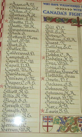
[column 1/colonne 1]
Agar, A.V.
Alexander, J.C.
Allen, J.C.
Barker, A.R.
Barker, L.H.
*Beattie, H.J.
Beattie, W.K.
Bergsteinsson, J.
Black, J.
Botterell, Nora
Burt, P.W.
Burt, T.J.
Butler, H.
Calderwood, D.
Campbell, J.
Capell, H.C.W.
Capell, H.B.
Capell, W.A.
Davidson, R.
Denison, J.M.
Draper, C.A.E.
*Drinkwater, G.
Elliott, R.G.
Ellis, R.M.
Floyd, S.J.
Forsyth, C.W.
Forsyth, W.
Franklin, R.E.
Frappier, F.
Gervan, H.C.
Gervan, W.R.

[column 2/colonne 2]
Gill, D.C.
Gill, E.A.
Gobey, A.
Graham, J.B.A.
Guest, N.
Halliday, E.C.
Haw, J.
Hobbs, C.A.
*Hodgins, K.Y.
Hogg, W.G.
Hogg, J.E.
Holliday, Gwen, M.
Holliday, Jean
*Irwin, D.L.
Jackson, J.S.
Johnson, B.
Johnson, K.A.
Keays, G.M.
Kennedy, R.C.
Ker, A.G.
*Lewis, S.G.

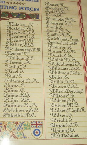
[column 3/colonne 3]
Maloley, T.
Maloley, W.
McRae, J.S.
Mcabry, H.S.
Mcabry, W.
Miller, W.J.
Montgomery, W.M.
Morgan, N.
Mulligan, J.L.
Murray, A.
Neill, C.S.
Nicol, J.
Pals, V.
Patterson, H.A.
Payne, L.
Payne, O.
Payne, R.G.
Payne, S.R.
Paynter, K.A.
Pickthorne, E.B.
Pitkethly, D.C.

[column 4/colonne 4]
Poyser, N.
Proudfoot, N.
Reid, G.E.
Reid, R.
Shouldice, F.M.
Simpson, L.J.
Smith, C.
Smith, F.A.
Smith, R.A.
Strickland, Ann
Sunderland, J.F.
Thomson, J.
Turner, W.M.
Walsh, J.E.
Walsh, W.A.
Watchhorn, T.A.
William, W.O.
Whitman, Helen
Willis, E.
Willis, J.N.
Wilson, C.J.C.
Wilson, Dorothy J.
Wilson, J.E.
Wilson, J.S.
Wilson, M.B.
Wilson, Myrtle R.
Wilson, S.
Wright, S.
Wyand, J.B.
Young, W.
R.G. Hodgins 

Image
Photo Credit
Richard Turcotte
Caption
Scroll
1 of 3 images
Image
Photo Credit
Richard Turcotte
Caption
Scroll Columns 1 and 2
1 of 3 images
Image
Photo Credit
Richard Turcotte
Caption
Scroll Columns 3 and 4
1 of 3 images
War or Conflict Term
Province
!4v1625770786979!6m8!1m7!1sgMfyAw5TVJVOWwjsuUyZ-g!2m2!1d45.3918138250163!2d-75.75442647085553!3f322.37537812038437!4f4.859160371606961!5f1.799216230616775
Body Content

This memorial consists of a framed scroll, and is dedicated to the members of the First United Church of Ottawa who served in the Second World War. It was unveiled by the First United Church of Ottawa.

First United Church shares a building with All Saints' Anglican Church Westboro.

City
Ottawa
Country
Type Description
Framed scroll; parchment & wood
Memorial CF Legacy ID
8700
City/Municipality
Ottawa
Memorial Number
35059-217
Type
Address
347 Richmond Road
Location
All Saints' Anglican Church Westboro
in Canada
Yes
GPS Coordinates
45.3918138, -75.7544265
Inscription

[front/devant]

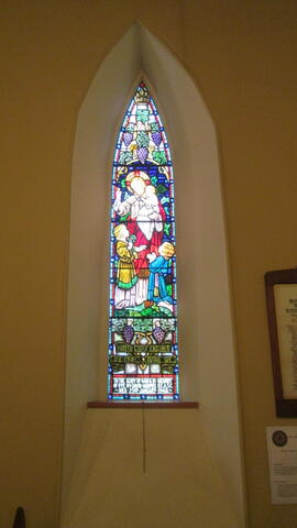
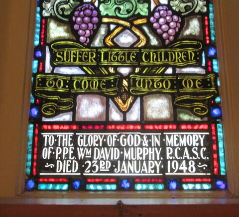
"Suffer little children
to come unto me"

To the gloriy of God & in memory
of P.P.E. Wm. David Murphy R.C.A.S.C.
Died 23rd January 1948 

Image
Photo Credit
Richard Turcotte
Caption
stained glass window
1 of 2 images
Image
Photo Credit
Richard Turcotte
Caption
inscription
1 of 2 images
War or Conflict Term
Province
!4v1625770786979!6m8!1m7!1sgMfyAw5TVJVOWwjsuUyZ-g!2m2!1d45.3918138250163!2d-75.75442647085553!3f322.37537812038437!4f4.859160371606961!5f1.799216230616775
Body Content

This memorial is dedicated to P.P.E. William David Murphy, Royal Canadian Army Service Corps (RCASC).

William David Murphy was born in 1895 in Ottawa. Raise and educated in Ottawa, he operated a butcher shop in the city for many years before enlisting in 1940. He served overseas with the Royal Canadian Army Service Corps (RCASC) from 1940 to 1944 and upon his return to Ottawa, joined the Department of Agriculture. He died suddenly at his home on January 23, 1948, and is buried at Pinecrest Cemetery.

All Saints' Anglican Church Westboro shares a building with First United Church.

City
Ottawa
Country
Type Description
Stained glass window
Memorial CF Legacy ID
8696
City/Municipality
Ottawa
Memorial Number
35059-216
Type
Address
347 Richmond Road
Location
All Saints' Anglican Church Westboro
in Canada
Yes
GPS Coordinates
45.3918138, -75.7544265
Inscription

[front/devant]

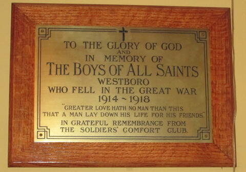
To the glory of God
and
in memory of
The Boys of All Saints
Westboro
who fell in the Great War
1914 - 1918
"Greater love hath no man than this
that a man lay down his life for his friends"

In grateful remembrance from
the Soldiers' Comfort Club 

Image
Photo Credit
Richard Turcotte
Caption
plaque
War or Conflict Term
Province
!4v1625770786979!6m8!1m7!1sgMfyAw5TVJVOWwjsuUyZ-g!2m2!1d45.3918138250163!2d-75.75442647085553!3f322.37537812038437!4f4.859160371606961!5f1.799216230616775
Body Content

This memorial consists of a brass plaque, and is dedicated to the members of All Saints' Anglican Church who served in the First World War. It was unveiled by the Church's Soldiers' Comfort Club.

All Saints' Anglican Church Westboro shares a building with First United Church.

City
Ottawa
Country
Type Description
Plaque; brass
Memorial CF Legacy ID
8699
City/Municipality
Ottawa
Memorial Number
35059-215
Type
Address
347 Richmond Road
Location
All Saints' Anglican Church Westboro
in Canada
Yes
GPS Coordinates
45.3918138, -75.7544265
Inscription

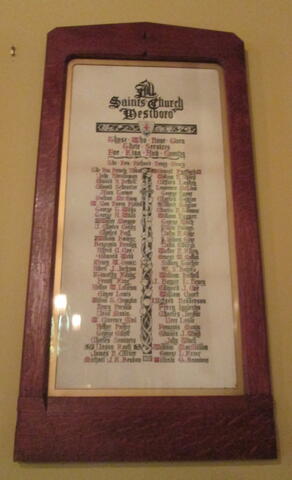
[left scroll/défilement gauche]
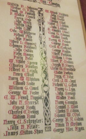
All Saints Church Westboro
Those who have given
their services
for King and Country

Wilfred B. Johnson; W. Ward Bickford
Arthur G. King; John Smith
Frank W. Howland; Hugh Tucker
F. Walter Cowell; Thomas Elliott
Harry Dale; Albert J. Liddiard
John Welch; John Liddiard
Andrew Schaw; T. Edward Olive
John Todd; Evan T. Thomas
Otto Whitehorne; Walter Smith
Richard Philip; Harry E. Palmer
John Kimber; George Moyle
Alfred L. Evans; Cecil E. Cathcart
Thomas Benbow; George Rankin
John Osborn; Albert Parkinson
Kirby Mooney; William I. Down
Percy Belot; Albert P. Mullins
W. Albert Spears; Joseph H. Rigers
Charles Rawlins; Victor T. Merrifield
Albert E. Leigh; Walter Borham
Henry Elliot; Percy C. Belot
Harry Whitehorn; Cecil J.W. Jount
Edward Scobie; Richard V. Gifford
William G. Cowell; Harry G. Lyon
George W. Foster; John Servage
E.W. Frank Hopgood; Walter Bond
John H. Meers; Harry Crampton
Ernest Beatty; Samuel S. Wood
Charles E. Tenney; Charles H. Gibson
William Bond; Thomas W. O'Neil
Harry C. Schroeter; George F.A. Gibson
John H. Kezar; Hiram N. McEwen
James Milton Skuce; George Alex Ryan 

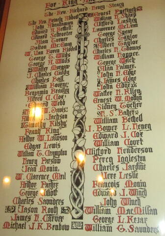
[right scroll/défilement vers la droite]
All Saints Church Westboro
Those who have given
their services
for King and Country
The Rev. Richard Henry Steacy

The Rev. Brinley Abbott; Ernest Pyefinch
John Abrahamsen; William H. Sharp
Edward A. Bethell; Clifford Lashey
Edward Schroeter; Lawrence McLean
Alan Turner; George Spear
Dalton McEwan; Charles Taylor
W. Van Buren Riddell; Albert Taylor
George T. Wilds; Charles H. Thomas
George A. Wilds; William Hopper
Walter Morgan; Geogre Welch
J. Charles Caddy; Alan Palmer
Charles Ball; John H. Edge
William Bourne; James Edge
Benjamin Bradley; John Edge
Alfred C. Cof; Walter H. Riley
Edward Webb; Ernest W. Molton
W. Davis; Sidney Tucker
Albert J. Jackson; H.S. Baker
Timothy Kilsby; William Bethell
Frank King; J. Bower Henry
Arthur W. Lawson; Edward J. Cof
Edgar Lewis; William Court
William Crampton; Clifford Henderson
Henry Parslow; Percy Iggleston
Jean Monin; Charles Jardin
W. Clarence O'Neil; Urer Leslie
Arthur Parker; Francois Monin
George Elliott; Edward J. Winch
Charles Saunders; John Winch
Jason Routh; William McMillan
James H. Carver; George L. Kezar
Michael J.K. Brubow; William G. Saunders 

Image
Photo Credit
Richard Turcotte
Caption
Left Scroll
1 of 4 images
Image
Photo Credit
Richard Turcotte
Caption
Left Scroll close up
1 of 4 images
Image
Photo Credit
Richard Turcotte
Caption
Right Scroll
1 of 4 images
Image
Photo Credit
Richard Turcotte
Caption
Right Scroll close up
1 of 4 images
War or Conflict Term
Province
!4v1625770786979!6m8!1m7!1sgMfyAw5TVJVOWwjsuUyZ-g!2m2!1d45.3918138250163!2d-75.75442647085553!3f322.37537812038437!4f4.859160371606961!5f1.799216230616775
Body Content

This memorial consists of two framed scrolls, and is dedicated to the members of All Saints' Anglican Church Westboro who served in the First World War. It was unveiled in 1918 by members of All Saints' Anglican Church Westboro.

The names listed on each scroll are arranged in two columns.

All Saints' Anglican Church Westboro shares a building with First United Church.

City
Ottawa
Country
Type Description
framed scroll; parchment & wood
Memorial CF Legacy ID
8698
City/Municipality
Ottawa
Memorial Number
35059-214
Type
Address
Apeldoorn Avenue
in Canada
Yes
GPS Coordinates
45.3621673, -75.7057165
Inscription

[front/devant]

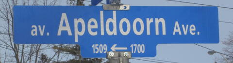
av. Apeldoorn Ave.

Image
Photo Credit
Richard Turcotte
Caption
street sign
War or Conflict Term
Province
!4v1625770311551!6m8!1m7!1stAq4GGYzerdgHCmKdDw6Fw!2m2!1d45.36216731897584!2d-75.70571647892885!3f199.52048467502973!4f-1.2032759737351312!5f3.2198574389736394
Body Content

Apeldoorn Avenue is dedicated to the Canadian troops who fought in the capture of Apeldoorn, The Netherlands. Apeldoorn Avenue is located in the Carleton Heights – Rideau View neighbourhood of Ottawa. This area was developed in the mid-late 1940’s to house returning Second World War veterans and their families. Many streets in the area are named for famous battles and a nearby church was named to memorialize all Second World War veterans.

The city of Apeldoorn was one of the first Allied objectives in the spring offensive of 1945. The 1st Canadian Infantry Brigade was set to make a decisive strike against the town on April 16, 1945, and by 4:300am on April 17, The Royal Canadian Regiment was in control of the eastern edge of the town. The Hastings and Prince Edward Regiment and the 48th Highlanders followed later at dawn. By mid-morning, the Highlanders had secured the north-western section, the Hastings were on the grounds of Het Loo Palace (the summer residence of the Dutch Royal Family) and the Royal Canadian Regiment was in the town square. The West Nova Scotia Regiment of the 3rd Brigade took over the south-western perimeter of the town before noon.

City
Ottawa
Country
Type Description
Street; street sign
Photo Credit
Richard Turcotte
Memorial CF Legacy ID
8901
City/Municipality
Ottawa
Memorial Number
35059-213
Type
Address
Arnhem Street
in Canada
Yes
GPS Coordinates
45.3653811, -75.7050325
Inscription

[front/devant]

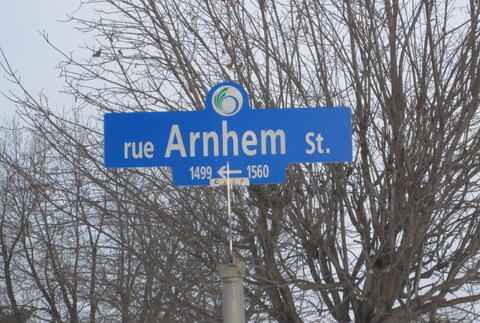
rue Arnhem St.

Image
Photo Credit
Richard Turcotte
Caption
street sign
War or Conflict Term
Province
!4v1625770166114!6m8!1m7!1sfu43jdZj2mbznpT3wLZ0rQ!2m2!1d45.36538111076447!2d-75.7050324734037!3f222.42915770117221!4f0.9785750664429855!5f3.1790543411460472
Body Content

Arnhem Street is dedicated to the Canadian troops who fought in the two Battles of Arnhem. Arnhem Street is located in the Carleton Heights – Rideau View neighbourhood of Ottawa. This area was developed in the mid-late 1940’s to house returning Second World War veterans and their families. Many streets in the area are named for famous battles and a nearby church was named to memorialize all Second World War veterans.

The first Battle of Arnhem took place between September 17-25, 1944 when Allied Forces launched OPERATION MARKET GARDEN, the surprise attack that was to capture bridges at Eindhoven, Nijmegan and Arnhem in the Netherlands, to allow the Allied Forces to bypass the German defensive Siegfried Line before pursuing offensive operations into Germany. 437 Squadron RCAF, was involved in towing gliders and logistic airdrops to support the British 1st Airborne Division at Arnhem, but the Division encountered far stronger resistance than anticipated.

In the ensuing battle, only a small force managed to hold one end of the Arnhem Road Bridge and after the ground forces failed to relieve them, they were overrun on September 21. The rest of the division, trapped in a small pocket west of the bridge, had to be evacuated on September 25. 20 Field Company and 23 Field Company, Royal Canadian Engineers, assisted in the withdrawal of these forces by establishing crossing sites at Heveadorp and Driel, just west of Arnhem, along the Nederrijn River.

The second Battle of Arnhem was part of an Allied offensive that began in the early months of 1945, to enter Germany and the Reichwald. 1st Canadian Army was given the mission to capture a number of towns and cities along the advance including Arnhem, which was capture by 1 Canadian Corps in mid-April 1945.

City
Ottawa
Country
Type Description
Street; street sign
Photo Credit
Richard Turcotte
Memorial CF Legacy ID
8900
City/Municipality
Ottawa
Memorial Number
35059-212
Type
Address
Falaise Road
in Canada
Yes
GPS Coordinates
45.3583526, -75.708838
Inscription

[front/devant]

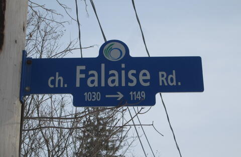
ch. Falaise Rd.

Image
Photo Credit
Richard Turcotte
Caption
Street sign
War or Conflict Term
Province
!4v1625770038856!6m8!1m7!1sx_rwY6SaIcPDcwKxYaw57g!2m2!1d45.35835259117778!2d-75.70883795252517!3f140.47327388441087!4f3.9826604754668295!5f3.325193203789971
Body Content

Falaise Road is dedicated to the Canadian troops who fought in the Battle of the Falaise Pocket. Falaise Road is located in the Carleton Heights – Rideau View neighbourhood of Ottawa. This area was developed in the mid-late 1940’s to house returning Second World War veterans and their families. Many streets in the area are named for famous battles and a nearby church was named to memorialize all Second World War veterans.

Falaise is a small French town, 35 km south of Caen, known for the battle of the “Falaise Pocket” during the Allied re-conquest of France (OPERATION OVERLORD) from August 12-21, 1944, in which two German armies were encircled and destroyed by the Allied armies. Some 10,000 German troops were killed and 50,000 taken prisoner. Much of the Falaise was destroyed before the town was taken by a combined force of Canadian and Polish troops. Falaise was largely restored after the war.

City
Ottawa
Country
Type Description
Street; street sign
Photo Credit
Richard Turcotte
Memorial CF Legacy ID
8899
City/Municipality
Ottawa
Memorial Number
35059-211
Type
Address
Melfa Crescent
in Canada
Yes
GPS Coordinates
45.3640251, -75.7005197
Inscription

[front/devant]

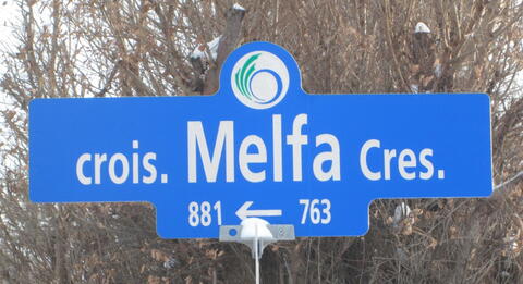
crois. Melfa Cres.

Image
Photo Credit
Richard Turcotte
Caption
Street sign
War or Conflict Term
Province
!4v1625769905905!6m8!1m7!1sRnspSYAG0dS1GU4WvL6qyg!2m2!1d45.36402509983863!2d-75.70051968273374!3f48.6861528389683!4f-0.611591878524564!5f3.2392300787854484
Body Content

Melfa Crescent is dedicated to the Canadian troops who fought in the Battle for the Melfa River crossing. Melfa Crescent is located in the Carleton Heights – Rideau View neighbourhood of Ottawa. This area was developed in the mid-late 1940’s to house returning Second World War veterans and their families. Many streets in the area are named for famous battles and a nearby church was named to memorialize all Second World War veterans.

The Battle for the Melfa River crossing began in the early hours of May 24, 1944 when the British Columbia Dragoons passed through a gap in the HITLER LINE, advancing beyond to establish a firm base through which the Lord Strathcona Horse (RC), reinforced with a company from the Westminster Regiment, would pass with the objective of seizing a crossing on the Melfa River. Using a less obvious route, the Strathcona’s quickly covered the distance to the river and soon found themselves in the rear of the enemy covering the near bank. The action developed into a series of bitter duals between Panther and Sherman tanks and by the end of the afternoon the Germans had withdrawn across the river. However, the Germans had brought up reinforcements and the battle raged on back and forth across the river until nightfall.

As the battle continued, the recce troop along with A Company Westminster Regiment, managed to cross the river and establish a bridgehead. The forming and holding of a bridgehead across the river was vital to the whole 1st Canadian Corps operation. For five hours the company maintained its position in the face of superior enemy fire and attack until the remaining companies and supporting weapons were able to reinforce them.

Early in the action, the company commander, Major John Mahony was wounded in the head and twice in the leg, but refused medical aid and continued to direct the defence of the bridgehead. Through his actions, the bridgehead remained intact and the advance through the Liri Valley was able to continue. For his exemplary leadership and courage in this action, Major Mahony was awarded the Victoria Cross.

City
Ottawa
Country
Type Description
Street; street sign
Photo Credit
Richard Turcotte
Memorial CF Legacy ID
8898
City/Municipality
Ottawa
Memorial Number
35059-210
Type
Address
Normandy Crescent
in Canada
Yes
GPS Coordinates
45.3616015, -75.7069874
Inscription

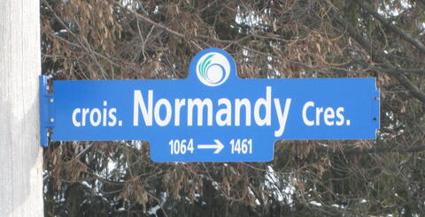
crois. Normandy Cres.

Image
Photo Credit
Richard Turcotte
Caption
street sign
War or Conflict Term
Province
!4v1625769806185!6m8!1m7!1sJeRVIfrDkkcBXmqVS8In3g!2m2!1d45.36160149993994!2d-75.70698738121771!3f105.0259568988349!4f-1.211748980981696!5f3.1770936169332895
Body Content

Normandy Crescent is dedicated to the Canadian troops who fought in the Battle of Normandy. Normandy Crescent is located in the Carleton Heights – Rideau View neighbourhood of Ottawa. This area was developed in the mid-late 1940’s to house returning Second World War veterans and their families. Many streets in the area are named for famous battles and a nearby church was named to memorialize all Second World War veterans.

City
Ottawa
Country
Type Description
Street; street sign
Photo Credit
Richard Turcotte
Memorial CF Legacy ID
8964
City/Municipality
Ottawa
Memorial Number
35059-209
Type
Address
Ortona Avenue
in Canada
Yes
GPS Coordinates
45.3588495, -75.7069812
Inscription

[front/devant]

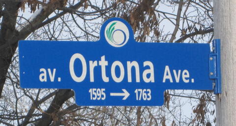
av. Ortona Ave.

Image
Photo Credit
Richard Turcotte
Caption
street sign
War or Conflict Term
Province
!4v1625769699704!6m8!1m7!1stvAsf4zRguyNprKICHz6gA!2m2!1d45.35884947550822!2d-75.70698120476368!3f44.33337958495701!4f0.11374108065334098!5f2.764820395058887
Body Content

Ortona Avenue is dedicated to the Canadian troops who fought in the Battle of Ortona. Ortona Avenue is located in the Carleton Heights – Rideau View neighbourhood of Ottawa. This area was developed in the mid-late 1940’s to house returning Second World War veterans and their families. Many streets in the area are named for famous battles and a nearby church was named to memorialize all Second World War veterans.

The Battle of Ortona (20-28 December 1943) was an extremely fierce battle fought between German Fallschirmjäger (paratroops) from the German 1st Parachute Division and assaulting Canadian forces from the Canadian 1st Infantry Division. It was the culmination of the fighting on the Adriatic front in Italy during “Bloody December”. The battle, dubbed “Little Stalingrad” for the deadliness of its close-quarters combat, took place in the small Adriatic Sea town of Ortona, about halfway down the Italian coast.

The initial Canadian attack on the town was made on December 20 by Canadian 2nd Brigade’s Loyal Edmonton Regiment with elements of the Seaforth Highlanders of Canada under command. Meanwhile elements of the division’s 3rd Brigade launched a northerly attack to the west of the town in attempt to outflank and cut off the town’s rear communications but made slow progress because of the difficult terrain and the skillful and determined German defence.

The Germans also concealed various machine guns and anti-tank emplacements throughout the town, making movement by armour and infantry increasingly difficult. The house to house fighting was vicious and the Canadians made use of a new tactic: “mouse-holing”. On December 26, Princess Patricia’s Canadian Light Infantry and the Three Rivers Regiment joined the battle. After eight days of fierce fighting, the depleted German troops withdrew from the town.

City
Ottawa
Country
Type Description
Street; street sign
Photo Credit
Richard Turcotte
Memorial CF Legacy ID
8897