Ontario

Province Code
ON
City/Municipality
Kingston
Memorial Number
35036-097
Type
Address
13 General Crerar Crescent
Location
Royal Military College of Canada
in Canada
Yes
GPS Coordinates
44.23069, -76.46936
Inscription

[front/devant]

"In memory of the officers and seamen of the Royal Navy and Provincial Marine, and of the officers and solders of the Royal Marines, Royal Newfoundland, King's (8th) and 100th Regiments, who served on Lake Ontario in defence of Canada in 1812-14."

Image
Caption
Panel 1
1 of 4 images
Image
Caption
Panel 2
1 of 4 images
Image
Caption
Panel 4
1 of 4 images
Image
Caption
Panel 5
1 of 4 images
Province
Body Content

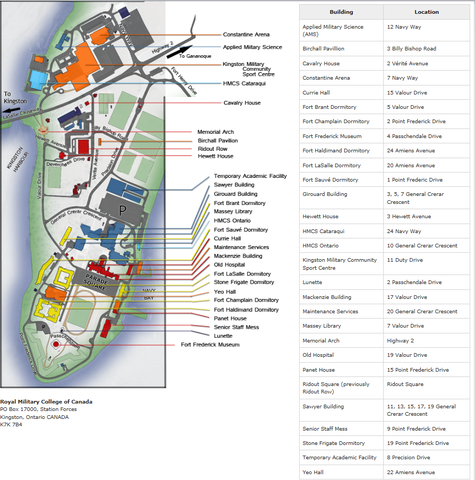
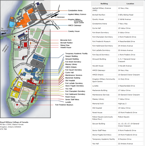
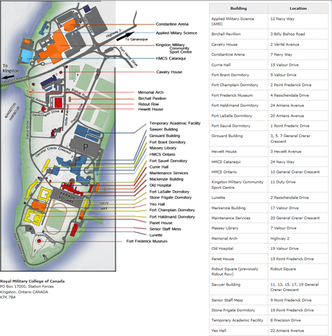
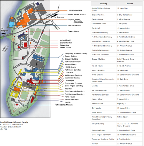
At the Royal Military College of Canada, there is a walking tour featuring information panels. The tour begins at Panet House on the grounds of the Royal Military College of Canada near where the slips on which these magnificent ships were built were located. It was erected in 2013 by the Royal Military College of Canada, made possible through a funding grant from the Department of Canadian Heritage.

There are 13 stations:

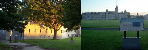
  • Panel 1 is located in front of Panet House (15 Point Frederick Drive) on the eastern side of the Point and relates the importance of the Point and Naval Dockyard during the War. During the war, British naval operations on Lake Ontario were centered here at Point Frederick, at the confluence of the St Lawrence and Cataraqui rivers at Lake Ontario. In 1812, the Provincial Marines operated only four vessels armed with 20 short-barreled guns. After May 1813, when the royal Navy units under Commodore Sir James Yeo took command of the facility, it grew rapidly. At the end of 1814, the Kingston Dockyard produced the largest naval Squadron on the Great Lakes, with 1,600 personnel serving on the massive flagship St. Lawrence, on four other ships, and four smeller vessel totaling 518 guns.
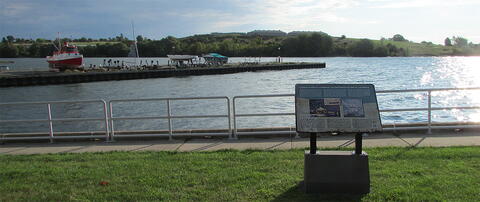
  • Panel 2 is location beside the walking path at the foot of General Crerar Crescent. It is sited to view the St. Lawrence Pier. During the period the pier was in the same location. You can see the protection that could be provided from batteries on Point Henry, to the east.
  • Panel 3 is located just to the south of panel 2, and is oriented towards Sackets Harbor, some 45 kms to the southeast in Northern New York. These two panels are located approximately where the slips were located during the construction of HMS St. Lawrence, Canada, and Wolfe.
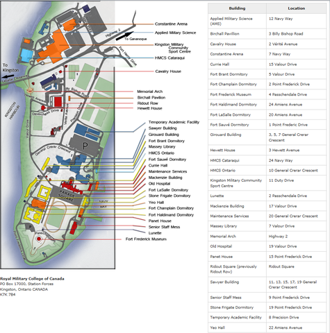
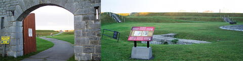
  • Panel 4 is located at the entrance to Fort Frederick and sited back towards Navy Bay and the ship building sites. The panel refers to Canada, and Wolfe, under construction.
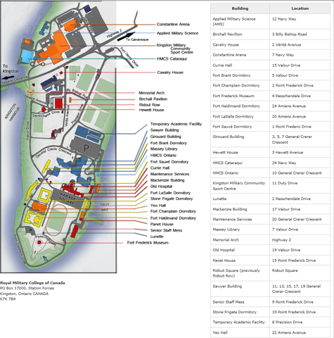
  • Panel 5 is located inside Fort Frederick, just beyond the Martello Tower that serves as the RMCC Museum, beside the footings of an earlier blockhouse. In the decades after the war, Fort Frederick’s stone Martello Tower with its surrounding walls and earthworks were constructed on the original Point Frederick site. This was part of six similar installations built to strengthen Kingston’s defences, the dockyard, the Rideau Canal, and entrance to the St Lawrence River from possible United States aggression in such crises as the Canadian rebellions in 1837 and the later Oregon Boundary dispute. Fort Frederick was only abandoned in 1870. Today the Fort Frederick Martello tower houses the Royal Military College of Canada Museum.
  • Panel 6 is located a little further into the Fort, just below the battery at the tip of the Point. A battery located in the area fired on the American ships that were attacking the Royal George in November 1812. Supporting buildings at the tip of Point Frederick provided protection for the blockhouse which stood on the approximate location of the Fort Frederick Tower, constructed in 1846 and preserved today as the Museum of the Royal Military College. Additional batteries and fortifications were established on Point Henry and fortified outposts were built on Amherst and Snake Islands, Lemoyne Point and Lake Ontario Point to control the approaches to Kingston harbor, but these guns were never fired in action.
  • Panel 7 is located on the water-side of the gazebo in front of Fort Champlain, a dormitory located at 2 Point Frederick Drive, and is sited toward Kingston’s inner harbor, where the Royal George sought refuge. The gazebo was a gift from the Class of 1966.
  • Panel 8 is located just to the south of Panel 7 (on the water side of the gazebo in front of 2 Point Frederick Drive) and is sited towards the Lake where the victualling wharf that faced Kingston and the lake where supplies were stored or loaded on the warships and commercial craft.
  • Panel 9 is located at the intersection of Valour Drive and Point Frederick Drive, facing the Dockyard gate and the former guard house. While the current gate and stone wall were erected after the war, being part of an 1815 plan which included a gatehouse, earlier drawings clearly show a sentry post and gate in this area.
  • Panel 10 is located at the end of Watt’s Walk (a gift of the Class of 1983) on General Crerar Drive at the southern end of Precision Drive. It looks out over the sports fields which cover much of what used to be Navy Bay.
  • Panel 11 is located approximately 25 m beyond the Wall of Honour (erected by the Class of 1963) on the east side of the path and is sited looking back towards the current Commandant’s residence.
  • Panel 12 is located at the north end of the Birchall Pavilion on the south side of Billy Bishop Road.
  • The last stop on the tour is the Historic sites and Monuments Board of Canada cairn located across from the entrance to RMCC, at the foot of the hill and road that leads up to Fort Henry. The Historic Sites and Monuments Board of Canada monument, created in 1937 in memory of those officers and seamen of the Royal Navy and Provincial Marine, and of the officers and soldiers of the Royal Marines, Royal Newfoundland, King’s (8th) and 100th Regiments who served on Lake Ontario in defence of Canada 1812-1814.
City
Kingston
Country
Type Description
Walking tour
Memorial CF Legacy ID
8597
City/Municipality
Kingston
Memorial Number
35036-096
Type
Address
Devercheres Drive
Location
Royal Military College of Canada
in Canada
Yes
GPS Coordinates
44.23374, -76.46932
Image
Province
Body Content

Devercheres Drive is named in memorial to Marie-Madeleine Jarret de Verchères.

In the immediate post-World War II era, the Royal Military College of Canada renamed street names on the College grounds for significant military leaders.

Marie-Madeleine Jarret de Verchères (March 3, 1678 - August 8, 1747) was the daughter of François Jarret, a seigneur in New France, and Marie Perrot. Her ingenuity is credited with thwarting a raid on Fort Verchères when she was 14 years old.

City
Kingston
Country
Type Description
street; street sign
Memorial CF Legacy ID
8596
City/Municipality
Kingston
Memorial Number
35036-095
Type
Address
Hewett Avenue
Location
Royal Military College of Canada
in Canada
Yes
GPS Coordinates
44.23423, -76.46991
Image
Province
Body Content

Hewett Avenue is named in memorial to Colonel Edward Osborne Hewett.

In the immediate post-World War II era, the Royal Military College of Canada renamed street names on the College grounds for significant military leaders.

Colonel Edward Osborne Hewett CMG, ADC (1875 - 1886) was the first Commandant of the Military College in Canada and a member of Royal Engineers. He chose the RMC motto ("Truth, Duty, Valour"), assembled a civilian staff; organized a 4 year curriculum, and prepared site for use as a College.

City
Kingston
Country
Type Description
Street
Memorial CF Legacy ID
8595
City/Municipality
Kingston
Memorial Number
35036-094
Type
Address
General Crerar Crescent
Location
Royal Military College of Canada
in Canada
Yes
GPS Coordinates
44.23206, -76.46936
Image
War or Conflict Term
Province
Body Content

General Crerar Crescent is named in memorial to General Henry Duncan Graham "Harry" Crerar.

In the immediate post-World War II era, the Royal Military College of Canada renamed street names on the College grounds for significant military leaders.

General Henry Duncan Graham "Harry" Crerar CH, CB, DSO, KStJ, CD, PC (April 28 1888 - April 1 1965) was a Canadian general and the country's "leading field commander" in World War II.

City
Kingston
Country
Type Description
street; street sign
Memorial CF Legacy ID
8594
City/Municipality
Kingston
Memorial Number
35036-093
Type
Address
Billy Bishop Road
Location
Royal Military College of Canada
in Canada
Yes
GPS Coordinates
44.23458, -76.46735
Image
War or Conflict Term
Province
Body Content

Billy Bishop Road is named in memorial to Air Marshal William Avery "Billy" Bishop.

In the immediate post-World War II era, the Royal Military College of Canada renamed street names on the College grounds for significant military leaders.

Air Marshal William Avery "Billy" Bishop, VC, CB, DSO & Bar, MC, DFC, ED, LL.D. (8 February 1894 - 11 September 1956) was a Canadian First World War Flying Ace, officially credited with 72 victories, making him the top Canadian are of the war. During the Second World War, Bishop was instrumental in setting up and promoting the British Commonwealth Air Training Plan.

City
Kingston
Country
Type Description
street; street sign
Memorial CF Legacy ID
8593
City/Municipality
Kingston
Memorial Number
35036-092
Type
Address
Amiens Avenue
Location
Royal Military College of Canada
in Canada
Yes
GPS Coordinates
44.23011, -76.46864
Image
War or Conflict Term
Province
Body Content

Amiens Avenue is named in memorial to the Battle of Amiens.

In the immediate post-World War I era, the Royal Military College of Canada renamed street names on the College grounds for significant battles.

The Battle of Amiens, also known as the Third Battle of Picardy, which began on 8 August 1918, was the opening phase of the Allied offensive later known as the Hundred Days Offensive that ultimately let to the end of the First World War. Allied forces advanced over 11 kilometers on the first day, one of the greatest advances of the war, with Henry Rawlinson's British Fourth Army playing the decisive role. The battle is also notable for its effects on both sides' morale and the large number of surrendering German forces.

City
Kingston
Country
Type Description
street; street sign
Memorial CF Legacy ID
8592
City/Municipality
Kingston
Memorial Number
35036-091
Type
Address
Passchendale Drive
Location
Royal Military College of Canada
in Canada
Yes
GPS Coordinates
44.22846, -76.47049
Image
Photo Credit
Victoria Edwards
Caption
RMC streets and buildings
War or Conflict Term
Province
Body Content

Passchendale Drive is named in memorial to the Battle of Passchendale.

In the immediate post-World War I era, the Royal Military College of Canada renamed street names on the College grounds for significant battles.

The Battle of Passchendale, also referred to as the Third Battle of Ypres, was a campaign of the First World War, fought by the Allies of World War I against the German Empire. The battle took place on the Western Front, from July-November 1917, for control of the ridges south and east of the Belgian city of Ypres in West Flanders, as part of a strategy decided by the Allies at conferences in November 1916 and May 1917.

City
Kingston
Country
Type Description
Street
Memorial CF Legacy ID
8591
City/Municipality
Kingston
Memorial Number
35036-088
Type
Address
4 Passchendale Drive
Location
Royal Military College of Canada Museum
in Canada
Yes
GPS Coordinates
44.22775, -76.46967
Inscription

[front/devant]

"WEAPONS TECH" 1993 ANDRE GAUTHIER

Image
Photo Credit
Victoria Edwards
Caption
WEAPONS TECH 1993 ANDRE GAUTHIER
Province
Body Content

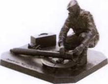
This sculpture, “WEAPONS TECH”, depicts a weapons technician working on a dis-assembled 81 mm mortar. He is depicted with parts of the weapon laid out on a ground sheet, as he is cleaning the flash eliminator of the mortar barrel. It was unveiled in March 2013, and is dedicated to current and past Canadian weapons technicians (Electrical, Mechanical Engineering).

City
Kingston
Country
Type Description
Sculpture; epoxy
Memorial CF Legacy ID
9237
City/Municipality
Kingston
Memorial Number
35036-087
Type
Address
4 Passchendale Drive
Location
Royal Military College of Canada Museum
in Canada
Yes
GPS Coordinates
44.22775, -76.46967
Inscription

[front/devant]

"SGT E.J. HOLLAND, VC" 1999 ANDRE GAUTHIER

Image
Photo Credit
Victoria Edwards
Caption
SGT EJ HOLLAND, VC 1999 ANDRE GAUTHIER
War or Conflict Term
Province
Body Content

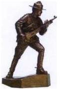
This sculpture, “SGT E.J. HOLLAND, VC”, depicts a Royal Canadian Dragoon who was awarded the Victoria Cross for his actions during the Battle of Leliefontein (South Africa) on November 7, 1900. Sgt Holland is shown saving his .303 cal Colt MG that had jammed as the Boers were within a few hundred yards. He burned his hands freeing the MG from its carriage but he succeeded in mounting a horse and carrying the MG back to the next secured Royal Canadian Dragoon Rearguard positon in this battle. It was unveiled in March 2013, and is dedicated to the memory of Sgt E.J. Holland, VC.

City
Kingston
Country
Type Description
Sculpture; bronze
Memorial CF Legacy ID
9238
City/Municipality
Kingston
Memorial Number
35036-086
Type
Address
4 Passchendale Drive
Location
Royal Military College of Canada Museum
in Canada
Yes
GPS Coordinates
44.22775, -76.46967
Inscription

[front/devant]

"SAILOR" 1995 ANDRE GAUTHIER

Image
Photo Credit
Victoria Edwards
Caption
Sailor 1978 @ RMC
1 of 2 images
Image
Caption
Sailor 1995 @ RMC
1 of 2 images
Province
Body Content

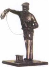
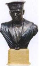
This sculpture, “SAILOR”, depicts a Second World War Canadian Sailor (bust). On the Sailor’s cap is seen a Tally band with the letter “H.M.C.S.”, since the actual name of a ship was not shown on Tally bands during the war for security reasons. In addition, the bow in the Tally band is seen worn over the Sailor’s left eye, as was the preference affected by Canadian Naval Reservists; Regular Navy wore this bow closer to the left ear. It was unveiled in March 2013, and is dedicated to current and past members of the Royal Canadian Navy.

City
Kingston
Country
Type Description
Sculpture; bronze
Memorial CF Legacy ID
9239