Ontario

Province Code
ON
City/Municipality
Hamilton (Binbrook)
Memorial Number
35029-001
Type
Address
2600 Regional Road 56
in Canada
Yes
GPS Coordinates
43.1228563, -79.8036858
Inscription

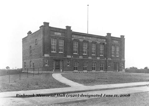
1914     BINBROOK SOLDIERS' MEMORIAL     1918

Image
Photo Credit
Glanbrook Heritage Society
Caption
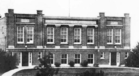
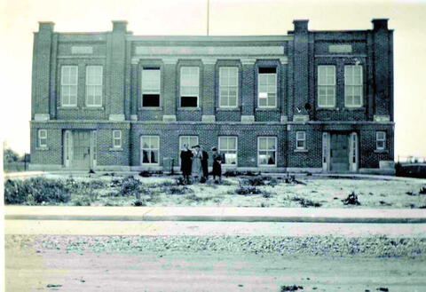
Soldiers’ Memorial Hall in 1930.
1 of 3 images
Image
Photo Credit
Glanbrook Heritage Society
Caption
Soldiers’ Memorial Hall as built in 1919-20.
1 of 3 images
Image
Photo Credit
Glanbrook Heritage Society
Caption
Soldiers’ Memorial Hall in the final stages of construction.
1 of 3 images
War or Conflict Term
Province
!4v1633609115332!6m8!1m7!1s642utWH6eDtyuq2C01JvfA!2m2!1d43.12285625245389!2d-79.80368576600927!3f297.4788367812074!4f4.049336512817845!5f1.7780165287566425
Body Content

Soldiers’ Memorial Hall was erected in 1919-20 and dedicated on December 13, 1920. The classic revival style was designed by Hamilton, Ontario, Architect Joshua A. Armes and built by Isbister Brothers of Hamilton.

The building is owned by the City of Hamilton and is one of three buildings to serve as a Veterans memorial in the City. The other two are located in Waterdown and Carlisle. When built, it was one of 12 such buildings in Canada. A building was selected by the community of Binbrook rather than a traditional monument with the view that it would serve as a social/cultural/practical focal point for the community — this objective has been achieved and continues to do so today.

Soldiers’ Memorial Hall has been expanded over the years to include wings on the north and south sides. A larger addition was made in the 1960s to make room for a kitchen and an area for plaques bearing the names of those whose lives were lost in the First World War and the Second World War as well as the names of those who served in both wars. The building was designated under the Ontario Heritage Act in December, 2008.
City
Hamilton (Binbrook)
Country
Type Description
Building - hall
Memorial CF Legacy ID
10608
City/Municipality
Halton Hills (Georgetown)
Memorial Number
35028-044
Type
Address
James and Charles Streets
Location
Remembrance Park
in Canada
Yes
GPS Coordinates
43.6486969, -79.9294434
Inscription

THIS PLAQUE IS ERECTED
IN MEMORY OF THE MEN
OF PROVINCIAL PAPER
LIMITED, WHO GAVE
THEIR LIVES IN THE
SECOND WORLD WAR
1939 1945

  • M. BADRE
  • W. CARNEY
  • C. CARPENTER
  • R. CARTMELL
  • L. DENNENY
  • C. DILLON
  • J. HEMPHILL
  • W. HUKKANEN
  • R. HUNTER
  • D. ISSACS
  • J. KEATING
  • W. LANKTREE
  • J.C. MCGREGOR
  • W. MURPHY
  • H. NELSON
  • G. ROBERTSON
  • J. TESKEY
  • J. O. WELDON

THEY GAVE THEIR ALL IN THE CAUSE OF FREEDOM

War or Conflict Term
Province
!4v1733922122841!6m8!1m7!1sCAoSLEFGMVFpcFBxRVQ2ZjJZMTRzTmYtMjd0QTJqZVY5dHg1amxlWW9sbTNaU3A2!2m2!1d43.64869693019176!2d-79.92944338022595!3f100.66003423597255!4f-41.649423677584394!5f1.4020050341723604
Body Content

The Provincial Paper Limited plaque was commissioned in 1948 to honor the 18 employees of the Georgetown paper mill who lost their lives during the Second World War. Crafted from bronze and weighing approximately 100 pounds, the plaque prominently displayed the names of the fallen. For decades, it hung within the mill as a tribute to the sacrifices made by its workers during the war. 

In 1991, the Abitibi Provincial Paper Mill, formerly known as Barber Coated Paper Mill, then Provincial Paper Ltd. and one of Georgetown’s largest employers, ceased operations. During the process of clearing out the building, the plaque was removed and entrusted to the Georgetown Royal Canadian Legion, Branch 120. While the Legion initially planned to install it at Greenwood Cemetery, its significant size and weight led to it being stored temporarily in the cemetery’s maintenance garage. Over time, the plaque was misplaced behind other stored items and remained forgotten for nearly two decades. 

In 2011, Shel Lawr, a Second World War Veteran and long-time member of the Georgetown Legion, recalled the plaque’s existence while reading about a similar effort to honor Veterans at Georgetown District High School. Motivated by the story, Lawr contacted the Town of Halton Hills’ Parks and Open Spaces department to investigate its whereabouts. A town employee rediscovered the plaque in the cemetery’s storage shed, untouched since its placement there 20 years earlier. 

Recognizing its significance, Lawr and other local advocates concluded that it should be displayed prominently at Remembrance Park, a site dedicated to honoring those who served in Canada’s wars. Lawr collaborated with Martin Bosomsa and Tom Schenk, who oversaw additions to the park, to ensure its placement. 

City
Halton Hills (Georgetown)
Country
Type Description
Tablet
Memorial CF Legacy ID
12830
City/Municipality
Halton Hills (Georgetown)
Memorial Number
35028-043
Type
Address
James and Charles Streets
Location
Remembrance Park
in Canada
Yes
GPS Coordinates
43.6486015, -79.9292145
Inscription

AIR•SON•AR•DUTCHAIS
THE LORNE SCOTS
PEEL DUFFERIN AND HALTON REGT.

  • DEFENCE OF CANADA,
    1812-1815
  • QUEENSTON
  • YPRES, 1916, '17
  • MOUNT SORREL
  • ARRAS, 1917, '18
  • AMIENS
  • PURSUIT TO MONS
  • ITALY, 1943-1945
  • AFGHANISTAN
  • DETROIT
  • NIAGARA
  • FESTUBERT, 1915
  • SOMME, 1916
  • HILL 70
  • HINDENBURG LINE
  • SICILY, 1943
  • NORTH-WEST EUROPE,
    1944-1945

DEDICATED TO THE SOLDIERS OF
THE LORNE SCOTS
(PEEL, DUFFERIN AND HALTON REGIMENT)

IN HONOUR OF THEIR 150TH ANNIVERSARY
1866-2016

AND FOR THEIR CONTINUING SERVICE
TO OUR COMMUNITY AND COUNTRY

War or Conflict Term
Province
!4v1733918734892!6m8!1m7!1sCAoSLEFGMVFpcE9icGt3RmUycGJQLVp2ZkZVdS1PU3lTVmNIdG5KV3dSNXJpRjBy!2m2!1d43.64860152882012!2d-79.92921452967465!3f61.37741472757158!4f-1.4421704691876869!5f0.4000000000000002
Body Content

The Lorne Scots Monument honours the soldiers of the Lorne Scots (Peel, Dufferin, and Halton Regiment) and commemorates the regiment’s 150th anniversary, celebrated in 2016. The unveiling was presided by their Colonel-in-Chief, His Royal Highness, Prince Edward, The Duke of Kent, KG, GCMG, GCVO, CD, ADC(P). 

The regiment's origins date back to September 1866 when it was formed in Brampton, Ontario, as the 36th Peel Battalion of Infantry. Over the years, the regiment experienced several re-designations: it became the 36th Peel Regiment in 1900, the Peel Regiment in 1920, and the Peel and Dufferin Regiment in 1923. On December 15, 1936, it was amalgamated with the Lorne Rifles (Scottish), formerly the 20th battalion of Halton Rifles, assuming its current designation as the Lorne Scots (Peel, Dufferin, and Halton Regiment). The regiment has a storied history of service, participating in every major theater of operations, including the First World War, Second World War, and the mission in Afghanistan. 

The monument’s design draws inspiration from the iconic Canadian National Vimy Memorial in France and is constructed of the same white granite. It features two columns, each standing 7.5 feet high with a symbolic design conveying the regiment’s core values. The left column represents duty, while the right column signifies honour, and the space between the two columns symbolizes sacrifice. At the top of the monument is the regiment’s bronze badge. Below the badge, the regiment's 17 Battle Honours are inscribed, commemorating significant engagements. A bronze Heraldic Ship, symbolizing service overseas, is depicted on the plinth. A twin monument is located in Gage Park at 2 Wellington Street, Brampton.  

City
Halton Hills (Georgetown)
Country
Type Description
Obelisk
Memorial CF Legacy ID
12829
City/Municipality
Halton Hills (Georgetown)
Memorial Number
35028-042
Type
Address
James and Charles Streets
Location
Remembrance Park
in Canada
Yes
GPS Coordinates
43.6482697, -79.9295883
Inscription

[left wall/mur gauche]

Remembrance Park

[right wall/mur droit]

needs further research/recherche incomplète

Province
!4v1733925934922!6m8!1m7!1sCAoSLEFGMVFpcFBoSG5JQnVNNFZrSjJnTzZ5YmxvekZHZnhVQi00a1BHYk1ybWVL!2m2!1d43.64826968038402!2d-79.92958829013519!3f31.63323252770209!4f-4.897543025273507!5f0.7820865974627469
Body Content

The original proposed name for the memorial park was “Dieppe Park,” put forward in 1959. However, it was felt by Georgetown citizens that it should reflect the sacrifice of all Georgetown servicemen from every conflict, and they worried the name Dieppe Park placed too heavy an emphasis on the Second World War. 

The name Remembrance Park was voted on by council in August of 1960 and announced to the public on the following month. It was first dedicated on Sunday, October 2, 1960, however, a much larger re-dedication ceremony and remembrance service was held the following month on November 13, 1960.

City
Halton Hills (Georgetown)
Country
Type Description
Park
Memorial CF Legacy ID
12826
City/Municipality
Halton Hills (Georgetown)
Memorial Number
35028-040
Type
Address
Normandy Boulevard
in Canada
Yes
GPS Coordinates
43.6506847, -79.9141864
War or Conflict Term
Province
!4v1645035299038!6m8!1m7!1sgD1I8BivrQS0Ub2DhllsHw!2m2!1d43.65068465963748!2d-79.91418636465703!3f103.27880818765011!4f4.533660944846005!5f1.9934777228632083
Body Content

Normandy Boulevard, built in 1947, was the first of four Victory Home streets built in Halton Hills. It was named after an important and strategic Second World War battle that took place on the beaches of Normandy, France, on June 6, 1944. 

City
Halton Hills (Georgetown)
Country
Type Description
Street
Memorial CF Legacy ID
10774
City/Municipality
Halton Hills (Georgetown)
Memorial Number
35028-039
Type
Address
57 Normandy Boulevard
in Canada
Yes
GPS Coordinates
43.6490759, -79.9174014
Inscription

OUR VICTORY (WARTIME) HOUSING HERITAGE

Normandy Blvd.,
Georgetown

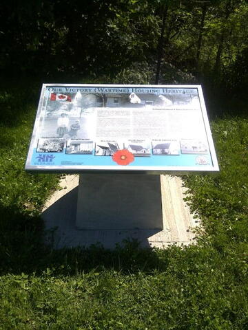
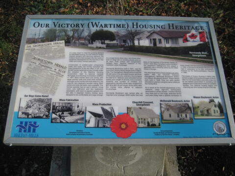
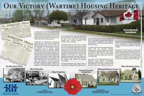
In a step meant to meet the growing demand for affordable housing, for both defence-related industry workers and returning veterans, the Federal Government jumped into the world of residential development for the first time in the 1940s and Victory Homes were born.

Constructed of prefabricated components (walls and roofs), the homes mimicked the mass production of the war effort. In all, over 30,000 homes were built across Canada under the direction of the Wartime Housing Corporation, later to become Canada Mortgage and Housing Corporation (CMHC) in 1947. Most homes were one storey, with steep pitched roofs and small sash windows. Although some homes had brick exteriors, the majority had clapboard wooden siding. Both centre and side-hall plans were available. The homes typically had an eat-in kitchen, living room, one bathroom and two bedrooms downstairs, with room to expand upstairs into the attic if required. Victory Homes were designed to be comfortable and large enough for a single family. Most often, the homes were built on large lots on winding streets and cul de sacs. Their unique and recognizable designs, have become “classics” in the Canadian urban landscape.

Normandy Boulevard, built in 1947, was the first of four Victory Home streets built in Halton Hills. The Georgetown Herald announced that 48 vets were to be allocated houses, but three of the wives were also veterans,  thus bringing the total to 51. Veterans were allocated homes based upon  length of service, time overseas, disability and number of children and dependents. Monthly rental rates ranged from $27.00 to $37.50 per house. A few years later, the homes were offered to veterans for purchase. 

Normandy Boulevard was named after an important and strategic WWII battle that took place on the beaches of Normandy, France, on June 6, 1944. Many Canadians were involved in this beachfront battleground that played a significant role in ensuring victory by the Allied forces in Europe. The other three Victory Home streets built within Halton Hills are Churchill Crescent (Georgetown), McDonald Boulevard (Acton) and Mason Boulevard (Acton). These streets were built in 1948. They too were quickly allocated to veterans using the same criteria as Normandy Blvd.

As a result of the shared experiences of the veterans, close tight-knit communities developed on all four streets. Children felt that they were part of one huge, extended family and even today have a special connection to these streets and the memories they provide. In 1992, a Normandy Boulevard Reunion was held in celebration of its 45th anniversary, followed by the McDonald/Mason Reunion in 1996.

The streets of Victory Housing in Halton Hills remind us again of the profound impact of World War II on our social history, and mark a new role for the federal government in providing well designed and constructed homes for Canadian families. The national housing legacy and charming war time homes endure to this day.

Image
Photo Credit
Town of Halton Hills
Caption
storyboard
1 of 2 images
Image
Photo Credit
Town of Halton Hills
Caption
inscription
1 of 2 images
War or Conflict Term
Province
!4v1645033343793!6m8!1m7!1s1Jer_ttrVgaYd_tJ7xl1Tw!2m2!1d43.64907588401462!2d-79.91740144291931!3f257.94126434722864!4f-6.512261540260326!5f1.9587109090973311
Body Content

During the 1940s the Canadian government made a concerted effort to supply housing for the men and women who worked in defense-oriented industries and later for Veterans returning from the Second World War. Much legislation, including The Veteran's Land Act, provided funding for such projects, and small subdivisions sprang up in virtually every major town or city in Canada. 

Most of Victory Housing was prefabricated, generally one-and-a-half storey with a steep roof, shallow eaves and no dormers. Homes built for Second World War Veterans created a blueprint for the city’s suburbs.

This storyboard was unveiled on June 6, 2009.

City
Halton Hills (Georgetown)
Country
Type Description
Interpretive Panel
Memorial CF Legacy ID
10773
City/Municipality
Halton Hills (Georgetown)
Memorial Number
35028-038
Type
Address
60 Guelph Street
Location
St. George's Anglican Church
in Canada
Yes
GPS Coordinates
43.6511949, -79.9223329
Inscription

BE THOU FAITHFUL UNTO DEATH AND I WILL GIVE THEE A CROWN OF LIFE

TO THE GLORY OF GOD AND IN PROUD MEMORY OF
THE MEN OF THIS PARISH WHO GAVE THEIR LIVES IN THE GREAT WAR, 1914-1918

Image
Caption
St. George's Anglican Church Great War Window
1 of 4 images
Image
Caption
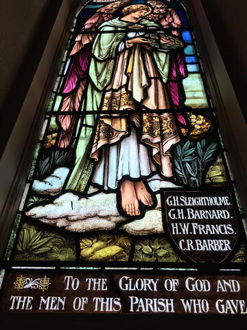
Window - depicts an angel holding a wreath.
1 of 4 images
Image
Caption
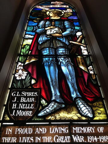
Window - depicts a knight who persisted unto death.
1 of 4 images
Image
Caption
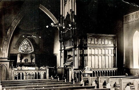
Expansion of sanctuary to make room for the two Great War windows, 1921.
1 of 4 images
War or Conflict Term
Province
!4v1729173911902!6m8!1m7!1sek-666LN-4nQi9qJVru2aw!2m2!1d43.65119488695695!2d-79.92233285091288!3f185.2359178990896!4f3.9635322622205393!5f0.7820865974627469
Body Content

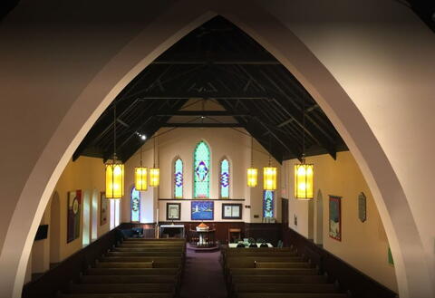
When St. George's Anglican Church was enlarged in 1921, a memorial window was unveiled by Lieutenant Governor H. O. Cockshatt and dedicated by Bishop Clark to those from the congregation who died in the First World War. The window depicts an angel holding a wreath, the crown of life, and a knight who persisted unto death.

City
Halton Hills (Georgetown)
Country
Type Description
Stained glass window
Photo Credit
St. George's Anglican Church
Memorial CF Legacy ID
10409
City/Municipality
Halton Hills (Georgetown)
Memorial Number
35028-037
Type
Address
127 Mill Street
Location
On the facade of the Royal Canadian Legion, Branch 120
in Canada
Yes
GPS Coordinates
43.6489985, -79.9267093
Image
Province
!4v1625502313968!6m8!1m7!1sLPukk0JVYfN-b9WCd6HyGg!2m2!1d43.6489984558294!2d-79.92670927170357!3f128.4804513288969!4f5.75981504933911!5f0.4000000000000002"
Body Content

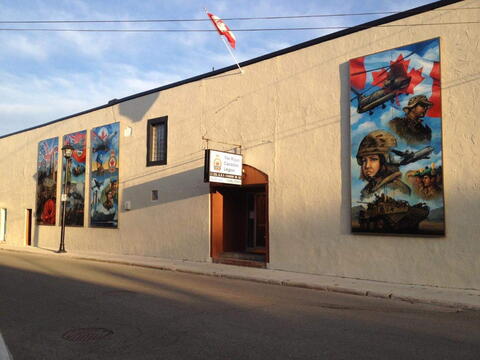
Robert Johannsen was commissioned by the Royal Canadian  Legion Georgetown branch 120 to paint a mural in 2012. The mural depicts the military history of the town in War and peacekeeping missions.

City
Halton Hills (Georgetown)
Country
Type Description
Mural
Memorial CF Legacy ID
10240
City/Municipality
Halton Hills (Acton)
Memorial Number
35028-036
Type
Address
McDonald and Wallace Streets
in Canada
Yes
GPS Coordinates
43.636979, -80.039468
Inscription

OUR VICTORY (WARTIME) HOUSING HERITAGE

McDonald Boulevard & Mason Boulevard, Acton

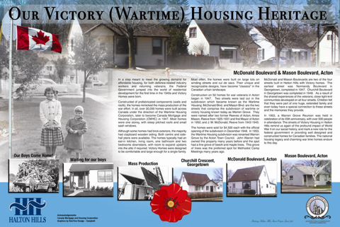
In a step meant to meet the growing demand for affordable housing, for both defence-related industry workers and returning veterans, the Federal Government jumped into the world of residential development for the first time in the 1940s and Victory Homes were born.

Constructed of prefabricated components (walls and roofs), the homes mimicked the mass production of the war effort. In all, over 30,000 homes were built across Canada under the direction of the Wartime Housing Corporation, later to become Canada Mortgage and Housing Corporation (CMHC) in 1947. Most homes were one storey, with steep pitched roofs and small sash windows.

Although some homes had brick exteriors, the majority had clapboard wooden siding. Both centre and side-hall plans were available. The homes typically had an eat-in kitchen, living room, one bathroom and two bedrooms downstairs, with room to expand upstairs into the attic if required. Victory Homes were designed to be comfortable and large enough for a single family. Most often, the homes were built on large lots on winding streets and cul de sacs. Their unique and recognizable designs, have become “classics” in the Canadian urban landscape.

Construction on 50 homes for war veterans in Acton began in 1947. Two streets were laid out in the subdivision which became known as the Wartime Housing. McDonald Blvd. and Mason Blvd. are the two streets that comprise the subdivision of wartime or victory housing known today as Warren Grove. They were named after two former Reeves of Acton, Amos Mason, Reeve from 1925-1931 and first Mayor of Acton in 1950; and J. M. McDonald, Reeve from 1942-1945.

The homes were sold for $4,500 each with the official opening of the subdivision in December 1948. In 1953, the Wartime Housing subdivision was renamed Warren Grove by the Acton Town Council. John Warren had owned this property many years before and the spot had a fine grove of beech and maple trees. This grove of trees was the preferred spot for Methodist Camp Meetings many years ago.

McDonald and Mason Boulevards are two of the four streets built in Halton Hills with Victory homes. The earliest street was Normandy Boulevard in Georgetown, completed in 1947. Churchill Boulevard in Georgetown was completed in 1948. As a result of the shared experiences of the veterans, close tight-knit communities developed on all four streets. Children felt that they were part of one huge, extended family and even today have a special connection to these streets and the memories they provide.

In 1993, a Warren Grove Reunion was held in celebration of its 45th anniversary, with over 500 people in attendance. The streets of Victory Housing in Halton Hills remind us again of the profound impact of World War II on our social history, and mark a new role for the federal government in providing well designed and constructed homes for Canadian families. The national housing legacy and charming war time homes endure to this day.

Image
Photo Credit
Town of Halton Hills
Caption
storyboard
1 of 2 images
Image
Photo Credit
Town of Halton Hills
Caption
inscription
1 of 2 images
War or Conflict Term
Province
!4v1645017279634!6m8!1m7!1sYh92_aJj4CmB9mzrRK2zSQ!2m2!1d43.63697902475796!2d-80.03946802956173!3f260.17200736440265!4f-3.2255790410855525!5f0.7820865974627469
Body Content

During the 1940s the Canadian government made a concerted effort to supply housing for the men and women who worked in defense-oriented industries and later for Veterans returning from the Second World War. Much legislation, including The Veteran's Land Act, provided funding for such projects, and small subdivisions sprang up in virtually every major town or city in Canada. 

Most of Victory Housing was prefabricated, generally one-and-a-half storey with a steep roof, shallow eaves and no dormers. Homes built for Second World War Veterans created a blueprint for the city’s suburbs.

On September 10, 2013, Rick Bonnette, Mayor of Halton Hills; Councilor Moya Johnson, Chair, Heritage Halton Hills and John Wagg, President Royal Canadian Legion, Branch 197 Acton, unveiled the newly-installed storyboard highlighting the architecturally unique and historically significant Victory Housing.

City
Halton Hills (Acton)
Country
Type Description
Interpretive Panel
Memorial CF Legacy ID
10771
City/Municipality
Halton Hills (Georgetown)
Memorial Number
35028-034
Type
Address
1 Park Avenue
Location
Georgetown Fairgrounds
in Canada
Yes
GPS Coordinates
43.6458068, -79.9272846
Inscription

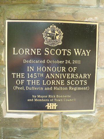
LORNE SCOTS WAY
Dedicated October 24, 2011

IN HONOUR OF
THE 145TH ANNIVERSARY
OF THE LORNE SCOTS
(Peel, Dufferin, and Halton Regiment)

by Mayor Rick Bonette
and Members of Town Council

Image
Photo Credit
Gerardo Cacella
Caption
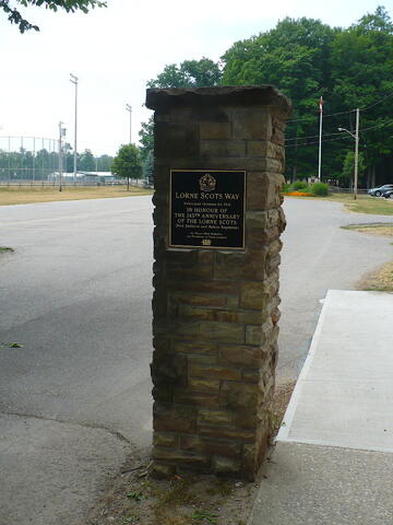
Gateway to park.
1 of 3 images
Image
Photo Credit
Tim Laye, Ontario War Memorials
Caption
Column with plaque.
1 of 3 images
Image
Photo Credit
Tim Laye, Ontario War Memorials
Caption
inscription
1 of 3 images
Province
!4v1625501893732!6m8!1m7!1sYW6cp6T2kHtgxamBGJ7EFA!2m2!1d43.64580613220517!2d-79.92728918260683!3f222.2460450735785!4f-3.6756316877577433!5f1.5041220219451086"
Body Content

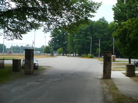
These gates and the entrance to the town park and fairgrounds have been dedicated to The Lorne Scots Regiment on their 145 anniversary of service.

City
Halton Hills (Georgetown)
Country
Type Description
Gate - columns
Memorial CF Legacy ID
9435