Ontario

Province Code
ON
City/Municipality
Fort Erie
Memorial Number
35019-031
Type
Address
2 Peace Bridge Plaza
Location
Border of Canada and the United States, crossing over the Niagara River
in Canada
Yes
GPS Coordinates
42.9080196, -78.9095936
Image
Photo Credit
Ken Holmes, Victoria Edwards
Caption
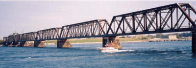
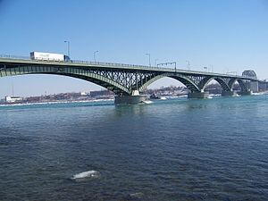
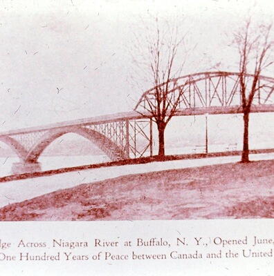
Peace Bridge
1 of 4 images
Image
Caption
Peace Bridge
1 of 4 images
Image
Caption
Peace Bridge “Peace Bridge, #17,” Fort Erie Local History, accessed September 15, 2017, http://www.fepl.ca/localhistory/items/show/4871.
1 of 4 images
Image
Photo Credit
Victoria Edwards
Caption
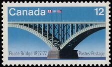
The Peace Bridge's was features in a Canada Post stamp - 50th anniversary 1927-1977
1 of 4 images
Province
!4v1625489046365!6m8!1m7!1s5-lrK22PqknjjQlReGh-IQ!2m2!1d42.90801960098377!2d-78.90959363268682!3f125.775700813057!4f2.1327320634789118!5f1.602010237126113"
Body Content

The Peace Bridge was constructed in 1927 to recognize over 100 years of peace and prosperity between the U.S. and Canada. The Peace Bridge is an international bridge between Canada and the United States at the east end of Lake Erie at the source of the Niagara River, about 20 kilometres upriver of Niagara Falls. The Peace Bridge was dedicated on August 7, 1927. The bridge is a 2580 foot long steel structure with three lanes. The Peace Bridge is the second busiest border crossing between the US and Canada.

The Peace Bridge is located near the center of downtown Buffalo, New York, and Fort Erie, Ontario, where it crosses the Niagara River. The main approaches to the Peace Bridge on the United States side are the New York State Thruway (I-190) and Porter Avenue, a four-lane arterial. On the Canadian side, the principal approach highways are the Queen Elizabeth Way ("QEW"), a four-lane controlled-access highway, Highway 3, a regional four-lane highway and the Niagara Parkway. The Peace Bridge addresses are 100 Queen Street Fort Erie, ON L2A 3S6 Canada and 1 Peace Bridge, Buffalo, NY 14213, United States. 

The building of the Peace Bridge was approved by the International Joint Commission on August 6, 1925. A major obstacle to building the bridge was the swift river current, which averages 7.5 to 12 miles per hour (12.1 to 19.3 km/h). Construction began in 1925 and was completed in the spring of 1927. On March 13, 1927, Edward Lupfer who served as chief engineer, drove the first car across the bridge. On June 1, 1927, the bridge was opened to the public.

The Peace Bridge measures 3,580 feet in length from abutment to abutment. The roadway is 36 feet wide from curb to curb with two six-foot pedestrian sidewalks on either side of the bridge. The superstructure of the Peace Bridge consists of riveted steel with reinforced concrete deck slabs and a latex modified concrete wearing surface. Today, the Peace Bridge has been modified to a three-lane bridge with twelve-foot wide lanes, able to accommodate heavy-duty commercial loads. The center lane of this three-lane bridge is reversible, allowing for two-lane operation in one direction during peak hours.
City
Fort Erie
Country
Type Description
Bridge
Memorial CF Legacy ID
7123
City/Municipality
Dunnville
Memorial Number
35019-030
Type
Address
536 Port Maitland Road
Location
In front of the No. 6 RCAF Dunville Museum
in Canada
Yes
GPS Coordinates
42.8789321, -79.586664
Inscription

ROYAL CANADIAN AIR FORCE
NO. 6 SERVICE FLYING TRAINING SCHOOL

With the outbreak of hostilities in 1939, one of Canada’s
major responsibilities was to provide air training facilities
far removed from the theatre of war and so on December 17,
1939, the British Commonwealth Air Training Plan was
inaugurated. The first of 107 air training schools was opened
the following year, among them No. 6 S.F.T.S. on this 400-
acre site at Dunnville. From then until the school officially
closed November 25, 1944, this was home for many thou-
sands of airmen and airwomen and 2436 pilots from Canada,
the United Kingdom, Australia, New Zealand and the U.S.A.
received their coveted "wings". During that period, 47 Cana-
dian, Commonwealth and American airmen paid the supreme
sacrifice at No. 6 S.F.T.S. while serving King and Country.

Erected by the R,C.A.F., wartime personnel of No. 6 with assistance from the
Ontario Ministry of Culture and Communications, September 10, 1988

Image
Photo Credit
Deborah Hamilton and/et Melvin Robinson. (www.ontarioplaques.com)
Caption
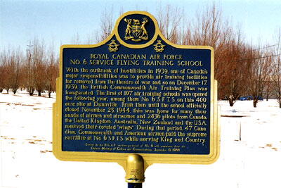
front view
1 of 2 images
Image
Caption
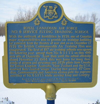
plaque
1 of 2 images
War or Conflict Term
Province
!4v1627472208621!6m8!1m7!1sCKoaIBmcO9nf4IuQ8M4QyQ!2m2!1d42.87893208969181!2d-79.58666395643966!3f241.60071342253303!4f-4.284838874830527!5f3.325193203789971"
Body Content

This memorial plaque title "Royal Canadian Air Force No. 6 Service Flying Training School" was erected by and dedicated to the Royal Canadian Air Force No. 6 Service Flying Training School.

City
Dunnville
Country
Type Description
Plaque (aluminums)
Memorial CF Legacy ID
5550
City/Municipality
Dunnville
Memorial Number
35019-029
Type
Address
206 Cedar Street
Location
Central Park
in Canada
Yes
GPS Coordinates
42.9040837, -79.6190546
Inscription

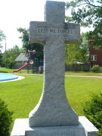
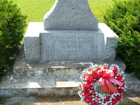
LEST WE FORGET

IN HONOURED MEMORY
OF THOSE WHO SERVED
IN WARS OF
1914 - 1918
1939 - 1945
1950 - 1953

Image
Caption
inscription
1 of 3 images
Image
Caption
inscription
1 of 3 images
Image
Caption
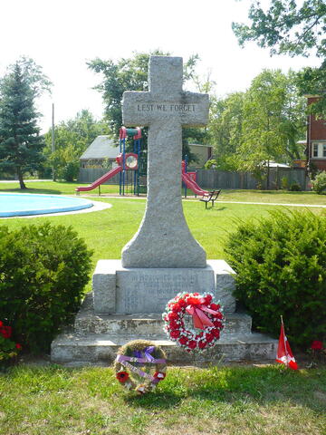
Dunnville Cenotaph
1 of 3 images
Province
!4v1624991269778!6m8!1m7!1sWDyI1fZV6ZRsay88rA_NLg!2m2!1d42.90408231360926!2d-79.61905094636948!3f260.7962987969453!4f-0.5621447686918799!5f3.325193203789971"
Body Content

This memorial is dedicated to those who fought in the First and Second World Wars and the Korean War. It was erected by the Town of Dunnville.

City
Dunnville
Country
Type Description
Cross - stone
Photo Credit
Tim Laye, Ontario War Memorials
Memorial CF Legacy ID
5049
City/Municipality
Dunnville
Memorial Number
35019-028
Type
Address
660 Main Street West
Location
Riverside Cemetery
in Canada
Yes
GPS Coordinates
42.9071635, -79.6345187
Inscription

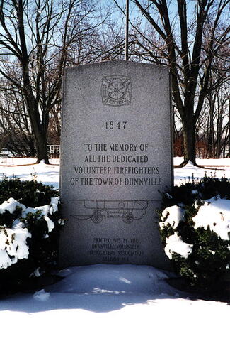
1847

TO THE MEMORY OF
ALL THE DEDICATED
VOLUNTEER FIREFIGHTERS
OF THE TOWN OF DUNNVILLE

ERECTED 1975 BY THE
DUNNVILLE VOLUNTEER
FIREFIGHTERS ASSOCIATION
STATION NO. 1

Image
Photo Credit
Deborah Hamilton and/et Melvin Robinson
Caption
front view
Province
!4v1636567356175!6m8!1m7!1stzfNCG8viNlID7NpjkWlcA!2m2!1d42.90716354555532!2d-79.63451871704065!3f201.0673270385151!4f-3.7699805649364038!5f1.6984623709315305"
Body Content

This memorial is dedicated to all volunteer firefighters of the Town of Dunnville, many of whom were war veterans. It was erected by the Dunnville Volunteer Firefighters Association Station No. 1.

City
Dunnville
Country
Type Description
Stele (stone)
Memorial CF Legacy ID
5363
City/Municipality
Dunnville
Memorial Number
35019-027
Type
Address
305 Queen Street
Location
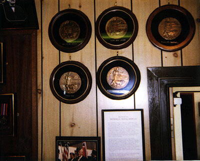
Inside the Royal Canadian Legion, Branch 142
in Canada
Yes
GPS Coordinates
42.9023119, -79.6146943
Inscription

Died for Freedom & Honor

David McMahon
Harrison Jones
William Robbie
Fred Fox
Peter Brown

Image
Photo Credit
Deborah Hamilton and/et Melvin Robinson
Caption
front view
War or Conflict Term
Province
!4v1627470160813!6m8!1m7!1sMKxRnC1308Y3qp_Mnt4u7g!2m2!1d42.90231189809006!2d-79.61469426999099!3f23.16953829167892!4f10.221190046673684!5f0.7820865974627469"
Body Content

This memorial is dedicated to five veterans killed in action. It was erected by the Royal Canadian Legion Branch 142.

City
Dunnville
Country
Type Description
Plaque
Memorial CF Legacy ID
5048
City/Municipality
Dunnville
Memorial Number
35019-026
Type
Address
121 Robinson Road
Location
Woodlawn Cemetery
in Canada
Yes
GPS Coordinates
42.9166278, -79.6322309
Inscription

[front/devant]

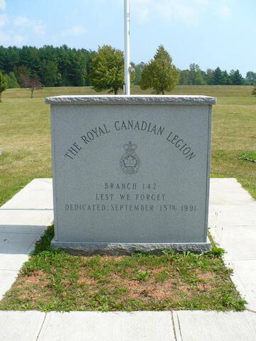
THE ROYAL CANADIAN LEGION
BRANCH 142
LEST WE FORGET
DEDICATED SEPTEMBER 15TH, 1991

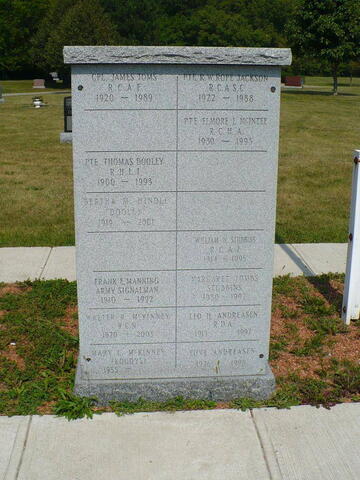
[right side/côté droit]

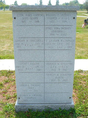
[left side/côté gauche]

Image
Caption
Dunnville Service Memorial
1 of 4 images
Image
Caption
right side
1 of 4 images
Image
Caption
left side
1 of 4 images
Image
Caption
surroundings
1 of 4 images
Province
!4v1627469187100!6m8!1m7!1s2dDCggGlcbAR43bP0amYgg!2m2!1d42.91662872076709!2d-79.6322372349812!3f118.69047306789516!4f3.622940578678339!5f3.325193203789971"
Body Content

This memorial is dedicated to all Veterans. It was erected by the Royal Canadian Legion Branch 142 and the Town of Dunnville and dedicated on September 15, 1991. On the sides of the stone are lists of those who have served and died.

City
Dunnville
Country
Type Description
Slab
Photo Credit
Tim Laye, Ontario War Memorials
Memorial CF Legacy ID
5047
City/Municipality
Dunnville
Memorial Number
35019-025
Type
Address
305 Queen Street
Location
Next to the Royal Canadian Legion, Branch 142
in Canada
Yes
GPS Coordinates
42.9024584, -79.6151085
Inscription

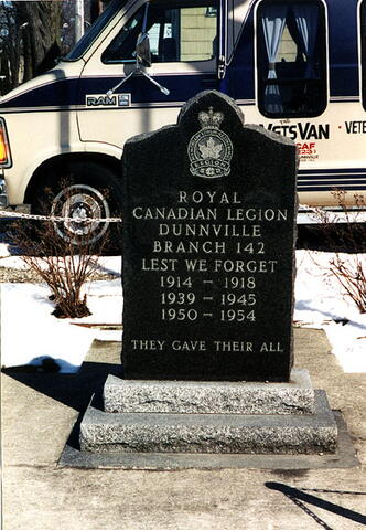
ROYAL
CANADIAN LEGION
DUNNVILLE
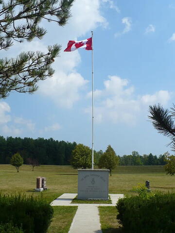
BRANCH 142
LEST WE FORGET
1914 – 1918
1939 – 1945
1950 – 1954
THEY GAVE THEIR ALL

Image
Photo Credit
Deborah Hamilton and/et Melvin Robinson; Colin Semple
Caption
front view
1 of 2 images
Image
Caption
surroundings
1 of 2 images
Province
!4v1624984377692!6m8!1m7!1sF_F0-BOXgWpm2ml0gJrmdA!2m2!1d42.90245841528773!2d-79.61510849772893!3f104.870681806028!4f-4.762084514144377!5f2.3416044534727685"
Body Content

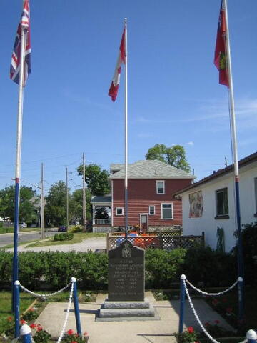
This memorial is dedicated to all those who fought in the First and Second World Wars and the Korean War. It was erected by the Royal Canadian Legion Branch 142.

City
Dunnville
Country
Type Description
Stele
Memorial CF Legacy ID
5046
City/Municipality
Fort Erie
Memorial Number
35019-024
Type
Address
Niagara Parkway & Thompson Road
in Canada
Yes
GPS Coordinates
42.9490316, -78.9451679
Inscription

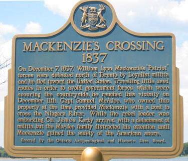
MACKENZIE’S CROSSING 1837

On December 7, 1837, William Lyon MacKenzie’s “Patriot”
forces were defeated north of Toronto by Loyalist militia
and he fled toward the United States. Travelling little used
routes in order to avoid government forces which were
scouring the countryside, he reached this vicinity on
December 11th. Capt. Samuel McAfee, who owned this
property at the time, provided MacKenzie with a boat to
cross the Niagara River. While the rebel leader was
embarking, Col. William Kerby arrived with a detachment of
militia, but the McAfee family distracted his attention until
MacKenzie gained the safety of the American shore.

Erected by the Ontario Archaeological and Historic Sites Board.

Image
Photo Credit
(www.ontarioplaques.com)
Caption
plaque
Province
!4v1625487700979!6m8!1m7!1sjg-8pVGtCZDYh7uA_IkHrA!2m2!1d42.94903158710617!2d-78.94516788446775!3f167.6685949184358!4f-2.2057464174417447!5f3.325193203789971"
Body Content

The title of this plaque is Mackenzie's Crossing 1837. It was erected in 1959.

City
Fort Erie
Country
Type Description
Provincial Military Plaque
Memorial CF Legacy ID
4590
City/Municipality
Port Maitland
Memorial Number
35019-023
Type
Address
Port Maitland Road
Location
Esplanade Park
in Canada
Yes
GPS Coordinates
42.8575791, -79.5784776
Inscription

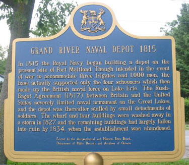
GRAND RIVER NAVAL DEPOT 1815

In 1815 the Royal Navy began building a depot on the
present site of Port Maitland. Though intended in the event
of war to accommodate three frigates and 1,000 men, the
base actually supported only the four schooners which then
made up the British naval force on Lake Erie. The Rush-
Bagot Agreement (1817) between Britain and the United
States severely limited naval armament on the Great Lakes,
and the depot was thereafter staffed by small detachments of
soldiers. The wharf and four buildings were washed away in
a storm in 1827, and the remaining buildings had largely fallen
into ruin by 1834 when the establishment was abandoned.

Erected by the Archaeological and Historic Sites Board,
Department of Public Records and Archives of Ontario

Image
Photo Credit
(www.ontarioplaques.com)
Caption
plaque
Province
!4v1624452238647!6m8!1m7!1s7DOlbmY4eFSCpvWvLDwk1g!2m2!1d42.85757907976995!2d-79.5784776063595!3f164.13935433384216!4f-8.469620895835263!5f3.325193203789971"
Body Content

The title of this plaque is Grand River Naval Depot 1815. It was erected in 1969.

City
Port Maitland
Country
Type Description
Provincial Military Plaque
Memorial CF Legacy ID
4607
City/Municipality
Crystal Beach
Memorial Number
35019-022
Type
Address
Queens Circle
in Canada
Yes
GPS Coordinates
42.8658597, -79.0617751
Inscription

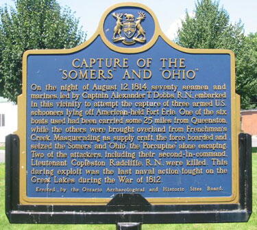
CAPTURE OF THE “SOMERS” AND “OHIO”

On the night of August 12, 1814, seventy seamen and
marines, led by Captain Alexander T. Dobbs, R.N., embarked
in this vicinity to attempt the capture of three armed U.S.
schooners lying off American-held Fort Erie. One of the six
boats used had been carried some 25 miles from Queenston,
while the others were brought overland from Frenchman’s
Creek. Masquerading as supply craft, the force boarded and
seized the “Somers” and “Ohio”, the “Porcupine” alone escaping.
Two of the attackers, including their second-in-command,
Lieutenant Copleston Radcliffe, R.N., were killed. This
daring exploit was the last naval action fought on the
Great Lakes during the War of 1812.

Erected by the Ontario Archaeological and Historic Sites Board.

Image
Photo Credit
(www.ontarioplaques.com)
Caption
plaque
Province
!4v1631552643540!6m8!1m7!1ssE-T-4BYfOTnDmX6pnyQiw!2m2!1d42.86585966791119!2d-79.06177510436366!3f61.109345319827575!4f-2.3921562863626633!5f3.325193203789971"
Body Content

The title of this plaque is Capture of Somers and Ohio. It was erected in 1962.

City
Crystal Beach
Country
Type Description
Provincial Military Plaque
Memorial CF Legacy ID
4623