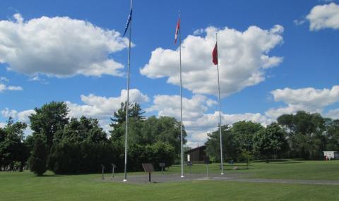
This memorial, a stone plaque on a pedestal, is dedicated to the Battle of Iroquois Point.
Capturing Point Iroquois Plaque
City/Municipality
Iroquois
Memorial Number
35083-047
Type
Address
6020 Carman Road
Location
In a park overlooking the Iroquois Locks Gauging Station
in Canada
Yes
GPS Coordinates
44.83143, -75.3135
Submitted By
Richard Turcotte
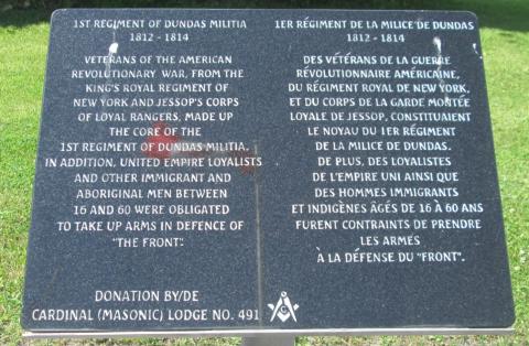
Inscription
[front/devant]
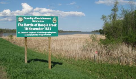
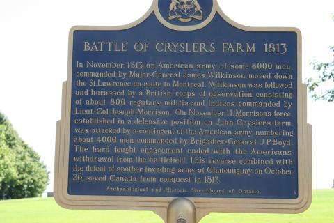
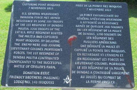
Capturing Point Iroquois
7 November 1813
U.S. General Wilkinson’s invasion force met armed resistance by some 200 troops of the 1st Regiment of Dundas Militia. 1200 troops of the 1st U.S. Rifle Regiment routed the militia and captured Point Iroquois. By delaying the enemy here and joining Lieutenant-Colonel Morrison’s forces, the 1st Regiment of Dundas Militia contributed significantly to the successful Battle of Crysler’s Farm.
Prise de la Pointe des Iroquois
7 novembre 1813
La force envahissante de Général américain Wilkinson a affronté la résistance armés de quelque 200 soldats du 1er Régiment de la Milice de Dundas. 1200 soldats du 1er Régiment des Fusiliers américain ont dérouté la Milice et capturé la Pointe des Iroquois. En retardant ici l’ennemi et en rejoignant les forces du Lieutenant-colonel Morrison, le 1er Régiment de la Milice de Dundas a contribué largement au succès du combat de la Ferme Crysler.
Donation by/ de Friendly Brothers (Masonic) Lodge No. 143 Iroquois
Image
Caption
plaque
1
of
2
images
Image

Caption
surroundings
1
of
2
images
Province
Body Content
City
Iroquois
Country
Display photo gallery on sidebar
Off
Type Description
Plaque (black stone) on a pedestal
Photo Credit
Richard Turcotte
Memorial CF Legacy ID
8726