British Columbia

Province Code
BC
City/Municipality
Vancouver
Memorial Number
59027-015
Type
Address
Matapan Crescent
Location
Grandview Heights
in Canada
Yes
GPS Coordinates
49.2556676, -123.0292946
Inscription

MATAPAN Cr

Image
Photo Credit
Jeff Oldfield
Caption
Matapan Crescent street sign
War or Conflict Term
Province
!4v1622572705683!6m8!1m7!1sQksf9aRi3fhlbJHY9CaF4Q!2m2!1d49.2556676083214!2d-123.029294597696!3f197.80867699227576!4f2.7453633769579966!5f2.8278930170967182
Body Content

In 1948, Grandview Heights in northeast Vancouver was developed as a sub-division to provide low rental housing for Veterans after the Second World War. Initially the streets were to be named after wildlife, but this was changed and the streets were named after personalities, battles and events from the two World Wars. The Chair of the Street Naming Sub-Committee was Alderman Halford Hal Wilson, who served as a Major during the Second World War.

Matapan Crescent was named on March 23, 1948, to commemorate those who fought at the Battle of Cape Matapan on March 28, 1941, during the Second World War. Control over the Mediterranean Sea was critical and in this Battle, the Royal Navy massacred the Italian Navy.

City
Vancouver
Country
Type Description
Street
Memorial CF Legacy ID
7717
City/Municipality
Vancouver
Memorial Number
59027-014
Type
Address
Malta Place
Location
Grandview Heights
in Canada
Yes
GPS Coordinates
49.2551955, -123.0265628
Inscription

Malta Pl

Image
Photo Credit
Jeff Oldfield
Caption
Malta Place street sign
War or Conflict Term
Province
!4v1622572387231!6m8!1m7!1spd_3WLQSmq89rVKaEjz7Uw!2m2!1d49.25518878428881!2d-123.0265712474636!3f170.0898072385609!4f-1.197425750440459!5f1.308651244592295
Body Content

In 1948, Grandview Heights in northeast Vancouver was developed as a sub-division to provide low rental housing for Veterans after the Second World War. Initially the streets were to be named after wildlife, but this was changed and the streets were named after personalities, battles and events from the two World Wars. The Chair of the Street Naming Sub-Committee was Alderman Halford Hal Wilson, who served as a Major during the Second World War.

During the Second World War, the tiny island of Malta, situated between Sicily and the coast of north Africa, provided a base of operations for the Royal Navy and the Royal Air Force to conduct several raids against the convoys that supplied the German and Italian armies in north Africa. In October 1941, these units based in Malta had destroyed over 60 per cent of the German-Italian traffic bound for the north African ports of Tunis and Tripoli. As a result, the Germans assembled a force of 600 fighters and bombers in Sicily, 105 kilometers north of Malta, to destroy the base and airfields on Malta.

Although no Royal Canadian Air Force squadrons were based in Malta, 25 per cent of the pilots in Malta's Royal Air Force fighter and bomber squadrons were Canadians. Mark "Hilly" Brown, the youngest wing commander in the Royal Air Force, was sent to Malta in the summer of 1941 to direct all fighter operations. Other Veteran Canadian pilots followed, including Squadron Leaders Robert Barton and Stan Turner.

A new group of Veteran Canadian pilots arrived in Malta on 9 June 1942. They included Flight Commanders "Laddie" Lucas and R.W. "Buck" McNair and Flight Officers F.E. Jones, Al Yates, "Mac" MacLean, Chuck Ramsay, John Williams, C.S.G. de Nancrede, Basil Butler, Bob Middlemiss, "Rip" Mutch, Jean Paradis, Wally MacLeod, R.C. Fumerton, Pat Bing, and George "Buzz" Beurling.

Both Bing and Fumerton would win the Distinguished Flying Cross while in Malta. MacLeod downed 13 enemy planes in 18 weeks. Beurling scored 30 victories in the battles that raged over Malta during the summer and autumn of 1942.

Malta Place was named on March 23, 1948, in honour of those who fought at the Island of Malta.

City
Vancouver
Country
Type Description
Street
Memorial CF Legacy ID
7716
City/Municipality
Vancouver
Memorial Number
59027-013
Type
Address
Malta Avenue
Location
Grandview Heights
in Canada
Yes
GPS Coordinates
49.2557023, -123.0255872
Inscription

Malta Ave

Image
Caption
Malta Avenue street sign
1 of 2 images
Image
Caption
Malta Avenue street sign
1 of 2 images
War or Conflict Term
Province
!4v1622572187790!6m8!1m7!1sRrk-uAZ_mH3Qo4eKgioy6Q!2m2!1d49.25572233430012!2d-123.0256132752898!3f352.18305766588076!4f-1.334740661378504!5f1.7975516893095684
Body Content

In 1948, Grandview Heights in northeast Vancouver was developed as a sub-division to provide low rental housing for Veterans after the Second World War. Initially the streets were to be named after wildlife, but this was changed and the streets were named after personalities, battles and events from the two World Wars. The Chair of the Street Naming Sub-Committee was Alderman Halford Hal Wilson, who served as a Major during the Second World War.

During the Second World War, the tiny island of Malta, situated between Sicily and the coast of North Africa, provided a base of operations for the Royal Navy and the Royal Air Force to conduct several raids against the convoys that supplied the German and Italian armies in North Africa. In October 1941, these units based in Malta had destroyed over 60 per cent of the German-Italian traffic bound for the north African ports of Tunis and Tripoli. As a result, the Germans assembled a force of 600 fighters and bombers in Sicily, 105 kilometers north of Malta, to destroy the base and airfields on Malta.

Although no Royal Canadian Air Force squadrons were based in Malta, 25 per cent of the pilots in Malta's Royal Air Force fighter and bomber squadrons were Canadians. Mark "Hilly" Brown, the youngest wing commander in the Royal Air Force, was sent to Malta in the summer of 1941 to direct all fighter operations. Other Veteran Canadian pilots followed, including Squadron Leaders Robert Barton and Stan Turner.

A new group of Veteran Canadian pilots arrived in Malta on 9 June 1942. They included Flight Commanders "Laddie" Lucas and R.W. "Buck" McNair and Flight Officers F.E. Jones, Al Yates, "Mac" MacLean, Chuck Ramsay, John Williams, C.S.G. de Nancrede, Basil Butler, Bob Middlemiss, "Rip" Mutch, Jean Paradis, Wally MacLeod, R.C. Fumerton, Pat Bing, and George "Buzz" Beurling.

Both Bing and Fumerton would win the Distinguished Flying Cross while in Malta. MacLeod downed 13 enemy planes in 18 weeks. Beurling scored 30 victories in the battles that raged over Malta during the summer and autumn of 1942.

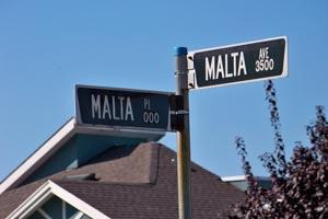
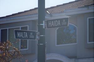
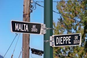
Malta Avenue was named on March 23, 1948, in honour of those who fought at the Island of Malta.

City
Vancouver
Country
Type Description
Street
Photo Credit
Jeff Oldfield
Memorial CF Legacy ID
7715
City/Municipality
Vancouver
Memorial Number
59027-012
Type
Address
Haida Drive
Location
Grandview Heights
in Canada
Yes
GPS Coordinates
49.2544761, -123.0274991
Inscription

Haida Dr

Image
Caption
Haida Drive street sign
1 of 2 images
Image
Caption
Haida Drive street sign
1 of 2 images
Province
!4v1622571744234!6m8!1m7!1sJZc4SMtn0wm8Og-SBB1Uuw!2m2!1d49.25447161181814!2d-123.0275018726034!3f74.7157833084763!4f0.5184442692809199!5f0.8009224918866113
Body Content

In 1948, Grandview Heights in northeast Vancouver was developed as a sub-division to provide low rental housing for Veterans after the Second World War. Initially the streets were to be named after wildlife, but this was changed and the streets were named after personalities, battles and events from the two World Wars. The Chair of the Street Naming Sub-Committee was Alderman Halford Hal Wilson, who served as a Major during the Second World War.

Haida Drive was named on March 23, 1948, in honour of the HMCS Haida and her crews who served during the Second World War. HMCS Haida sank more enemy vessels than any other Canadian ship during the Second World War.

City
Vancouver
Country
Type Description
Street
Photo Credit
Jeff Oldfield
Memorial CF Legacy ID
7714
City/Municipality
Vancouver
Memorial Number
59027-011
Type
Address
Falaise Place
Location
Grandview Heights
in Canada
Yes
GPS Coordinates
49.2560179, -123.0287302
Inscription

FALAISE PL

Image
Photo Credit
Jeff Oldfield
Caption
Falaise Place street sign
War or Conflict Term
Province
!4v1721843327460!6m8!1m7!1sgd0mmab5-ZgnEswwhnwh7g!2m2!1d49.2560178764194!2d-123.028730243363!3f59.76874033089306!4f-0.5167398670802328!5f3.307978153195307
Body Content

In 1948, Grandview Heights in northeast Vancouver was developed as a sub-division to provide low rental housing for Veterans after the Second World War. Initially the streets were to be named after wildlife, but this was changed and the streets were named after personalities, battles and events from the two World Wars. The Chair of the Street Naming Sub-Committee was Alderman Halford Hal Wilson, who served as a Major during the Second World War.

This street commemorates those who fought at Falaise in the Second World War and was named on March 23, 1948. Lieutenant General Guy Simonds developed an innovative plan to break through to the critical road junction at Falaise. Using radio beams, searchlights, and tracer fire to steer them, the Canadians would attack at night in conjunction with an immense air bombardment. To help nullify the German anti-tank defences, Simonds instructed his men to convert some of their self-propelled artillery into armoured personnel carriers the first of their kind. With the infantry riding in relative safety inside what were soon dubbed "Kangaroos," with the enemy blasted from above by American bombers, and using darkness as a screen, Simonds intended to puncture the enemy line.

City
Vancouver
Country
Type Description
Street
Memorial CF Legacy ID
7713
City/Municipality
Vancouver
Memorial Number
59027-010
Type
Address
Falaise Avenue
Location
Grandview Heights
in Canada
Yes
GPS Coordinates
49.2555522, -123.0294862
Inscription

FALAISE AVE

Image
Caption
Falaise Avenue street sign
1 of 2 images
Image
Caption
Falaise Avenue street sign
1 of 2 images
War or Conflict Term
Province
!4v1721842518378!6m8!1m7!1sGGK2LOR6mcHB_5jWiuTPew!2m2!1d49.25555224266611!2d-123.0294862044085!3f91.80605270272719!4f-2.144581303828474!5f2.688538366723933
Body Content

In 1948, Grandview Heights in northeast Vancouver was developed as a sub-division to provide low rental housing for Veterans after the Second World War. Initially the streets were to be named after wildlife, but this was changed and the streets were named after personalities, battles and events from the two World Wars. The Chair of the Street Naming Sub-Committee was Alderman Halford Hal Wilson, who served as a Major during the Second World War.

This street commemorates those who fought at Falaise in the Second World War and was named on March 23, 1948. Lieutenant General Guy Simonds developed an innovative plan to break through to the critical road junction at Falaise. Using radio beams, searchlights, and tracer fire to steer them, the Canadians would attack at night in conjunction with an immense air bombardment. To help nullify the German anti-tank defences, Simonds instructed his men to convert some of their self-propelled artillery into armoured personnel carriers the first of their kind. With the infantry riding in relative safety inside what were soon dubbed "Kangaroos," with the enemy blasted from above by American bombers, and using darkness as a screen, Simonds intended to puncture the enemy line.

City
Vancouver
Country
Type Description
Street
Photo Credit
Jeff Oldfield
Memorial CF Legacy ID
7712
City/Municipality
Vancouver
Memorial Number
59027-009
Type
Address
Dieppe Place
Location
Grandview Heights
in Canada
Yes
GPS Coordinates
49.256259, -123.0264108
Inscription

DIEPPE PL

Image
Photo Credit
Jeff Oldfield
Caption
Dieppe Place street sign
War or Conflict Term
Province
!4v1622570743716!6m8!1m7!1syM2-DmSLFBepQ28V0dpTdw!2m2!1d49.25625551609718!2d-123.0264155120063!3f352.41438311561063!4f-0.17493543160072988!5f1.767084986100243
Body Content

In 1948, Grandview Heights in northeast Vancouver was developed as a sub-division to provide low rental housing for Veterans after the Second World War. Initially the streets were to be named after wildlife, but this was changed and the streets were named after personalities, battles and events from the two World Wars. The Chair of the Street Naming Sub-Committee was Alderman Halford Hal Wilson, who served as a Major during the Second World War.

Although extremely valuable lessons were learned in the Raid on Dieppe, a steep price was paid. Of the 4,963 Canadians who embarked for the operation, only 2,210 returned to England, and many of these were wounded. There were 3,367 casualties, including 1,946 prisoners of war; 916 Canadians lost their lives. This street was named in their honour on March 23, 1948.

City
Vancouver
Country
Type Description
Street
Memorial CF Legacy ID
7711
City/Municipality
Vancouver
Memorial Number
59027-008
Type
Address
Dieppe Drive
Location
Grandview Heights
in Canada
Yes
GPS Coordinates
49.2557715, -123.0256632
Inscription

DIEPPE DR

Image
Caption
Dieppe Drive street sign
1 of 4 images
Image
Photo Credit
Jeff Oldfield
Caption
Dieppe Drive street sign
1 of 4 images
Image
Caption
Dieppe Drive street sign
1 of 4 images
Image
Caption
Dieppe Drive street sign
1 of 4 images
War or Conflict Term
Province
!4v1721842184743!6m8!1m7!1sQtbNcn18aZ7nQIYwiZGffg!2m2!1d49.25577154252106!2d-123.0256631646581!3f45.844815065505486!4f-6.6249598160036385!5f0.7820865974627469
Body Content

In 1948, Grandview Heights in northeast Vancouver was developed as a sub-division to provide low rental housing for Veterans after the Second World War. Initially the streets were to be named after wildlife, but this was changed and the streets were named after personalities, battles and events from the two World Wars. The Chair of the Street Naming Sub-Committee was Alderman Halford Hal Wilson, who served as a Major during the Second World War.

Although extremely valuable lessons were learned in the Raid on Dieppe, a steep price was paid. Of the 4,963 Canadians who embarked for the operation, only 2,210 returned to England, and many of these were wounded. There were 3,367 casualties, including 1,946 prisoners of war; 916 Canadians lost their lives. This street was named in their honour on March 23, 1948.

City
Vancouver
Country
Type Description
Street
Photo Credit
Jeff Oldfield
Memorial CF Legacy ID
7710
City/Municipality
Vancouver
Memorial Number
59027-007
Type
Address
Anzio Drive
Location
Grandview Heights
in Canada
Yes
GPS Coordinates
49.2523112, -123.0310861
Inscription

ANZIO DR

Image
Photo Credit
Jeff Oldfield
Caption
Anzio Drive street sign
1 of 2 images
Image
Caption
Anzio Drive street sign
1 of 2 images
War or Conflict Term
Province
!4v1721841212063!6m8!1m7!1sakngPbEWfPxLppAQ7uJYRg!2m2!1d49.25231123256807!2d-123.0310860501917!3f18.0108612269631!4f-5.120253905807829!5f3.31299128801055
Body Content

In 1948, Grandview Heights in northeast Vancouver was developed as a sub-division to provide low rental housing for Veterans after the Second World War. Initially the streets were to be named after wildlife, but this was changed and the streets were named after personalities, battles and events from the two World Wars. The Chair of the Street Naming Sub-Committee was Alderman Halford Hal Wilson, who served as a Major during the Second World War.

The 1st Canadian Special Service Battalion was the Canadian component of a joint Canadian-American organization called the First Special Service Force. Organized as part of the United States Army, and using American equipment, the Force, as it was known, comprised three regiments each of two battalions plus a Service Battalion or echelon. Canadians commanded five of the six battalions and made up roughly one third of the unit’s strength. After six weeks of arduous service in the Italian mountains, the Force was deployed into the Anzio bridgehead, southwest of Rome.

On 1 February 1944 the Force was landed at Anzio where it took over roughly a quarter of the defensive perimeter, a front that extended about seven miles. This was held for 14 weeks until the Force was pulled back into the center of the bridgehead to prepare for the breakout battle in May that would eventually lead to the fall of Rome. Anzio Drive was named in their honour on March 23, 1948.

City
Vancouver
Country
Type Description
Street
Memorial CF Legacy ID
7709
City/Municipality
Vancouver
Memorial Number
59027-005
Type
Address
Keefer and Columbia Streets
Location
Chinatown Memorial Plaza
in Canada
Yes
GPS Coordinates
49.2794786, -123.1022561
Inscription

[left plaque/plaque de gauche]

THIS CHINATOWN MEMORIAL MONUMENT IS THE CREATION OF SCULPTOR MR. ARTHUR
SHU-REN CHENG. THE BRONZE STATUES OF THE RAILWAY WORKER AND THE WORLD
WAR II VETERAN REPRESENT THE SACRIFICES MADE BY CHINESE CANADIANS IN
BUILDING A UNITED AND PROSPEROUS CANADA. THE MAIN COLUMN IS A STYLIZED
FORM OF THE CHINESE CHARACTER "CENTRE" WHICH SYMBOLIZES CHINESE CULTURE.
THE CHINESE COUPLET INSCRIBED ON THE FRONT AND BACK OF THE COLUMN READS:

"RICH LAGACIES OF CHINESE PIONEERS SHINING BRIGHT AS THE SUN AND MOON
GREAT DEEDS OF NOBLE FORBEARS ZEAL ENTRENCHED AS MOUNTAINS AND RIVERS".

THE CHINATOWN MEMORIAL SQUARE COMMITTEE

(text in Chinese/texte en chinois)

[right plaque/plaque de droite]

IN COMMEMORATION OF THE SIGNIFICANT CONTRIBUTIONS OF CHINESE
CANADIANS TO THE GROWTH, VITALITY AND PROSPERITY OF VANCOUVER,
BRITISH COLUMBIA AND CANADA.

THE CHINATOWN MEMORIAL MONUMENT IS FUNDED BY THE CITY OF
VANCOUVER, PROVINCE OF BRITISH COLUMBIA, AND GOVERNMENT OF
CANADA UNDER THE VANCOUVER AGREEMENT

UNVEILED ON THE 2ND NOVEMBER 2003

(text in Chinese/texte en chinois)

Image
Photo Credit
Julie Clements
Caption
Chinatown Memorial Monument
1 of 5 images
Image
Photo Credit
Julie Clements
Caption
back
1 of 5 images
Image
Photo Credit
Julie Clements
Caption
statue
1 of 5 images
Image
Photo Credit
Submitted by Colin Schatz to ReadThePlaque.com, a project of 99% Invisible/Soumis par Colin Schatz à ReadThePlaque.com, un projet de 99% Invisible
Caption
left plaque inscription
1 of 5 images
Image
Photo Credit
Submitted by Colin Schatz to ReadThePlaque.com, a project of 99% Invisible/Soumis par Colin Schatz à ReadThePlaque.com, un projet de 99% Invisible
Caption
right plaque inscription
1 of 5 images
War or Conflict Term
Province
!4v1610047539888!6m8!1m7!1sAwbEURLecvutxGA37u8jLA!2m2!1d49.27936985546064!2d-123.1017786173652!3f306.6830573836926!4f7.570755368599848!5f1.9587109090973311
Body Content

The Chinatown Memorial Monument is the creation of sculpture Arthur Shu-ren Cheng. It was funded by the City of Vancouver, the Province of British Columbia and the Government of Canada under the Vancouver Agreement and unveiled on November 2, 2003.

The first bronze figure, a railway worker, recognizes the thousands of Chinese Canadians who lived and died building the Trans-Canadian railway system. The second bronze figure, a Chinese Canadian Second World War solider, represents some six hundred Chinese Canadians who volunteered in the War efforts, proving their patriotism which later earned them the right to vote. The main column is a stylized form of the Chinese character zhong  (English translation center) which symbolizes moderation and harmony.


City
Vancouver
Country
Type Description
Monument, statues
Memorial CF Legacy ID
7699