Ontario

Province Code
ON
City/Municipality
Cedar Springs
Memorial Number
35035-018
Type
Address
8643 Chatham-Kent County Road 3
Location
In front of the building at 8643 Chatham-Kent County Road 3
in Canada
Yes
GPS Coordinates
42.2831989, -82.0296142
Inscription

HARRY G.B. MINER, V.C. 1891-1918

Born in Raleigh Township, Miner enlisted in the 142nd Battalion,
C.E.F. in December 1915, and the following year transferred to
the 58th Battalion, then serving in France. During a Canadian
attack near Amiens on August 8, 1918. Corporal Miner rushed a
German machine gun post single-handed and turned the gun on
the enemy. Later, with two companions, he assaulted another
post and put its gun out of action, following which he again
attacked alone and captured an enemy bombing post. In carrying
out these gallant acts he was mortally wounded. For his
conspicuous bravery Corporal Miner was posthumously
awarded the Croix de Guerre and British Empire's highest
award for military valour, the Victoria Cross.

Archaeological and Historic Sites Board of Ontario

Image
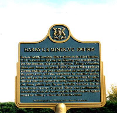
Photo Credit
Terry MacDonald
Caption
front view
War or Conflict Term
Province
!4v1623853859802!6m8!1m7!1sJLg-CJ91OLXm5YOksUJkEQ!2m2!1d42.28319885384747!2d-82.02961423092708!3f300.010431615739!4f-3.459422213332246!5f3.325193203789971"
Body Content

This memorial is dedicated to Harry G.B. Miner, V.C. It was erected by the Archaeological and Historic Sites Board of Ontario.

City
Cedar Springs
Country
Type Description
Provincial Military Plaque
Memorial CF Legacy ID
4976
City/Municipality
Chatham
Memorial Number
35035-017
Type
Address
50 William Street North
Location
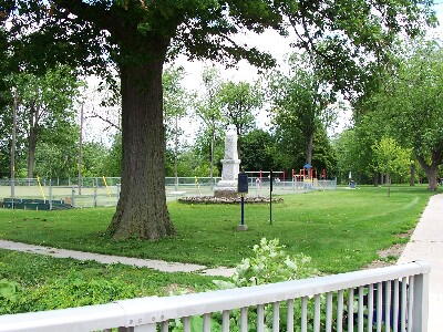
Tecumseh Park
in Canada
Yes
GPS Coordinates
42.40703, -82.18372
Inscription

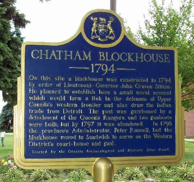
CHATHAM BLOCKHOUSE
1794
On this site a blockhouse was constructed in 1794
by order of Lieutenant-Governor John Graves Simcoe.
He planned to establish here a small naval arsenal
which would form a link in the defences of Upper
Canada's western frontier and also draw the Indian
trade from Detroit. The post was garrisoned by a
detachment of the Queen's Rangers, and two gunboats
were built; but by 1797 it was abandoned. In 1798
the province's Administrator, Peter Russell, had the
blockhouse moved to Sandwich to serve as the Western
District's courthouse and gaol.

Erected by the Ontario Archaeological and Historic Sites Board

Image
Photo Credit
John Sargeant. (www.ontarioplaques.com)
Caption
plaque
1 of 3 images
Image
Caption
surroundings
1 of 3 images
Image
Caption
plaque
1 of 3 images
Province
Body Content

The title of this plaque is Chatham Blockhouse 1794. It was erected in 1958.

City
Chatham
Country
Type Description
Provincial Military Plaque
Memorial CF Legacy ID
4587
City/Municipality
Ridgeway
Memorial Number
35035-016
Type
Address
366 Ridge Road North
Location
People’s Memorial United Church
in Canada
Yes
GPS Coordinates
42.8847187, -79.0520861
Inscription

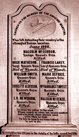
SACRED TO THE MEMORY OF THE RIDGEWAY MARTYRS.
Who fell defending their country in the
attempted Fenian invasion
June 1866,
MALCOLM MCECHRON.
Ensign Queen's Own
Killed.

HUGH MATHESON.
Sergt, Queen's Own
Died of Wounds.
WILLIAM SMITH.
Queen's Own
Killed.
CHRIST PR ALDERSON.
Queen's Own
Killed.
I.H. NEWBURN.
Queen's Own
Killed.

FRANCIS LAKEY.
Corpl, Queen's Own
Died of Wounds.
MARK DEFRIES.
Queen's Own
Killed.
WN FAIRBANKS TEMPEST.
Queen's Own
Killed.
MALCOLM McKENZIE
Queen's Own
Killed.

Go strew his ashes to the wind
Whose sword or voice has served mankind
And is he dead whose glorious mind
Lifts thine on high
To live in hearts we leave behind
Is not to die

Erected by the citizens in the vaiinity of the Battle around Sep'1874

Image
Photo Credit
The Queen's Own Rifles of Canada Regimental Museum and Archive
Caption
tablet
Province
!4v1667232389438!6m8!1m7!1se_NImTTp0rsGZm5RzM2F6g!2m2!1d42.88471868065895!2d-79.05208614686899!3f94.47551392606844!4f6.65612232225088!5f0.7820865974627469
Body Content

A marble tablet was installed in People’s Memorial United Church in memory of the brave volunteers who fell at Lime Ridge on 2 June 1866 while defending the Niagara frontier against Fenians. The stanza inscribed on the tablet is from the poem 'Hallowed Ground' by Thomas Campbell. 

The Toronto militia volunteers were fighting Irish-American Fenian insurgents who had invaded Canada near Fort Erie in the hopes of holding Canada ransom for Irish independence. Between 1866 and 1871, this group raided Canadian territory from New Brunswick to Manitoba. Nine riflemen from Toronto’s The Queen’s Own Rifles of Canada were killed.

City
Ridgeway
Country
Type Description
Tablet
Memorial CF Legacy ID
11073
City/Municipality
Morpeth
Memorial Number
35035-015
Type
Address
Lakeshore Road and Gardiner Avenue
Location
Rondeau Provincial Park
in Canada
Yes
GPS Coordinates
42.2814374, -81.8432026
Inscription

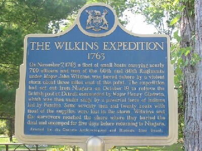
THE WILKINS EXPEDITION
1763
On November 7, 1763 a fleet of small boats carrying nearly
700 officers and men of the 60th and 80th Regiments
under Major John Wilkins, was forced ashore by a violent
storm about 5 km east of this point. The expedition
had set out from Niagara on October 19 to relieve the
British post at Detroit, commanded by Major Henry Gladwin,
which was then under siege by a powerful force of Indians
led by Pontiac. Some seventy men and twenty boats with
most of the supplies were lost in the storm. Wilkins and
the survivors reached the shore where they buried the
dead and encamped for five days before returning to Niagara.

Erected by the Ontario Archaeological and Historic Sites Board.

Image
Photo Credit
Ontario Plaques
Caption
front
Province
!4v1624366420747!6m8!1m7!1su2aORDNRnGc8ZvEQCHi00A!2m2!1d42.28143742798343!2d-81.84320259209404!3f194.67776602383066!4f-1.7560077226833215!5f3.325193203789971
Body Content

The Wilkins Expedition Plaque was erected in 1962.

City
Morpeth
Country
Type Description
Plaque
Memorial CF Legacy ID
4621
City/Municipality
Chatham
Memorial Number
35035-013
Type
Address
50 William Street North
Location
Tecumseh Park
in Canada
Yes
GPS Coordinates
42.4067475, -82.1820942
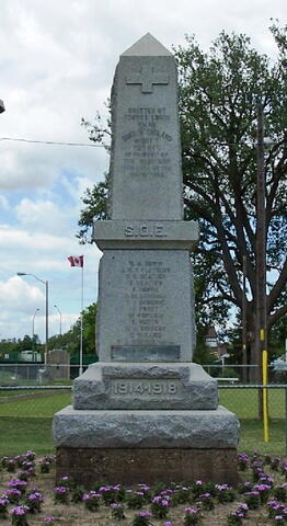
Inscription

[front/devant]

ERECTED BY
THAMES LODGE
NO .101
SONS OF ENGLAND
BENEFIT
SOCIETY.
IN MEMORY OF
THE BROTHERS
WHO FELL IN THE
GREAT WAR

S. O. E.

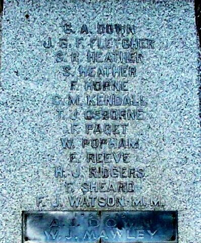
G. A. DOWN
J. G. F. FLETCHER
A. R. HEATHER
S. HEATHER
F. HORNE
C. M. KENDALE
T.J. OSBORNE
A. R. PAGET
W. POPHAM
E. REEVE
H. J. RIDGES
F. SHEARD
F. J. WATSON M.M.
1941 – 1945
A. J. DOWN
W. J. MAWLEY

1914-1918

Image
Photo Credit
Murray D. Tuck; John Sargeant
Caption
Front view
1 of 4 images
Image
Caption
front
1 of 4 images
Image
Caption
surroundings
1 of 4 images
Image
Caption
detail
1 of 4 images
War or Conflict Term
Province
!4v1636994353247!6m8!1m7!1swIeMjtIHMY-RQqkUxkrnjw!2m2!1d42.40674747143775!2d-82.18209423004836!3f267.57697905953756!4f1.7718480821095142!5f3.325193203789971"
Body Content

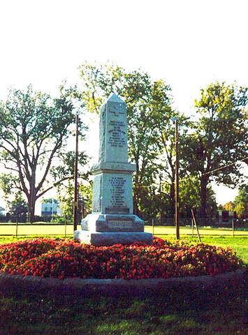
This memorial is dedicated to those who died in the First World War. It was erected by the Sons of England.

City
Chatham
Country
Type Description
Obelisk
Memorial CF Legacy ID
5013
City/Municipality
Chatham
Memorial Number
35035-012
Type
Address
50 William Street North
Location
Tecumseh Park
in Canada
Yes
GPS Coordinates
42.4068366, -82.1821324
Inscription

[front/devant]

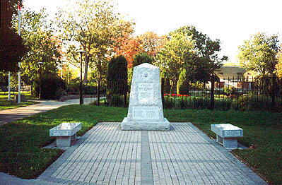
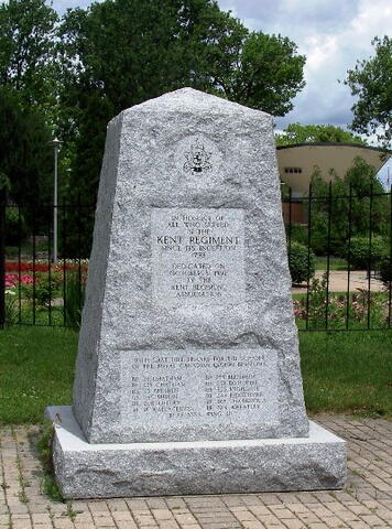
IN HONOUR OF
ALL WHO SERVED
IN THE
KENT REGIMENT
SINCE ITS INCEPTION
1792
DEDICATED ON
OCTOBER 3, 1992
BY THE
KENT REGIMENT
ASSOCIATION
WITH GRATEFULL THANKS FOR THE SUPPORT
OF THE ROYAL CANADIAN LEGION BRANCHES

[bottom/en bas]

[left column/colonne de gauche]

BR 28 CHATHAM
BR 628 CHATHAM
BR 113 DRESDEN
BR 465 MERLIN
BR 206 TILBURY
BR 18 WALLACEBURG

[right column/colonne de droite]
BR 185 BLENHEIM
BR 252 BOTHWELL
BR 335 HIGHGATE
BR 243 RIDGETOWN
BR 367 THAMESVILLE
BR 324 WHEATLEY
RCAF ASSN WING 411

Image
Photo Credit
Murray D. Tuck; John Sargeant
Caption
front view
1 of 4 images
Image
Caption
front
1 of 4 images
Image
Caption
surroundings
1 of 4 images
Image
Caption
back
1 of 4 images
Province
!4v1636994135580!6m8!1m7!1sif3fd6Qj4WE89ZSBk68BZQ!2m2!1d42.40683658645683!2d-82.18213239905428!3f254.74799533036128!4f0.7404383083164561!5f3.325193203789971"
Body Content

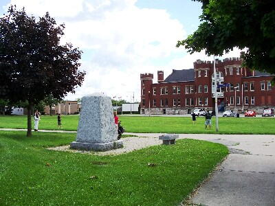
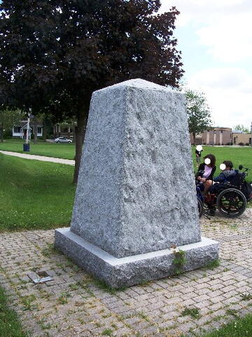
This memorial is dedicated to those who fought from the Kent Regiment. It was erected by the Kent Regiment Association.

City
Chatham
Country
Type Description
Shaft
Memorial CF Legacy ID
5014
City/Municipality
Chatham
Memorial Number
35035-011
Type
Address
44 William Street North
Location
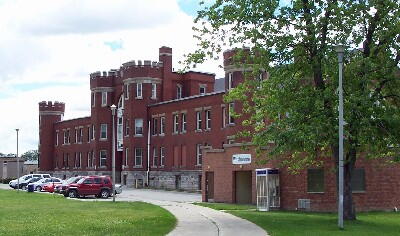
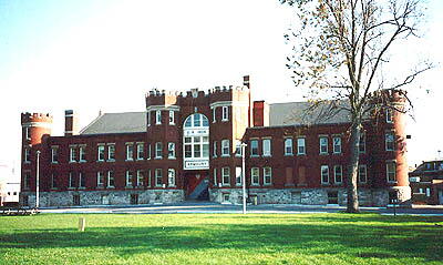
The Chatham Armoury
in Canada
Yes
GPS Coordinates
42.4068359, -82.1821309
Inscription

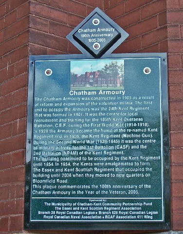
[plaque/plaque]

Chatham Armoury
100th Anniversary
1905-2005

Chatham Armoury
The Chatham Armoury was constructed in 1905 as a result
of reform and expansion of the volunteer militia. The first
unit to occupy the Armoury was the 24th Kent Regiment
that was formed in 1901. It was the centre in local
recruitment and training for the 186th Kent Overseas
Battalion, C.E.F. during the first World War (1914-1918).
In 1920 the Armoury became the home of the re-named Kent
Regiment and, in 1936, the Kent Regiment (Machine Gun).
During the Second World War (1939-1945) it was the centre
of military activity for the 1st Battalion (CASF) and the
2nd Battalion (NPAM) of the Kent Regiment.
The building continued to be occupied by the Kent Regiment
until 1954. In 1954, the Kents were amalgamated to form
The Essex and Kent Scottish Regiment that occupied the
Building until 2006 when they moved to new quarters on
Bloomfield Road.
This plaque commemorates the 100th anniversary of the
Chatham Armoury in the Year of the Veteran, 2005.
Sponsored by:
The Municipality of Chatham-Kent Community Partnership Fund
The Essex and Kent Scottish Regiment Association
Branch 28 Royal Canadian Legion - Branch 628 Royal Canadian Legion
Royal Canadian Naval Association - RCAF Association 411 Wing

Image
Photo Credit
John Sargeant and Murray D. Tuck
Caption
front view
1 of 3 images
Image
Caption
plaque
1 of 3 images
Image
Caption
Second front view
1 of 3 images
War or Conflict Term
Province
!4v1627313404391!6m8!1m7!1sif3fd6Qj4WE89ZSBk68BZQ!2m2!1d42.40683590976897!2d-82.18213085090291!3f208.55618269860122!4f5.713997855116318!5f2.8214327514217206"
Body Content

This armoury was constructed in 1905. A plaque was placed on the building to commemorate the 100th anniversary of the Chatham Armoury in the Year of the Veteran, 2005. Kent Regiment (still in use).

City
Chatham
Country
Type Description
Building
Memorial CF Legacy ID
7771
City/Municipality
Tilbury
Memorial Number
35035-010
Type
Address
2 Queen Street South
Location
Next to the library
in Canada
Yes
GPS Coordinates
42.2591677, -82.4321617
Inscription
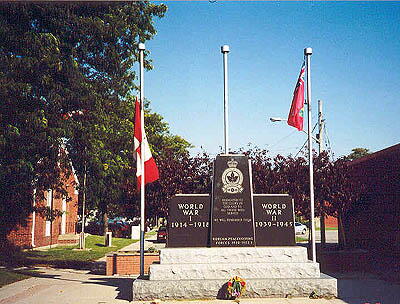
  • [left panel/panneau de gauche]
  • WORLD
  • WAR
  • 1914 - 1918
  •  
  •  
  •  
  •  
  •  
  • [center panel/panneau du centre]
  • DEDICATED TO
  • THE GLORY OF
  • GOD AND TO
  • ALL THOSE WHO
  • SERVED
  • WE WILL REMEMBER THEM
  • KOREAN PEACEKEEPING
  • FORCES 1950 - 1952-3
  • [right panel/panneau de droite]
  • WORLD
  • WAR
  • II
  • 1939 - 1945
  •  
  •  
  •  


Image
Photo Credit
Murray D. Tuck
Caption
front
Province
!4v1623427696596!6m8!1m7!1s7B6QMTCwjLxgnRhGUAopCg!2m2!1d42.25916632055022!2d-82.43216501117735!3f115.70999176214536!4f-1.6321779098244065!5f3.325193203789971
Body Content

The Tilbury Cenotaph was erected on May 7, 1987 and dedicated to all Veterans. It was erected by the Tilbury Royal Canadian Legion Branch 206.  The cenotaph is 15 feet by three feet, weighs 36,000 pounds and is made of granite.

City
Tilbury
Country
Type Description
Steles - polished granite
Memorial CF Legacy ID
5683
City/Municipality
Leamington
Memorial Number
35035-009
Type
Address
Mill Street East and Princess Street
Location
Dieppe Park (Legion Park)
in Canada
Yes
GPS Coordinates
42.0526522, -82.5983111
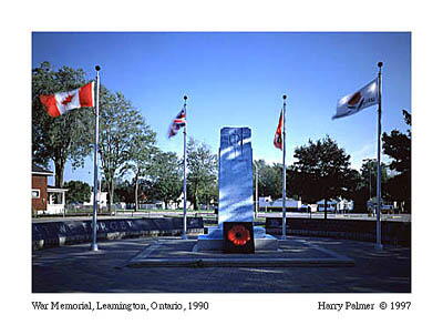
Image
Photo Credit
Harry Palmer
Caption
Leamington Cenotaph
1 of 2 images
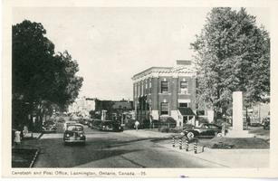
Image
Photo Credit
Victoria Edwards
Caption
Leamington Cenotaph postcard, 1951.
1 of 2 images
War or Conflict Term
Province
!4v1626711303386!6m8!1m7!1sOA8i5wH0CLZYD7WEnDWYjw!2m2!1d42.05268479717912!2d-82.59832031369872!3f134.58451375386443!4f1.2148502899223388!5f3.325193203789971
Body Content

In 1921, the town of Leamington created a small graveyard site at the Lakeview Cemetery to commemorate those from the area who died fighting in the South African War and First World War. The Leamington Legion began a drive in the early 1930s to raise funds for a proper monument. By 1939, Leamington’s council joined the campaign and enough funds were raised.

A new monument was placed on a small triangle of land in front of the First Baptist Church at Talbot Street West. The 14 feet high Canadian gray granite monument was made by Frank J. O’Heron, owner of O’Heron Monuments. 

Mrs. John Bell, whose son sacrificed his life in the First World War, removed the Union Jack and unveiled the cenotaph on October 22, 1939. Leamington Legion Branch 84 president Dr. H. R. Nicklin presided the ceremony with over 1,500 citizens attending along with 300 First World War Veterans from the area.

The cenotaph was moved when Talbot Street West underwent a couple of changes throughout the years, but stayed in front of the church until 1988 when it was moved to its current location. A special poppy memorial was created in Michigan and placed in front of the cenotaph.

City
Leamington
Country
Type Description
Stele
Memorial CF Legacy ID
690
City/Municipality
Erieau
Memorial Number
35035-007
Type
Address
Ross Lane & Nichols Avenue
Location
In a park on the corner of Ross Lane & Nichols Avenue
in Canada
Yes
GPS Coordinates
42.2608571, -81.9173604
Inscription

[front/devant]

IN HONOUR OF THOSE WHO SERVED AND DIED FOR THEIR COUNTRY

Province
!4v1625236912184!6m8!1m7!1sByZO0NvDCwdCsIQjbRt1-w!2m2!1d42.26085713089444!2d-81.91736043436931!3f139.9941959272538!4f-3.6316008694769266!5f3.325193203789971"
Body Content

Erected by local residents, this memorial is dedicated to the local war dead of the First and Second World Wars.

City
Erieau
Country
Type Description
Wooden cross and granite base
Memorial CF Legacy ID
2301