
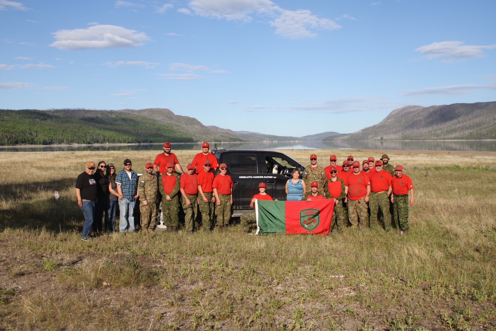
Find your way with the Canadian Rangers
Age group: 12 - 18
Activity description
![]()
Badge of the Canadian Rangers.
Students will carry out map-based activities to learn about the Canadian Rangers and where in our country they serve. They will learn about navigation skills the Rangers need, like knowledge of their local environment and how to use a map and compass. They will then apply their new skills as they follow a map to simulate finding their way for the kinds of missions tackled by real Canadian Rangers. An alternative activity also allows students to create their own orienteering map to challenge other groups in their class.
Objectives
Through this activity, youth will develop a better understanding and awareness of:
- What the Canadian Rangers do and why their work is important;
- Where the Canadian Rangers serve; and
- How to read maps and navigate their surroundings, like the Canadian Rangers do.
Target audience
This activity is suitable for ages 12 to 18. It can also be modified to support younger audiences.
Time required
Approximately 150 minutes [variable]
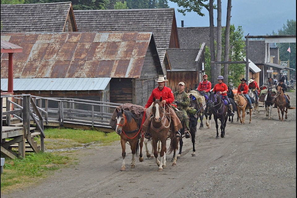
Canadian Rangers on horseback in British Columbia in 2021.
Photo: DND
Information for teachers
If you have not already completed previous lessons in the Canadian Rangers learning unit, refer to the background discussion section of The Canadian Rangers puzzle activity. The information sheets and photo gallery in that lesson can provide you and your students with helpful information about who the Canadian Rangers are and what they do. Your class could also watch Historica Canada’s video Who Patrols Canada’s North? The Rangers on the Northern Frontier [6 minutes].
Introduction
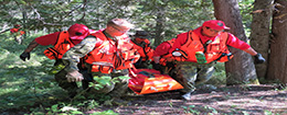
The Canadian Rangers work in remote areas of Canada. They are often tasked with patrolling their local regions, search and rescue operations and training with other Canadian Armed Forces members.
To do this, they need to be able to navigate in places that are hard to access. Sometimes, these are areas without roads or other convenient means of transportation. Canadian Rangers must rely on their knowledge of the areas where they live—including things like terrain and weather. They may have gained this knowledge thanks to personal experience or strong family roots in their home regions. Indigenous members may also draw on traditional knowledge. One thing is for sure, though – all Canadian Rangers need to be able to expertly use tools like maps, compasses and GPS (global positioning system) to carry out their challenging tasks.
Explain that the class will learn about the Canadian Rangers through the sport of orienteering. Orienteering is an activity that challenges participants to navigate their way across an area using tools like maps and compasses. Students will have to find checkpoints along the way to get to their final destination.
Bonus points for doing this activity in the winter! Winters are long in our country, after all, so many Canadian Rangers activities have to be carried out in the ice and snow.
You can pick from multiple options for this activity, depending on available time and resources:
Activity 1
How to read a map
Students explore a variety of Canadian maps, consider the information they provide and learn about map skills like scale and direction.
Activity 2
Mapping your home terrain
Students create a map capturing information about their school or a nearby outdoor space.
Activity 3
Creating an orienteering challenge
Students use maps and storylines to create an orienteering challenge. [Optional]
Activity 4
Finding your way like a Canadian Ranger
Students follow maps to simulate finding a missing person or other missions tackled by Canadian Rangers.
Activity 1 – How to read a map
Students explore a variety of Canadian maps, consider the information they provide and learn about map skills like scale and direction.
Before students can practice navigating, they first have to understand how to use maps and what information they can provide. There are many interesting maps of Canada that can tell us a lot about our beautiful (and enormous!) country.
Materials
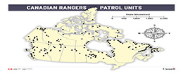
- Map of Canadian Ranger Patrol Group locations across the country
- Collection of maps of Canada showing:
- Student question sheet

Canadian Rangers during an exercise in Labrador in 2015.
Photo: DND
Provide students with a copy of a map showing where Canadian Ranger Patrol Units are found. Then show a selection of specialized maps of our country on a large screen to help students analyze their Canadian Rangers unit map. These zoomable pages from the National Atlas of Canada include visual representations of the circumpolar region, where Canadians live, population density, road networks, physical geography and climate/temperatures. Each of these aspects influence the important work the Canadian Rangers do.
You may want to discuss and highlight:
- Demographics
- Most Canadian Ranger units are found north of our country’s more populated areas, but there are also some units along our East and West Coasts.
- Big cities like Toronto, Montreal, Winnipeg or Vancouver don’t have any Canadian Rangers units. That’s because the Rangers have a unique task – one that involves being a light, rapidly-deployable force that works in remote areas that don’t already have many military members around.
- Transportation
- Canadian Rangers work in remote areas that are often not accessible by road.
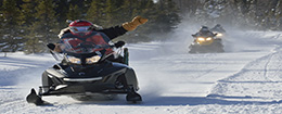
- They may need to hike long distances or use all-terrain vehicles, boats, skidoos or even horses to get where they need to go.
- Environment
- The terrain and landscapes Canadian Rangers work in are diverse. They include everything from mountainous wilderness to thick forests, marshlands, lakes and rivers, as well as vast expanses of tundra and frozen Arctic sea ice.
- The weather Canadian Rangers face can also be challenging. Canada has many climates and microclimates. That means Canadian Rangers can be dealing with scorching hot summer temperatures or cold, deep snow depending on where and at what time of year they are working.
Next, discuss what a scale is on a map and how it can be used to calculate real-world distances using a ruler and the map’s scale. Also share what a “compass rose” is and how to determine where north, south, east and west is on their map. Youth will use this information to complete a student question sheet asking the questions below. [Alternately, these questions could be done as an all-class discussion.]
- In what part of Canada are Canadian Rangers Patrol Units generally found?
- How many patrol units are found on the map?
- How many provinces and territories have patrol units?
- What is the approximate distance from your location to the patrol unit closest to your school? In what direction is it?
- What is the approximate distance to the patrol unit located the farthest away from your school? In what direction is it?
- What is the approximate distance between the patrol units located the farthest away from one another?
- Can you label on the Canadian Rangers unit map the locations of Canada’s capital city, the capital of each province and territory, CFS Alert in the Far North and other places you think are important?
- By looking at the Atlas of Canada maps, do you think roads are common in the North? How do you think people typically travel between smaller communities in Nunavut, the Northwest Territories and Yukon?
- What kind of natural barriers might make a straight line not be the quickest way to navigate across wild terrain?
When the activity is done, lead a quick class discussion to summarize what students have learned about the areas in which Canadian Rangers work. Here are some points you will want to make sure are covered:
- Canadian Rangers provide support to Canadians over very large distances.
- They often work in rugged landscapes dotted with small towns and sparse populations.
- Canada has very large areas with no or few roads, and limited travel connections.
- Canadian Rangers often have to work in or respond to extreme weather.
Alternatively, you can ask students to write a reflective paragraph on how geography and climate impact the duties of the Canadian Rangers.
Activity 2 – Mapping your home terrain
Students create a map capturing information about their school or a nearby outdoor space.
Now that students know how important maps are, it’s time to practice creating their own maps.
Materials
- Magnetic compass or compass app on smartphone
- Resources to create student maps (variable)
Provide students with instructions for creating a simple map of their school or the surrounding area. Maps can be handmade or digital, depending on classroom resources. A variety of apps, websites and software programs are available to help students create excellent digital maps.
If they are drawing maps by hand, students will need pencils, erasers, a ruler and a compass or a compass app. We recommend using large paper (such as 11” x 17”) to provide lots of space for them to work.
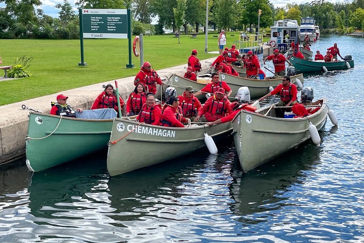
Members of No. 3 Canadian Rangers Patrol Group travelling by boat in central Ontario in September 2022.
Photo: DND
Maps can depict real places, such as your classroom, school, home or an outdoor space like a park. Students could also create their own imaginary island or country and include information about terrain, climate and transportation routes.
Hint: If you will be asking students to later use their map to create a pathway for another student to follow in Activities 3 and 4, clearly define the area you would like students to map. Make sure it is large enough to contain 5-6 hiding spots with enough distance between them that they will need to do some navigation to move on to their next targets.
Adjust the requirements according to the age and abilities of your students. For example, creating maps that are to scale may be challenging for younger students.
Here is some basic guidance you could provide:
Step 1: Start with the basics
Begin by drawing the outline of the space. An outline plot of your school may already be available to use as a starting point. Use measurements in meters or strides/footsteps to determine proportions. If working on paper, be sure to use a ruler to keep lines straight.
Step 2: Add landmarks
Identify and draw key features, like hallways, rooms, furniture, buildings and/or trees.
Step 3: Use symbols
Create a key or legend to explain the symbols used on the map. For instance, a small square could represent a building and a circle could represent a tree.
Step 4: Add details
Fill in the details of the map, using colours or shading to distinguish between different areas. Add roads or pathways, if applicable.
Step 5: Include a compass rose and scale:
Add a compass rose to indicate proper direction. Use a real compass to mark your directions. This will help map readers understand what direction is north on your map.
Add a box showing the scale you chose when you started drawing the map.
Activity 3 - Creating an orienteering challenge
Students use maps and storylines to create an orienteering challenge. [Optional]
The Canadian Rangers face many difficult situations. To better understand what they do, create an orienteering activity designed to challenge students’ navigation skills.
Materials
- Magnetic compass or compass app on smartphone
- The Canadian Rangers – 5Ws
- Scenario/question sheets for orienteering checkpoints
- Special letter sheets for orienteering checkpoints
- Canadian Rangers bullseye “good navigator” award
In Activity 4, students will be divided into groups to follow an orienteering map challenge. Each group will receive a different scenario connecting to a specific type of Canadian Rangers mission they are trying to accomplish:
- rescuing stranded hunters
- finding a downed airplane
- going on patrol looking for suspicious activity
- catching fish for elderly people in their community
- carrying out military training with other soldiers
Scenarios could be adapted to use the same challenge map or customized with different routes depending on the mission.
For deeper learning
This activity can be completed as a teacher-led or student-led activity.
Teachers or youth leaders should create the challenge map for younger students, small groups or to draft more challenging courses. It can be based on a floor plan for your school, the surrounding school yard and athletic fields or a park.
Older students may enjoy creating their own challenge maps which incorporate the themes listed above (see Activity 2). They could work together in groups to create a map and then exchange with another group for Activity 4.
Work with the following steps to create challenge maps. If students created maps in Activity 2, those may also be adapted for this activity. You could consider mapping out a test route first, if you wish.
Step 1 – Choose a start and end point
Decide where navigators will begin the course. Next, choose a spot to put the Canadian Rangers “bullseye” and mark its location on your map. The bullseye will be the end destination for students.
Step 2 - Identify checkpoints
Select locations for 5 check points between the starting point and the final destination.
On the day of the activity, you will place a special letter sheet at each checkpoint (along with print-outs of The Canadian Rangers – 5Ws sheets for students to use to find the proper responses). These can be printed and hidden in waterproof containers or taped to landmarks. Mark each checkpoint on your map.
Tip: You could use special ink stamps or different coloured markers at each checkpoint to verify that students made it to that physical location.
Step 3 - Create walking instructions (optional)
Students may find it useful to have instructions along with their map. Pace out or otherwise measure how many metres to proceed before turning in a certain direction. Younger students may find it easier to create or follow instructions marked out in footsteps.
Step 4 – Test the map
Before making a final copy of the map and instructions, test them out. Follow the map to make sure all the checkpoints and the bullseye can be found.
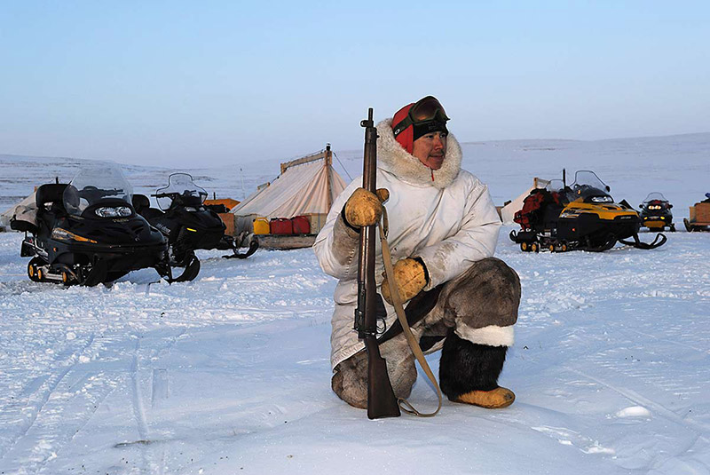
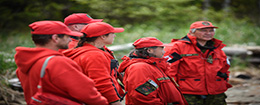
A Canadian Ranger during a patrol in Nunavut in 2012.
Photo: DND
Activity 4 – Finding your way like a Canadian Ranger
Students follow maps to simulate finding a missing person or other missions tackled by Canadian Rangers.
Now that students have learned how to read maps and create their own, it’s time to put those skills into action. This activity challenges students to complete a real-world navigation task inspired by the work of the Canadian Rangers.
Canadian Rangers during a patrol in British Columbia in 2025.
Photo: DND
Materials
- Magnetic compass or compass app on smartphone
- The Canadian Rangers – 5Ws
- Scenario/question sheets for orienteering checkpoints
- Special letter sheets for orienteering checkpoints
- Canadian Rangers bullseye “good navigator” award
Students will use a map and compass (or compass app) to follow a route, simulating what Rangers must sometimes do during patrols, search and rescue missions or other operations. At each checkpoint, they’ll answer a question about the Canadian Rangers using print-outs of The Canadian Rangers – 5Ws sheets to find the answers. They will also collect special letters. These letters will later form a hidden word at the end of the activity.
Depending on what option you selected in Activity 2 and Activity 3, this activity will use a map and walking instructions created by a teacher or by student groups. This can help ensure continuity between the map creation and navigation activities.
Setting up the course
Before the activity:
- Prepare activity sheets for each group with:
- The map and instructions they will be following (which may have been provided by another group in their class).
- An orienteering worksheet, which provides the Canadian Rangers scenario they are simulating, along with space to record their checkpoint answers, mystery letters and write the final secret word.
- rescuing stranded hunters
- finding a downed airplane
- going on patrol looking for suspicious activity
- catching fish for elderly people in their community
- carrying out military training with other soldiers
- Place a special letter sheet at each checkpoint, along with a print-out of The Canadian Rangers – 5Ws information sheets for students to use. These can be hidden in waterproof containers or taped to landmarks.
- Hide the Canadian Rangers “good navigator” bullseye at the location of the final destination.
Map reading review
Before students set out, review the skills they have learned. Remind them how map scales work and what the legend symbols mean. Review how compasses work and practice taking a reading to make sure everyone can find north. You may also wish to demonstrate how to use a compass or show a short video for students unfamiliar with the tool.
A note about compasses:
This activity can be completed using a compass or the compass app on a smartphone. If your school has a no-smartphone policy, check with your administration to see if educational use of student devices would be acceptable in this case. If you’re using an old-fashioned magnetic compass, explain what the magnetic declination is for your part of the country and how to correct for that when navigating with their special map.
A wealth of additional information on orienteering skills can be found on the Orienteering Canada website.
Instructions for students
- Briefing
Your team is part of a Canadian Rangers unit. You’ve been given a mission and a map. Your goal is to navigate to a final destination, stopping at checkpoints along the way to answer questions and find the special letters. - Briefing
Your team is part of a Canadian Rangers unit. You’ve been given a mission and a map. Your goal is to navigate to a final destination, stopping at checkpoints along the way to answer questions and find the special letters. - Navigation
Use your map, compass and navigation instructions to follow the route. At each checkpoint:- Read the question about the Canadian Rangers.
- Find the answer in the Canadian Rangers 5Ws information sheets.
- Record your answer on your sheet.
- Collect the special letter and write it in the correct blank.
- Final Destination
Once you’ve visited all the checkpoints, navigate to the final destination. Answer the final question and use the letters you found at each checkpoint to reveal the hidden word. Show your completed sheet to receive your own Canadian Rangers “good navigator” award.
Wrap-up discussion
After the activity, gather students to reflect:
- What scenario did you have to tackle?
- Did you make it to your final destination?
- What strategies helped you navigate successfully?
- What did you find hard?
- What did you learn about the Canadian Rangers?
- How does geography affect the work of the Rangers?
Alternatively, students could write a short reflection on how this activity helped them understand the challenges faced by Canadian Rangers.
Extension activities
- Our “Finding your way with the Canadian Rangers” learning unit could serve as a springboard for further activities exploring Indigenous knowledge. This could include what they know about their traditional territories and traveling the land. Check your provincial or territorial educational curricula for further ideas and resources in this vein.
- The geographical connections in this activity could also be a springboard to discussing the landscapes and biomes in which Canadian Rangers must operate – from the freezing High Arctic to the mild but rainy ocean coasts of Vancouver Island.
- If you live in a community with a nearby Canadian Ranger Patrol Unit, invite one of its members to visit your class. Your guest speaker could talk about their responsibilities, operations they have undertaken, answer questions and receive students’ recognition cards to bring back and share with fellow Rangers.